 |
|
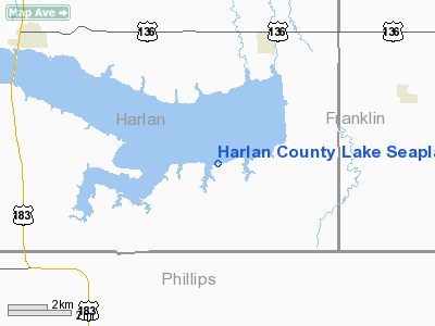
Harlan County Lake Seaplane Base Airport |
| Harlan County Lake Seaplane Base |
| IATA: none – ICAO: none – FAA LID: H63 |
| Summary |
| Airport type |
Public |
| Owner |
U.S. Army Corps of Engineers |
| Serves |
Alma, Nebraska |
| Elevation AMSL |
1,946 ft / 593 m |
| Coordinates |
40°02′35″N 099°15′03″W / 40.04306°N 99.25083°W / 40.04306; -99.25083 |
| Runways |
| Direction |
Length |
Surface |
| ft |
m |
| E/W |
15,000 |
4,572 |
Water |
| Source: Federal Aviation Administration |
Harlan County Lake Seaplane Base (FAA LID: H63) is a public use seaplane base located six nautical miles (11 km) southwest of the central business district of Alma, a city in Harlan County, Nebraska, United States. It is owned by the U.S. Army Corps of Engineers.
Facilities and aircraft
Harlan County Lake Seaplane Base has one seaplane landing area designated E/W which measures 15,000 x 4,000 ft (4,572 x 1,219 m).
The above content comes from Wikipedia and is published under free licenses – click here to read more.
Location & QuickFacts
| FAA Information Effective: | 2008-09-25 |
| Airport Identifier: | H63 |
| Airport Status: | Operational |
| Longitude/Latitude: | 099-15-03.3350W/40-02-35.0410N
-99.250926/40.043067 (Estimated) |
| Elevation: | 1946 ft / 593.14 m (Estimated) |
| Land: | 0 acres |
| From nearest city: | 6 nautical miles SW of Alma, NE |
| Location: | Harlan County, NE |
| Magnetic Variation: | 08E (1985) |
Owner & Manager
| Ownership: | Publicly owned |
| Owner: | U.s. Army Corps Of Engineers |
| Address: | P.o. Box 128
Republican City, NE 68917 |
| Phone number: | 308-799-2105 |
| Manager: | Jim Bowen |
| Address: | Route 1 Box 123a
Republican City, NE 68917 |
| Phone number: | 308-799-2105 |
Airport Operations and Facilities
| Airport Use: | Open to public |
| Segmented Circle: | No |
| Control Tower: | No |
| Sectional chart: | Omaha |
| Region: | ACE - Central |
| Boundary ARTCC: | ZDV - Denver |
| Tie-in FSS: | OLU - Columbus |
| FSS on Airport: | No |
| FSS Toll Free: | 1-800-WX-BRIEF |
| NOTAMs Facility: | OLU (NOTAM-d service avaliable) |
Airport Communications
Runway Information
Runway E/W
| Dimension: | 15000 x 4000 ft / 4572.0 x 1219.2 m |
| Surface: | WATER, |
| |
Runway E |
Runway W |
| Traffic Pattern: | Left | Left |
|
Radio Navigation Aids
| ID |
Type |
Name |
Ch |
Freq |
Var |
Dist |
| PHG | NDB | Phillipsburg | | 368.00 | 08E | 20.3 nm |
| HDE | NDB | Holdrege | | 396.00 | 07E | 24.7 nm |
| NRN | NDB | Norton | | 230.00 | 08E | 31.5 nm |
| CSB | NDB | Harry Strunk | | 389.00 | 08E | 44.5 nm |
| EAR | VOR | Kearney | | 111.20 | 10E | 42.5 nm |
| TKO | VORTAC | Mankato | 035X | 109.80 | 10E | 47.8 nm |
Images and information placed above are from
http://www.airport-data.com/airport/H63/
We thank them for the data!
| General Info
|
| Country |
United States
|
| State |
NEBRASKA
|
| FAA ID |
H63
|
| Latitude |
40-02-35.041N
|
| Longitude |
099-15-03.335W
|
| Elevation |
1946 feet
|
| Near City |
ALMA
|
We don't guarantee the information is fresh and accurate. The data may
be wrong or outdated.
For more up-to-date information please refer to other sources.
|
|


