 |
|
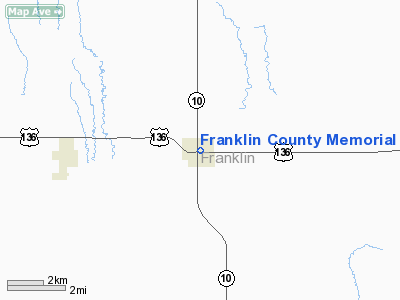
Franklin County Memorial Hospital Heliport |
Location & QuickFacts
| FAA Information Effective: | 2008-09-25 |
| Airport Identifier: | 0NE4 |
| Airport Status: | Operational |
| Longitude/Latitude: | 098-57-01.2900W/40-05-50.0470N
-98.950358/40.097235 (Estimated) |
| Elevation: | 1950 ft / 594.36 m (Estimated) |
| Land: | 0 acres |
| From nearest city: | 1 nautical miles N of Franklin, NE |
| Location: | Franklin County, NE |
| Magnetic Variation: | 08E (1985) |
Owner & Manager
| Ownership: | Publicly owned |
| Owner: | Franklin Co. Memorial Hosp. |
| Address: | 1406 Q Street
Franklin, NE 68939-0127 |
| Phone number: | 308-425-6221 |
| Manager: | Jerrell F. Gerdes |
| Address: | 216 18th Street
Franklin, NE 68939-0127 |
| Phone number: | 308-425-3011 |
Airport Operations and Facilities
| Airport Use: | Private
MEDICAL USE. |
| Wind indicator: | Yes |
| Segmented Circle: | No |
| Control Tower: | No |
| Lighting Schedule: | PHONE REQ
FOR FLOOD LGTS CALL 308-425-6221. |
| Sectional chart: | Wichita |
| Region: | ACE - Central |
| Boundary ARTCC: | ZMP - Minneapolis |
| Tie-in FSS: | OLU - Columbus |
| FSS Toll Free: | 1-800-WX-BRIEF |
Runway Information
Helipad H1
| Dimension: | 30 x 30 ft / 9.1 x 9.1 m |
| Surface: | CONC, |
| |
Runway H1 |
Runway |
| Traffic Pattern: | Left | Left |
|
Radio Navigation Aids
| ID |
Type |
Name |
Ch |
Freq |
Var |
Dist |
| HDE | NDB | Holdrege | | 396.00 | 07E | 27.7 nm |
| PHG | NDB | Phillipsburg | | 368.00 | 08E | 28.2 nm |
| PSS | NDB | Prosser | | 338.00 | 07E | 41.5 nm |
| NRN | NDB | Norton | | 230.00 | 08E | 45.6 nm |
| EAR | VOR | Kearney | | 111.20 | 10E | 37.9 nm |
| HSI | VOR/DME | Hastings | 025X | 108.80 | 07E | 38.7 nm |
| TKO | VORTAC | Mankato | 035X | 109.80 | 10E | 36.3 nm |
Remarks
- OWNER DESIRES HELIPAD NOT BE CHARTED.
- PRVDD CLEAR APCH/DEP PATHS FOR A 8:1 GLIDE SLOPE AND TRANSITIONAL SFC FOR A 2:1 SLOPE ARE MAINTAINED.
Images and information placed above are from
http://www.airport-data.com/airport/0NE4/
We thank them for the data!
| General Info
|
| Country |
United States
|
| State |
NEBRASKA
|
| FAA ID |
0NE4
|
| Latitude |
40-05-50.047N
|
| Longitude |
098-57-01.290W
|
| Elevation |
1950 feet
|
| Near City |
FRANKLIN
|
We don't guarantee the information is fresh and accurate. The data may
be wrong or outdated.
For more up-to-date information please refer to other sources.
|
|


