 |
|
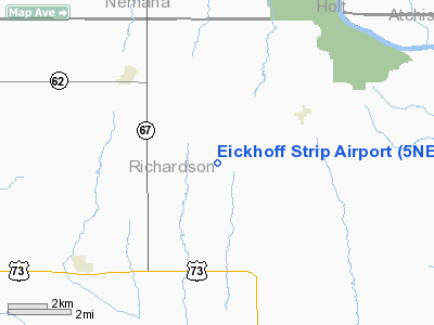
Location & QuickFacts
| FAA Information Effective: | 2008-09-25 |
| Airport Identifier: | 5NE2 |
| Airport Status: | Operational |
| Longitude/Latitude: | 095-37-45.9510W/40-11-45.0020N
-95.629431/40.195834 (Estimated) |
| Elevation: | 1000 ft / 304.80 m (Estimated) |
| Land: | 0 acres |
| From nearest city: | 3 nautical miles SE of Shubert, NE |
| Location: | Richardson County, NE |
| Magnetic Variation: | 06E (1985) |
Owner & Manager
| Ownership: | Privately owned |
| Owner: | L A H Eickhoff Farms, Inc. |
| Address: | 71570 650 Ave
Falls City, NE 68355 |
| Phone number: | 402-245-3498 |
| Manager: | Al Eickhoff |
| Address: | 71570 650 Ave
Falls City, NE 68355 |
| Phone number: | 402-245-3498 |
Airport Operations and Facilities
| Airport Use: | Private |
| Wind indicator: | Yes |
| Segmented Circle: | No |
| Control Tower: | No |
| Landing fee charge: | No |
| Sectional chart: | Omaha |
| Region: | ACE - Central |
| Boundary ARTCC: | ZMP - Minneapolis |
| Tie-in FSS: | OLU - Columbus |
| FSS on Airport: | No |
| FSS Toll Free: | 1-800-WX-BRIEF |
Runway Information
Runway 17/35
| Dimension: | 2400 x 80 ft / 731.5 x 24.4 m |
| Surface: | TURF, |
| |
Runway 17 |
Runway 35 |
| Traffic Pattern: | Left | Left |
|
Radio Navigation Aids
| ID |
Type |
Name |
Ch |
Freq |
Var |
Dist |
| FNB | NDB | Brenner | | 404.00 | 05E | 7.4 nm |
| AYB | NDB | Auburn | | 430.00 | 05E | 16.5 nm |
| AFK | NDB | Nebraska City | | 347.00 | 05E | 26.8 nm |
| EVU | NDB | Emville | | 317.00 | 05E | 34.0 nm |
| SDA | NDB | Shenandoah | | 411.00 | 05E | 34.9 nm |
| AZN | NDB | Amazon | | 233.00 | 06E | 38.1 nm |
| ICL | NDB | Clarinda | | 353.00 | 04E | 42.1 nm |
| PMV | NDB | Plattsmouth | | 329.00 | 06E | 46.8 nm |
| RBA | VOR/DME | Robinson | 019X | 108.20 | 04E | 22.8 nm |
| PWE | VORTAC | Pawnee City | 071X | 112.40 | 05E | 26.5 nm |
| STJ | VORTAC | St Joseph | 102X | 115.50 | 08E | 35.3 nm |
Remarks
- PROVIDED FENCE LCTD S END RWY IS REMOVED OR THR DSPLCD SUF DSTC THAT FENCE NO LONGER PRESENTS PSBL UNSAFE COND FOR ACFT USING RWY.
Images and information placed above are from
http://www.airport-data.com/airport/5NE2/
We thank them for the data!
| General Info
|
| Country |
United States
|
| State |
NEBRASKA
|
| FAA ID |
5NE2
|
| Latitude |
40-11-45.002N
|
| Longitude |
095-37-45.951W
|
| Elevation |
1000 feet
|
| Near City |
SHUBERT
|
We don't guarantee the information is fresh and accurate. The data may
be wrong or outdated.
For more up-to-date information please refer to other sources.
|
|


