 |
|
Location & QuickFacts
| FAA Information Effective: | 2008-09-25 |
| Airport Identifier: | 93Y |
| Airport Status: | Operational |
| Longitude/Latitude: | 097-07-22.5900W/41-13-51.1100N
-97.122942/41.230864 (Estimated) |
| Elevation: | 1617 ft / 492.86 m (Surveyed) |
| Land: | 188 acres |
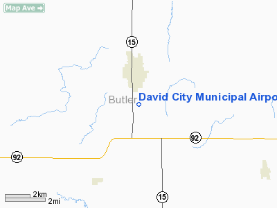
| From nearest city: | 1 nautical miles S of David City, NE |
| Location: | Butler County, NE |
| Magnetic Variation: | 07E (1985) |
Owner & Manager
| Ownership: | Publicly owned |
| Owner: | City Of David City |
| Address: | P.o. Box 191
David City, NE 68632-0191 |
| Phone number: | 402-367-3109 |
| Manager: | James Mcdonald |
| Address: | 174 West E Street
David City, NE 68632-1531 |
| Phone number: | 402-367-3109
CTC POLICE FOR SVC/EMERGENCY AT 367-3109/3133. |
Airport Operations and Facilities
| Airport Use: | Open to public |
| Wind indicator: | Yes |
| Segmented Circle: | No |
| Control Tower: | No |
| Lighting Schedule: | DUSK-DAWN |
| Beacon Color: | Clear-Green (lighted land airport) |
| Landing fee charge: | No |
| Sectional chart: | Omaha |
| Region: | ACE - Central |
| Traffic Pattern Alt: | 800 ft |
| Boundary ARTCC: | ZMP - Minneapolis |
| Tie-in FSS: | OLU - Columbus |
| FSS on Airport: | No |
| FSS Toll Free: | 1-800-WX-BRIEF |
| NOTAMs Facility: | OLU (NOTAM-d service avaliable) |
| Federal Agreements: | N1 |
Airport Communications
Airport Services
| Fuel available: | 100LLMOGAS
FOR FUEL & EMERG CALL; (402) 367-3133. |
| Airframe Repair: | NONE |
| Power Plant Repair: | NONE |
| Bottled Oxygen: | NONE |
| Bulk Oxygen: | NONE |
Runway Information
Runway 01/19
| Dimension: | 2100 x 120 ft / 640.1 x 36.6 m |
| Surface: | TURF, Fair Condition |
| |
Runway 01 |
Runway 19 |
| Longitude: | 097-07-31.6700W | 097-07-24.6400W |
| Latitude: | 41-13-43.0200N | 41-14-03.0800N |
| Elevation: | 1612.00 ft | 1613.00 ft |
| Alignment: | 15 | 127 |
| Traffic Pattern: | Right | Left |
| Obstruction: | 5 ft fence, 160.0 ft from runway, 32:1 slope to clear | 16 ft road, 500.0 ft from runway, 175 ft left of centerline, 31:1 slope to clear |
|
Runway 14/32
| Dimension: | 3100 x 50 ft / 944.9 x 15.2 m |
| Surface: | ASPH, Good Condition |
| Edge Lights: | Low |
| |
Runway 14 |
Runway 32 |
| Longitude: | 097-07-30.2200W | 097-07-07.4400W |
| Latitude: | 41-14-02.4700N | 41-13-37.1200N |
| Elevation: | 1612.00 ft | 1617.00 ft |
| Alignment: | 127 | 127 |
| Traffic Pattern: | Left | Right |
| Markings: | Non-precision instrument, | Non-precision instrument, |
| Obstruction: | 15 ft road, 500.0 ft from runway, 180 ft left of centerline, 20:1 slope to clear | , 50:1 slope to clear |
|
Radio Navigation Aids
| ID |
Type |
Name |
Ch |
Freq |
Var |
Dist |
| PLT | NDB | Platte Center | | 407.00 | 08E | 19.8 nm |
| SWT | NDB | Seward | | 269.00 | 06E | 22.2 nm |
| AHQ | NDB | Wahoo | | 400.00 | 07E | 23.7 nm |
| JYR | NDB | York | | 257.00 | 06E | 30.0 nm |
| FET | NDB | Fremont | | 311.00 | 06E | 30.3 nm |
| LN | NDB | Potts | | 385.00 | 06E | 33.4 nm |
| OF | NDB | Carsy | | 510.00 | 08E | 42.6 nm |
| FMZ | NDB | Beklof | | 392.00 | 07E | 43.5 nm |
| MLE | NDB | Millard | | 371.00 | 06E | 45.7 nm |
| OLU | VOR/DME | Columbus | 055X | 111.80 | 08E | 16.4 nm |
| SCB | VOR/DME | Scribner | 47X | 111.00 | 06E | 31.7 nm |
| OFK | VOR/DME | Norfolk | 033X | 109.60 | 08E | 47.6 nm |
| LNK | VORTAC | Lincoln | 108X | 116.10 | 09E | 25.3 nm |
Remarks
Images and information placed above are from
http://www.airport-data.com/airport/93Y/
We thank them for the data!
| General Info
|
| Country |
United States
|
| State |
NEBRASKA
|
| FAA ID |
93Y
|
| Latitude |
41-14-00.045N
|
| Longitude |
097-07-01.132W
|
| Elevation |
1614 feet
|
| Near City |
DAVID CITY
|
We don't guarantee the information is fresh and accurate. The data may
be wrong or outdated.
For more up-to-date information please refer to other sources.
|
|


