 |
|
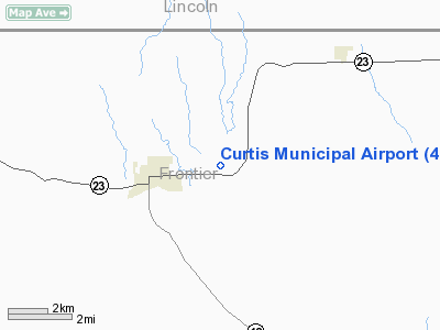
Location & QuickFacts
| FAA Information Effective: | 2008-09-25 |
| Airport Identifier: | 47V |
| Airport Status: | Operational |
| Longitude/Latitude: | 100-28-21.9000W/40-38-19.5000N
-100.472750/40.638750 (Estimated) |
| Elevation: | 2678 ft / 816.25 m (Surveyed) |
| Land: | 189 acres |
| From nearest city: | 2 nautical miles E of Curtis, NE |
| Location: | Frontier County, NE |
| Magnetic Variation: | 09E (1985) |
Owner & Manager
| Ownership: | Publicly owned |
| Owner: | Curtis Airport Authority
TRENTON LENZ, CHAIRMAN OF AIRPORT AUTHORITY. |
| Address: | Po Box 11
Curtis, NE 69025-0011 |
| Phone number: | 308-366-8640 |
| Manager: | Tom Brown |
| Address: | Po Box 131
Curtis, NE 69025-0131 |
| Phone number: | 308-367-8772 |
Airport Operations and Facilities
| Airport Use: | Open to public |
| Wind indicator: | Yes |
| Segmented Circle: | Yes |
| Control Tower: | No |
| Lighting Schedule: | DUSK-DAWN
ACTVT MIRL RY 12/30 - CTAF. |
| Beacon Color: | Clear-Green (lighted land airport) |
| Landing fee charge: | No |
| Sectional chart: | Omaha |
| Region: | ACE - Central |
| Boundary ARTCC: | ZDV - Denver |
| Tie-in FSS: | OLU - Columbus |
| FSS on Airport: | No |
| FSS Toll Free: | 1-800-WX-BRIEF |
| NOTAMs Facility: | OLU (NOTAM-d service avaliable) |
| Federal Agreements: | NGY |
Airport Communications
Airport Services
| Fuel available: | 100LL
FOR FUEL AFT HRS & UNATNDD DAYS CALL AMGR (308) 367-8772. |
| Bottled Oxygen: | NONE |
| Bulk Oxygen: | NONE |
Runway Information
Runway 12/30
| Dimension: | 3402 x 60 ft / 1036.9 x 18.3 m |
| Surface: | ASPH, Good Condition |
| Weight Limit: | Single wheel: 12000 lbs. |
| Edge Lights: | Medium |
| |
Runway 12 |
Runway 30 |
| Longitude: | 100-28-39.0506W | 100-28-04.6588W |
| Latitude: | 40-38-30.9855N | 40-38-09.9280N |
| Elevation: | 2677.00 ft | 2661.00 ft |
| Traffic Pattern: | Left | Left |
| Markings: | Basic, Good Condition | Basic, Good Condition |
|
Runway 17/35
| Dimension: | 2200 x 100 ft / 670.6 x 30.5 m |
| Surface: | TURF, Fair Condition |
| |
Runway 17 |
Runway 35 |
| Traffic Pattern: | Left | Left |
| Obstruction: | 4 ft fence, 84.0 ft from runway, 21:1 slope to clear | 15 ft pline, 491.0 ft from runway, 32:1 slope to clear |
|
Radio Navigation Aids
| ID |
Type |
Name |
Ch |
Freq |
Var |
Dist |
| MCK | FAN MARKER | Mc Cook | | | 11E | 27.8 nm |
| DWL | NDB | Willow | | 353.00 | 08E | 23.0 nm |
| CSB | NDB | Harry Strunk | | 389.00 | 08E | 24.7 nm |
| RRX | NDB | Darr | | 326.00 | 07E | 30.7 nm |
| OIN | NDB | Oberlin | | 341.00 | 09E | 48.7 nm |
| OZB | VOR | Cozad | | 109.00 | 09E | 25.5 nm |
| MCK | VOR/DME | Mc Cook | 100X | 115.30 | 08E | 26.7 nm |
| HCT | VORTAC | Hayes Center | 124X | 117.70 | 11E | 23.4 nm |
| LBF | VORTAC | North Platte | 121X | 117.40 | 11E | 27.6 nm |
Remarks
Images and information placed above are from
http://www.airport-data.com/airport/47V/
We thank them for the data!
| General Info
|
| Country |
United States
|
| State |
NEBRASKA
|
| FAA ID |
47V
|
| Latitude |
40-38-15.028N
|
| Longitude |
100-28-16.514W
|
| Elevation |
2676 feet
|
| Near City |
CURTIS
|
We don't guarantee the information is fresh and accurate. The data may
be wrong or outdated.
For more up-to-date information please refer to other sources.
|
|


