 |
|
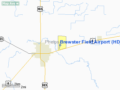
Location & QuickFacts
| FAA Information Effective: | 2008-09-25 |
| Airport Identifier: | HDE |
| Airport Status: | Operational |
| Longitude/Latitude: | 099-20-11.3150W/40-27-07.5200N
-99.336476/40.452089 (Estimated) |
| Elevation: | 2313 ft / 705.00 m (Estimated) |
| Land: | 398 acres |
| From nearest city: | 2 nautical miles NE of Holdrege, NE |
| Location: | Phelps County, NE |
| Magnetic Variation: | 07E (2000) |
Owner & Manager
| Ownership: | Publicly owned |
| Owner: | Holdrege Airport Authority |
| Address: | 1215 Tibbals Street
Holdrege, NE 68949-1255 |
| Phone number: | 308-995-2911
DOROTHY ANDERSON CHAIRMAN. |
| Manager: | Lanny Lambrecht |
| Address: | 1320 Brewster Road
Holdrege, NE 68949-1571 |
| Phone number: | 308-991-3760 |
Airport Operations and Facilities
| Airport Use: | Open to public |
| Wind indicator: | Yes |
| Segmented Circle: | Yes |
| Control Tower: | No |
| Lighting Schedule: | DUSK-DAWN
MIRL RY 18/36 PRESET LOW INTST; TO INCR INTST & ACTVT PAPI & REIL RYS 18 & 36 - CTAF. |
| Beacon Color: | Clear-Green (lighted land airport) |
| Landing fee charge: | No |
| Sectional chart: | Omaha |
| Region: | ACE - Central |
| Traffic Pattern Alt: | 1000 ft |
| Boundary ARTCC: | ZDV - Denver |
| Tie-in FSS: | OLU - Columbus |
| FSS on Airport: | No |
| FSS Toll Free: | 1-800-WX-BRIEF |
| NOTAMs Facility: | HDE (NOTAM-d service avaliable) |
| Federal Agreements: | NGY |
Airport Communications
| CTAF: | 122.800 |
| Unicom: | 122.800 |
Airport Services
| Fuel available: | 100LL
24 HR SELF SVC FUEL AVBL VIA CREDIT CARD SYSTEM. |
| Airframe Repair: | MAJOR |
| Power Plant Repair: | MAJOR |
| Bottled Oxygen: | NONE |
| Bulk Oxygen: | NONE |
Runway Information
Runway 11/29
| Dimension: | 1769 x 300 ft / 539.2 x 91.4 m |
| Surface: | TURF, Fair Condition
S 3100 FT & CENTER 50 FT ASPH. |
| |
Runway 11 |
Runway 29 |
| Longitude: | 099-20-12.3500W | 099-19-53.9200W |
| Latitude: | 40-27-06.9700N | 40-26-56.6100N |
| Elevation: | 2308.00 ft | 2313.00 ft |
| Alignment: | 126 | 127 |
| Traffic Pattern: | Left | Left |
| Obstruction: | 35 ft pline, 1600.0 ft from runway, 45:1 slope to clear | 26 ft rr, 650.0 ft from runway, 25:1 slope to clear |
|
Runway 18/36
| Dimension: | 4701 x 75 ft / 1432.9 x 22.9 m |
| Surface: | ASPH-CONC, Good Condition
S 3100 FT & CENTER 50 FT ASPH. |
| Weight Limit: | Single wheel: 30000 lbs. |
| Edge Lights: | Medium |
| |
Runway 18 |
Runway 36 |
| Longitude: | 099-20-09.3100W | 099-20-19.4780W |
| Latitude: | 40-27-32.5730N | 40-26-46.7810N |
| Elevation: | 2306.00 ft | 2308.00 ft |
| Alignment: | 127 | 10 |
| Traffic Pattern: | Left | Left |
| Markings: | Non-precision instrument, Good Condition | Non-precision instrument, Good Condition |
| VASI: | 2-light PAPI on left side | 2-light PAPI on left side |
| Runway End Identifier: | Yes | Yes |
| Obstruction: | , 50:1 slope to clear | 26 ft rr, 1170.0 ft from runway, 37:1 slope to clear |
|
Radio Navigation Aids
| ID |
Type |
Name |
Ch |
Freq |
Var |
Dist |
| HDE | NDB | Holdrege | | 396.00 | 07E | 0.3 nm |
| RRX | NDB | Darr | | 326.00 | 07E | 33.4 nm |
| CSB | NDB | Harry Strunk | | 389.00 | 08E | 38.6 nm |
| PSS | NDB | Prosser | | 338.00 | 07E | 41.7 nm |
| DWL | NDB | Willow | | 353.00 | 08E | 42.0 nm |
| NRN | NDB | Norton | | 230.00 | 08E | 43.9 nm |
| PHG | NDB | Phillipsburg | | 368.00 | 08E | 44.9 nm |
| EAR | VOR | Kearney | | 111.20 | 10E | 22.3 nm |
| OZB | VOR | Cozad | | 109.00 | 09E | 39.5 nm |
| HSI | VOR/DME | Hastings | 025X | 108.80 | 07E | 42.4 nm |
Remarks
- WATERFOWL INVOF ARPT.
- EXTENSIVE CROP SPRAYING OPNS INVOF ARPT APR THRU AUG.
- ULTRALIGHT ACTIVTY INVOF ARPT.
- RY 11/29 NOT PLOWED WINTER MONTHS.
- FOR SVCS AFTER HRS CALL 308-991-3760.
Images and information placed above are from
http://www.airport-data.com/airport/HDE/
We thank them for the data!
| General Info
|
| Country |
United States
|
| State |
NEBRASKA
|
| FAA ID |
HDE
|
| Latitude |
40-27-09.700N
|
| Longitude |
099-20-14.400W
|
| Elevation |
2309 feet
|
| Near City |
HOLDREGE
|
We don't guarantee the information is fresh and accurate. The data may
be wrong or outdated.
For more up-to-date information please refer to other sources.
|
|


