 |
|
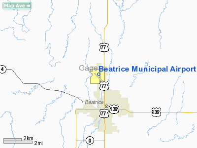
Location & QuickFacts
| FAA Information Effective: | 2008-09-25 |
| Airport Identifier: | BIE |
| Airport Status: | Operational |
| Longitude/Latitude: | 096-45-14.8000W/40-18-04.6000N
-96.754111/40.301278 (Estimated) |
| Elevation: | 1324 ft / 403.56 m (Surveyed) |
| Land: | 643 acres |
| From nearest city: | 3 nautical miles N of Beatrice, NE |
| Location: | Gage County, NE |
| Magnetic Variation: | 07E (1980) |
Owner & Manager
| Ownership: | Publicly owned |
| Owner: | Beatrice Arpt Auth |
| Address: | Box 277
Beatrice, NE 68310-0277 |
| Phone number: | 402-223-5349
DON FITZWATER, CHAIRMAN. |
| Manager: | Diana L. Smith |
| Address: | P.o. Box 277
Beatrice, NE 68310-0277 |
| Phone number: | 402-223-5349 |
Airport Operations and Facilities
| Airport Use: | Open to public |
| Wind indicator: | Yes |
| Segmented Circle: | Yes |
| Control Tower: | No |
| Lighting Schedule: | DUSK-DAWN
ACTVT MALSR RY 35 - CTAF. REIL RY 13 ON REQUEST. ODALS RY 13 DAYLGT HRS ON REQUEST; AFTER DUSK - CTAF. |
| Beacon Color: | Clear-Green (lighted land airport) |
| Landing fee charge: | No |
| Sectional chart: | Omaha |
| Region: | ACE - Central |
| Traffic Pattern Alt: | 1000 ft |
| Boundary ARTCC: | ZMP - Minneapolis |
| Tie-in FSS: | OLU - Columbus |
| FSS on Airport: | No |
| FSS Toll Free: | 1-800-WX-BRIEF |
| NOTAMs Facility: | BIE (NOTAM-d service avaliable) |
| Federal Agreements: | NGY3 |
Airport Communications
| CTAF: | 122.800 |
| Unicom: | 122.800 |
Airport Services
| Fuel available: | 100LLA
24 HR SELF SVC FUEL AVBL VIA CREDIT CARD SYSTEM AND FOR JET FUEL SVC AFT HRS CALL 402-223-5349 OR 402-223-5105. |
| Airframe Repair: | MINOR |
| Power Plant Repair: | MINOR |
| Bottled Oxygen: | NONE |
| Bulk Oxygen: | NONE |
Runway Information
Runway 13/31
| Dimension: | 4401 x 100 ft / 1341.4 x 30.5 m |
| Surface: | ASPH, Good Condition |
| Weight Limit: | Single wheel: 30000 lbs.
Dual wheel: 43000 lbs. |
| Edge Lights: | Medium |
| |
Runway 13 |
Runway 31 |
| Longitude: | 096-45-34.2970W | 096-45-00.2740W |
| Latitude: | 40-18-18.1720N | 40-17-43.3510N |
| Elevation: | 1319.00 ft | 1311.00 ft |
| Alignment: | 127 | 127 |
| Traffic Pattern: | Left | Left |
| Markings: | Non-precision instrument, Good Condition | Non-precision instrument, Good Condition |
| Approach lights: | ODALS | |
| Runway End Identifier: | | Yes |
|
Runway 17/35
| Dimension: | 5602 x 100 ft / 1707.5 x 30.5 m |
| Surface: | ASPH-CONC, Good Condition |
| Weight Limit: | Single wheel: 30000 lbs.
Dual wheel: 43000 lbs. |
| Edge Lights: | Medium |
| |
Runway 17 |
Runway 35 |
| Longitude: | 096-45-13.1090W | 096-45-12.6360W |
| Latitude: | 40-18-35.3670N | 40-17-40.0170N |
| Elevation: | 1324.00 ft | 1304.00 ft |
| Alignment: | 127 | 127 |
| Traffic Pattern: | Left | Left |
| Markings: | Non-precision instrument, Fair Condition | Non-precision instrument, Fair Condition |
| Crossing Height: | 0.00 ft | 45.00 ft |
| VASI: | | 2-light PAPI on left side |
| Visual Glide Angle: | 0.00° | 3.00° |
| Approach lights: | | MALSR |
|
Radio Navigation Aids
| ID |
Type |
Name |
Ch |
Freq |
Var |
Dist |
| HWB | NDB | Shaw | | 263.00 | 06E | 2.2 nm |
| BJU | NDB | Big Blue | | 248.00 | 06E | 4.6 nm |
| FBY | NDB | Fairbury | | 293.00 | 06E | 20.3 nm |
| LN | NDB | Potts | | 385.00 | 06E | 26.8 nm |
| MYZ | NDB | Marysville | | 341.00 | 06E | 27.5 nm |
| DBX | NDB | Morrison | | 212.00 | 06E | 35.0 nm |
| SWT | NDB | Seward | | 269.00 | 06E | 37.4 nm |
| HJH | NDB | Hebron | | 323.00 | 06E | 39.3 nm |
| FMZ | NDB | Beklof | | 392.00 | 07E | 41.1 nm |
| AYB | NDB | Auburn | | 430.00 | 05E | 44.2 nm |
| AFK | NDB | Nebraska City | | 347.00 | 05E | 44.8 nm |
| PWE | VORTAC | Pawnee City | 071X | 112.40 | 05E | 25.9 nm |
| LNK | VORTAC | Lincoln | 108X | 116.10 | 09E | 37.4 nm |
Remarks
- RY 17 IS DESIGNATED AS THE CALM WIND RY.
Images and information placed above are from
http://www.airport-data.com/airport/BIE/
We thank them for the data!
| General Info
|
| Country |
United States
|
| State |
NEBRASKA
|
| FAA ID |
BIE
|
| Latitude |
40-18-04.600N
|
| Longitude |
096-45-14.800W
|
| Elevation |
1324 feet
|
| Near City |
BEATRICE
|
We don't guarantee the information is fresh and accurate. The data may
be wrong or outdated.
For more up-to-date information please refer to other sources.
|
|


