 |
|
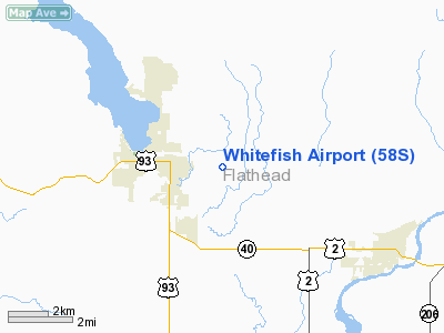
Location & QuickFacts
| FAA Information Effective: | 2008-09-25 |
| Airport Identifier: | 58S |
| Airport Status: | Operational |
| Longitude/Latitude: | 114-17-58.4740W/48-24-28.8720N
-114.299576/48.408020 (Estimated) |
| Elevation: | 3066 ft / 934.52 m (Estimated) |
| Land: | 41 acres |
| From nearest city: | 1 nautical miles E of Whitefish, MT |
| Location: | Flathead County, MT |
| Magnetic Variation: | 19E (1985) |
Owner & Manager
| Ownership: | Publicly owned |
| Owner: | Flathead Mun Airport Auth |
| Address: | 4170 Hwy 2
Kalispell, MT 59901 |
| Phone number: | 406-257-5994 |
| Manager: | Mike Daigle |
| Address: | 4170 Highway 2-e
Kalispell, MT 59901 |
| Phone number: | 406-257-5994 |
Airport Operations and Facilities
| Airport Use: | Open to public |
| Wind indicator: | Yes |
| Segmented Circle: | Yes |
| Control Tower: | No |
| Landing fee charge: | No |
| Sectional chart: | Great Falls |
| Region: | ANM - Northwest Mountain |
| Traffic Pattern Alt: | 1000 ft |
| Boundary ARTCC: | ZLC - Salt Lake City |
| Tie-in FSS: | GTF - Great Falls |
| FSS on Airport: | No |
| FSS Toll Free: | 1-800-WX-BRIEF |
| NOTAMs Facility: | GTF (NOTAM-d service avaliable) |
Airport Communications
Airport Services
| Airframe Repair: | NONE |
| Power Plant Repair: | NONE |
| Bottled Oxygen: | NONE |
| Bulk Oxygen: | NONE |
Runway Information
Runway 11/29
| Dimension: | 2560 x 75 ft / 780.3 x 22.9 m |
| Surface: | TURF, Good Condition |
| |
Runway 11 |
Runway 29 |
| Traffic Pattern: | Left | Left |
| Markings: | Basic, Good Condition
11/29 MKD WITH WHITE CONES. RY 11 DSPLCD THLD MKD WITH RED CONES. | , |
| Displaced threshold: | 278.00 ft | 0.00 ft |
| Obstruction: | 76 ft trees, 1216.0 ft from runway, 148 ft left of centerline, 16:1 slope to clear
APCH SLOPE TO DSPLCD THR 19:1. | 120 ft trees, 585.0 ft from runway, 159 ft right of centerline, 4:1 slope to clear |
|
Radio Navigation Aids
| ID |
Type |
Name |
Ch |
Freq |
Var |
Dist |
| SAK | NDB | Smith Lake | | 515.00 | 18E | 19.1 nm |
| PLS | NDB | Polson | | 275.00 | 20E | 43.0 nm |
| EUR | NDB | Eureka | | 392.00 | 20E | 45.9 nm |
| LYI | NDB | Libby | | 414.00 | 17E | 48.2 nm |
| FCA | VOR/DME | Kalispell | 079X | 113.20 | 18E | 12.7 nm |
Remarks
- RY 11/29 TREES RR & PLINES IN TRANSITIONAL SFC FULL RY LENGTH ON N SIDE.
- NO SNOW REMOVAL. ARPT CLSD FM NOV THROUGH MAY.
- FREE BICYCLES FOR ARPT USE LCTD IN STORAGE SHED. TO ACCESS USE EMERG FREQ ON LOCK.
Images and information placed above are from
http://www.airport-data.com/airport/58S/
We thank them for the data!
| General Info
|
| Country |
United States
|
| State |
MONTANA
|
| FAA ID |
58S
|
| Latitude |
48-24-28.872N
|
| Longitude |
114-17-58.474W
|
| Elevation |
3066 feet
|
| Near City |
WHITEFISH
|
We don't guarantee the information is fresh and accurate. The data may
be wrong or outdated.
For more up-to-date information please refer to other sources.
|
|


