 |
|
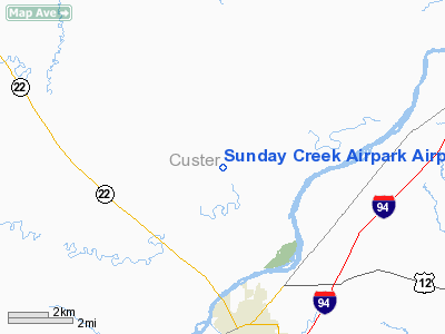
Sunday Creek Airpark Airport |
Location & QuickFacts
| FAA Information Effective: | 2008-09-25 |
| Airport Identifier: | MT29 |
| Airport Status: | Operational |
| Longitude/Latitude: | 105-51-30.0180W/46-28-44.0110N
-105.858338/46.478892 (Estimated) |
| Elevation: | 2490 ft / 758.95 m (Estimated) |
| Land: | 0 acres |
| From nearest city: | 4 nautical miles N of Miles City, MT |
| Location: | Custer County, MT |
| Magnetic Variation: | 13E (1985) |
Owner & Manager
| Ownership: | Privately owned |
| Owner: | W. T. Bergerson |
| Address: | Hc 46 Box 7979
Miles City, MT 59301 |
| Phone number: | 406-232-0130 |
| Manager: | W. T. Bergerson |
| Address: | 116 Pleasant
Miles City, MT 59301 |
| Phone number: | 406-232-3300 |
Airport Operations and Facilities
| Airport Use: | Private |
| Wind indicator: | Yes |
| Segmented Circle: | No |
| Control Tower: | No |
| Landing fee charge: | No |
| Sectional chart: | Billings |
| Region: | ANM - Northwest Mountain |
| Boundary ARTCC: | ZLC - Salt Lake City |
| Tie-in FSS: | GTF - Great Falls |
| FSS on Airport: | No |
| FSS Toll Free: | 1-800-WX-BRIEF |
Airport Services
| Fuel available: | 100 80 |
| Airframe Repair: | MAJOR |
| Power Plant Repair: | MAJOR |
Runway Information
Runway 12/30
| Dimension: | 3500 x 75 ft / 1066.8 x 22.9 m |
| Surface: | TURF, |
| |
Runway 12 |
Runway 30 |
| Traffic Pattern: | Left | Left |
|
Runway 18/36
| Dimension: | 3000 x 75 ft / 914.4 x 22.9 m |
| Surface: | GRVL, |
| |
Runway 18 |
Runway 36 |
| Traffic Pattern: | Left | Left |
|
Radio Navigation Aids
| ID |
Type |
Name |
Ch |
Freq |
Var |
Dist |
| HTN | NDB | Horton | | 320.00 | 15E | 5.2 nm |
| FOR | NDB | Forsyth | | 236.00 | 14E | 30.1 nm |
| MLS | VORTAC | Miles City | 058X | 112.10 | 15E | 7.0 nm |
Remarks
- OWNER DESIRES CHARTING
- PRVDD ALL TFC PAT OPNS ARE CONDUCTED TO NORTH OF RWY 12/30; LEFT TURNS FOR ALL DEPS/LDGS ON RWY 12; RGT TURNS FOR ALL DEPS/LDGS ON RWY 30.
Images and information placed above are from
http://www.airport-data.com/airport/MT29/
We thank them for the data!
| General Info
|
| Country |
United States
|
| State |
MONTANA
|
| FAA ID |
MT29
|
| Latitude |
46-28-44.011N
|
| Longitude |
105-51-30.018W
|
| Elevation |
2490 feet
|
| Near City |
MILES CITY
|
We don't guarantee the information is fresh and accurate. The data may
be wrong or outdated.
For more up-to-date information please refer to other sources.
|
|


