 |
|
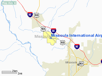
Missoula International Airport |
Missoula International Airport
Johnson-Bell Field |
| IATA: MSO – ICAO: KMSO |
| Summary |
| Airport type |
Public |
| Operator |
Missoula County Airport Authority |
| Location |
Missoula, Montana |
| Elevation AMSL |
3,205 ft / 977 m |
| Coordinates |
46°54′59″N 114°05′26″W / 46.91639°N 114.09056°W / 46.91639; -114.09056Coordinates: 46°54′59″N 114°05′26″W / 46.91639°N 114.09056°W / 46.91639; -114.09056 |
| Runways |
| Direction |
Length |
Surface |
| ft |
m |
| 11/29 |
9,501 |
2,896 |
Asphalt |
| 7/25 |
4,612 |
1,406 |
Asphalt |
Missoula International Airport/Johnson-Bell Field (IATA: MSO, ICAO: KMSO) is a public airport located four miles (6 km) northwest of the city of Missoula in Missoula County, Montana, USA. The airport has two runways. There are currently several expansion projects planned or underway, including the construction of 150 foot control tower. An expansion of the terminal building, providing a new security screening area, was completed in 2007. 565,000 passengers passed through the airport in 2007.
Airlines and destinations
| Airlines |
Destinations |
| Allegiant Air |
Las Vegas, Los Angeles, Phoenix/Mesa |
| Delta Connection operated by Compass Airlines |
Minneapolis/St. Paul |
| Delta Connection operated by SkyWest Airlines |
Salt Lake City |
| Horizon Air |
Seattle/Tacoma |
| United Express operated by SkyWest Airlines |
Chicago-O'Hare [seasonal], Denver, San Francisco [seasonal] |
The above content comes from Wikipedia and is published under free licenses – click here to read more.
Location & QuickFacts
| FAA Information Effective: | 2008-09-25 |
| Airport Identifier: | MSO |
| Airport Status: | Operational |
| Longitude/Latitude: | 114-05-26.0000W/46-54-58.7000N
-114.090556/46.916306 (Estimated) |
| Elevation: | 3205 ft / 976.88 m (Surveyed) |
| Land: | 2700 acres |
| From nearest city: | 4 nautical miles NW of Missoula, MT |
| Location: | Missoula County, MT |
| Magnetic Variation: | 17E (1990) |
Owner & Manager
| Ownership: | Publicly owned |
| Owner: | Missoula Cty Arpt Auth |
| Address: | 5225 Highway 10 West
Missoula, MT 59808 |
| Phone number: | 406-728-4381 |
| Manager: | Cris Jensen |
| Address: | 5225 Highway 10 West
Missoula, MT 59808 |
| Phone number: | 406-728-4381 |
Airport Operations and Facilities
| Airport Use: | Open to public |
| Wind indicator: | Yes |
| Segmented Circle: | Yes |
| Control Tower: | Yes |
| Lighting Schedule: | DUSK-DAWN
WHEN ATCT CLSD ACTVT HIRL RY 11/29 AND MALSR RY 11 - CTAF. |
| Beacon Color: | Clear-Green (lighted land airport) |
| Landing fee charge: | Yes |
| Sectional chart: | Great Falls |
| Region: | ANM - Northwest Mountain |
| Boundary ARTCC: | ZLC - Salt Lake City |
| Tie-in FSS: | GTF - Great Falls |
| FSS Toll Free: | 1-800-WX-BRIEF |
| NOTAMs Facility: | MSO (NOTAM-d service avaliable) |
| Certification type/date: | I B S 05/1973 |
| Federal Agreements: | NGY3 |
Airport Communications
| CTAF: | 118.400 |
| Unicom: | 122.950 |
Airport Services
| Fuel available: | 100LLA1+ |
| Airframe Repair: | MAJOR |
| Power Plant Repair: | MAJOR |
| Bottled Oxygen: | HIGH/LOW |
| Bulk Oxygen: | HIGH/LOW |
Runway Information
Runway 07/25
| Dimension: | 4612 x 75 ft / 1405.7 x 22.9 m |
| Surface: | ASPH, Fair Condition
SURFACE VARIATIONS WITH PATCHES. |
| Weight Limit: | Single wheel: 30000 lbs.
Dual wheel: 50000 lbs.
180 DEG TURNS FOR ACFT OVR 12500 LBS GWT PROHIBITED ON ALL MOVEMENT AREAS. AVOID LOCKED TURNS AT ALL TIMES. |
| Edge Lights: | Medium |
| |
Runway 07 |
Runway 25 |
| Longitude: | 114-05-47.8108W | 114-04-41.3905W |
| Latitude: | 46-54-57.6436N | 46-54-58.1687N |
| Elevation: | 3199.00 ft | 3204.00 ft |
| Alignment: | 89 | 127 |
| Traffic Pattern: | Left | Left |
| Markings: | Basic, Good Condition | Basic, Good Condition |
| Obstruction: | , 50:1 slope to clear | 41 ft poles, 1271.0 ft from runway, 300 ft right of centerline, 27:1 slope to clear |
|
Runway 11/29
| Dimension: | 9501 x 150 ft / 2895.9 x 45.7 m |
| Surface: | ASPH, Good Condition
SURFACE VARIATIONS WITH PATCHES. |
| Surface Treatment: | Saw-cut or plastic Grooved |
| Weight Limit: | Single wheel: 145000 lbs.
Dual wheel: 170000 lbs.
Dual tandem wheel: 255000 lbs.
180 DEG TURNS FOR ACFT OVR 12500 LBS GWT PROHIBITED ON ALL MOVEMENT AREAS. AVOID LOCKED TURNS AT ALL TIMES. |
| Edge Lights: | High |
| |
Runway 11 |
Runway 29 |
| Longitude: | 114-06-23.6151W | 114-04-39.5056W |
| Latitude: | 46-55-29.4394N | 46-54-28.5925N |
| Elevation: | 3192.00 ft | 3205.00 ft |
| Alignment: | 127 | 127 |
| ILS Type: | ILS
| |
| Traffic Pattern: | Left | Left |
| Markings: | Precision instrument, Good Condition | Non-precision instrument, Good Condition |
| Crossing Height: | 55.00 ft | 50.00 ft |
| VASI: | 4-light PAPI on left side | 4-light PAPI on left side |
| Visual Glide Angle: | 3.00° | 3.00° |
| Approach lights: | MALSR | |
| Runway End Identifier: | No | Yes |
|
Radio Navigation Aids
| ID |
Type |
Name |
Ch |
Freq |
Var |
Dist |
| INE | NDB | Konna | | 521.00 | 17E | 16.5 nm |
| HMM | NDB | Hamilton | | 410.00 | 19E | 39.7 nm |
| PLS | NDB | Polson | | 275.00 | 20E | 47.0 nm |
| DRU | VOR | Drummond | | 117.10 | 17E | 40.8 nm |
| MSO | VOR/DME | Missoula | 075X | 112.80 | 17E | 0.6 nm |
Remarks
- CONTACT ARPT MANAGER TO REQUEST APPROVAL PRIOR TO ULTRALIGHT OPNS.
- TWY G BTN RY 07 END TO RY 11/29 RSTRD TO ACFT UNDER 12,500 LBS.
- SNOW REMOVAL OPS IN PROGRESS WINTER MONTHS.
- PPR FOR UNSKED ACR OPR WITH MORE THAN 30 PSGR SEATS CTC APRT OPS MANAGER 406-728-4381.
- LNDG FEE FOR ALL COMMERCIAL ACFT AND ALL ACFT OVER 12,500 LBS.
- MIGRATORY & SMALL BIRD ACTIVITY ON & INVOF ARPT DURING MOS OF APRIL-MAY AND OCT-DEC.
- HANG GLIDER OPS 5.5 NM E OF AER RY29.
Images and information placed above are from
http://www.airport-data.com/airport/MSO/
We thank them for the data!
| General Info
|
| Country |
United States
|
| State |
MONTANA
|
| FAA ID |
MSO
|
| Latitude |
46-54-58.700N
|
| Longitude |
114-05-26.000W
|
| Elevation |
3205 feet
|
| Near City |
MISSOULA
|
We don't guarantee the information is fresh and accurate. The data may
be wrong or outdated.
For more up-to-date information please refer to other sources.
|
|


