 |
|
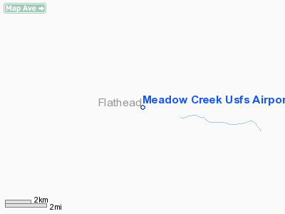
Meadow Creek Usfs Airport |
Location & QuickFacts
| FAA Information Effective: | 2008-09-25 |
| Airport Identifier: | 0S1 |
| Airport Status: | Operational |
| Longitude/Latitude: | 113-24-33.2880W/47-50-44.7970N
-113.409247/47.845777 (Estimated) |
| Elevation: | 3984 ft / 1214.32 m (Estimated) |
| Land: | 0 acres |
| From nearest city: | 1 nautical miles NE of Meadow Creek, MT |
| Location: | Flathead County, MT |
| Magnetic Variation: | 18E (1985) |
Owner & Manager
| Ownership: | Publicly owned |
| Owner: | Us Forest Service |
| Address: | Flathead Nat Forest
Kalispell, MT 59901 |
| Phone number: | 406-755-5401 |
| Manager: | Deb Mucklow |
| Address: | Spotted Bear Ranger Dist
Hungry Horse, MT 59919 |
| Phone number: | 406-758-5376
SUMMER NUMBER: 406-758-5376 |
Airport Operations and Facilities
| Airport Use: | Open to public |
| Wind indicator: | Yes |
| Segmented Circle: | No |
| Control Tower: | No |
| Landing fee charge: | No |
| Sectional chart: | Great Falls |
| Region: | ANM - Northwest Mountain |
| Boundary ARTCC: | ZLC - Salt Lake City |
| Tie-in FSS: | GTF - Great Falls |
| FSS on Airport: | No |
| FSS Toll Free: | 1-800-WX-BRIEF |
| NOTAMs Facility: | GTF (NOTAM-d service avaliable) |
Airport Communications
Airport Services
| Airframe Repair: | NONE |
| Power Plant Repair: | NONE |
| Bottled Oxygen: | NONE |
| Bulk Oxygen: | NONE |
Runway Information
Runway 17/35
| Dimension: | 2830 x 100 ft / 862.6 x 30.5 m |
| Surface: | TURF, Fair Condition |
| |
Runway 17 |
Runway 35 |
| Traffic Pattern: | Left | Left |
| Markings: | , | Nonstandard,
RY 35 NSTD MKGS; THLD MKD WITH CONES. |
| Obstruction: | 1124 ft gnd, 4500.0 ft from runway, 4:1 slope to clear | 97 ft trees, 971.0 ft from runway, 10:1 slope to clear |
|
>
Radio Navigation Aids
| ID |
Type |
Name |
Ch |
Freq |
Var |
Dist |
| PLS | NDB | Polson | | 275.00 | 20E | 32.7 nm |
| SAK | NDB | Smith Lake | | 515.00 | 18E | 45.2 nm |
| CII | NDB | Choteau | | 269.00 | 17E | 50.0 nm |
| FCA | VOR/DME | Kalispell | 079X | 113.20 | 18E | 37.9 nm |
Remarks
- CLEARED AREA NOT USABLE S OF RY 35 MKD RY END.
- BIG GAME ANIMALS MAY BE ON RY.
- TREES & TERRAIN IN TRANSITION SFC BOTH SIDES OF RY FULL LENGTH.
- ESTABLISHED PRIOR TO 1959
Images and information placed above are from
http://www.airport-data.com/airport/0S1/
We thank them for the data!
| General Info
|
| Country |
United States
|
| State |
MONTANA
|
| FAA ID |
0S1
|
| Latitude |
47-50-44.797N
|
| Longitude |
113-24-33.288W
|
| Elevation |
3984 feet
|
| Near City |
MEADOW CREEK
|
We don't guarantee the information is fresh and accurate. The data may
be wrong or outdated.
For more up-to-date information please refer to other sources.
|
|


