 |
|
Lindey's Landing West Seaplane Base |
| Lindey's Landing West Seaplane Base |
| IATA: none – ICAO: none – FAA LID: M35 |
| Summary |
| Airport type |
Public |
| Owner |
Lindemer Family |
| Serves |
Seeley Lake, Montana |
| Elevation AMSL |
3,993 ft / 1,217 m |
| Coordinates |
47°10′28″N 113°28′48″W / 47.17444°N 113.48°W / 47.17444; -113.48 |
| Runways |
| Direction |
Length |
Surface |
| ft |
m |
| 12/30 |
14,000 |
4,267 |
Water |
| Statistics (2005) |
| Aircraft operations |
230 |
| Source: Federal Aviation Administration |
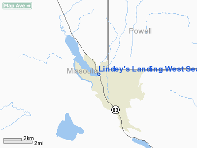
Lindey's Landing West Seaplane Base (FAA LID: M35) is a privately-owned, public-use seaplane base located one nautical mile (2 km) northwest of the central business district of Seeley Lake, a community in Missoula County, Montana, United States.
Facilities and aircraft
Lindey's Landing West Seaplane Base has one seaplane landing area designated 12/30 which measures 14,000 x 1,000 feet (4,267 x 305 m). For the 12-month period ending August 24, 2005, the airport had 230 aircraft operations: 70% general aviation and 30% military.
The above content comes from Wikipedia and is published under free licenses – click here to read more.
Location & QuickFacts
| FAA Information Effective: | 2008-09-25 |
| Airport Identifier: | M35 |
| Airport Status: | Operational |
| Longitude/Latitude: | 113-28-48.2830W/47-10-27.7670N
-113.480079/47.174380 (Estimated) |
| Elevation: | 3993 ft / 1217.07 m (Estimated) |
| Land: | 0 acres |
| From nearest city: | 1 nautical miles NW of Seeley Lake, MT |
| Location: | Missoula County, MT |
| Magnetic Variation: | 18E (1985) |
Owner & Manager
| Ownership: | Privately owned |
| Owner: | Lindemer Family |
| Address: | Po Box 491
Seeley Lake, MT 59868 |
| Phone number: | 651-633-9813 |
| Manager: | Lindemer Family |
| Address: | Po Box 491
Seeley Lake, MT 59868 |
| Phone number: | 406-677-4101 |
Airport Operations and Facilities
| Airport Use: | Open to public |
| Wind indicator: | Yes |
| Segmented Circle: | No |
| Control Tower: | No |
| Landing fee charge: | No |
| Sectional chart: | Great Falls |
| Region: | ANM - Northwest Mountain |
| Boundary ARTCC: | ZLC - Salt Lake City |
| Tie-in FSS: | GTF - Great Falls |
| FSS Toll Free: | 1-800-WX-BRIEF |
| NOTAMs Facility: | GTF (NOTAM-d service avaliable) |
Airport Communications
Airport Services
Runway Information
Runway 12/30
| Dimension: | 14000 x 1000 ft / 4267.2 x 304.8 m |
| Surface: | WATER, |
| |
Runway 12 |
Runway 30 |
| Traffic Pattern: | Left | Left |
|
Radio Navigation Aids
| ID |
Type |
Name |
Ch |
Freq |
Var |
Dist |
| INE | NDB | Konna | | 521.00 | 17E | 37.8 nm |
| PLS | NDB | Polson | | 275.00 | 20E | 42.5 nm |
| DRU | VOR | Drummond | | 117.10 | 17E | 34.5 nm |
| MSO | VOR/DME | Missoula | 075X | 112.80 | 17E | 29.5 nm |
Images and information placed above are from
http://www.airport-data.com/airport/M35/
We thank them for the data!
| General Info
|
| Country |
United States
|
| State |
MONTANA
|
| FAA ID |
M35
|
| Latitude |
47-10-27.767N
|
| Longitude |
113-28-48.283W
|
| Elevation |
3993 feet
|
| Near City |
SEELEY LAKE
|
We don't guarantee the information is fresh and accurate. The data may
be wrong or outdated.
For more up-to-date information please refer to other sources.
|
|


