 |
|
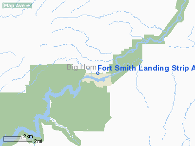
Fort Smith Landing Strip Airport |
Location & QuickFacts
| FAA Information Effective: | 2008-09-25 |
| Airport Identifier: | 5U7 |
| Airport Status: | Operational |
| Longitude/Latitude: | 107-55-52.3990W/45-19-14.8530N
-107.931222/45.320793 (Estimated) |
| Elevation: | 3242 ft / 988.16 m (Surveyed) |
| Land: | 60 acres |
| From nearest city: | 1 nautical miles N of Fort Smith, MT |
| Location: | Big Horn County, MT |
| Magnetic Variation: | 14E (1985) |
Owner & Manager
| Ownership: | Publicly owned |
| Owner: | Natl Park Svc |
| Address: | Bighorn Canyon Nra Box 458
Hardin, MT 59035 |
| Phone number: | 406-666-2412 |
| Manager: | North District Ranger
CHRIS RYAN |
| Address: | Bighorn Canyon Nra Box 7458
Hardin, MT 59035 |
| Phone number: | 406-666-2412 |
Airport Operations and Facilities
| Airport Use: | Open to public |
| Wind indicator: | Yes |
| Segmented Circle: | No |
| Control Tower: | No |
| Landing fee charge: | No |
| Sectional chart: | Billings |
| Region: | ANM - Northwest Mountain |
| Boundary ARTCC: | ZLC - Salt Lake City |
| Tie-in FSS: | GTF - Great Falls |
| FSS on Airport: | No |
| FSS Toll Free: | 1-800-WX-BRIEF |
| NOTAMs Facility: | GTF (NOTAM-d service avaliable) |
Airport Communications
Airport Services
| Airframe Repair: | NONE |
| Power Plant Repair: | NONE |
| Bottled Oxygen: | NONE |
| Bulk Oxygen: | NONE |
Runway Information
Runway 07/25
| Dimension: | 3827 x 50 ft / 1166.5 x 15.2 m |
| Surface: | ASPH, Fair Condition |
| Weight Limit: | Single wheel: 8000 lbs. |
| |
Runway 07 |
Runway 25 |
| Traffic Pattern: | Left | Left |
| Markings: | Basic, Poor Condition
RY 07 NUMBERS AND CNTRLN FADED. | Basic, Poor Condition
RY 25 NUMBERS AND CNTRLN FADED. |
| Displaced threshold: | 0.00 ft | 140.00 ft |
| Obstruction: | 480 ft pline, 5000.0 ft from runway, 625 ft right of centerline, 10:1 slope to clear
RY 07 -7 FT DITCH 116 FT FM EOR CROSSING RY CNTRLN. | 60 ft pline, 720.0 ft from runway, 175 ft right of centerline, 8:1 slope to clear
APCH SLOPE 14:1 TO DSPLCD THR.
+4' FENCE 52' FM EOR, -2' DITCH 56' FM EOR, BOTH XING RY CENTERLINE. PERPENDICULAR +4' FENCE PARALLEL TO RY CENTERLINE AND 75' RIGHT ENDING AT 52' FM EOR. +23' TREE 50' FM EOR & 122' R. |
|
Radio Navigation Aids
| ID |
Type |
Name |
Ch |
Freq |
Var |
Dist |
| HCY | NDB | Cowley | | 257.00 | 14E | 32.7 nm |
| POY | NDB | Powell | | 344.00 | 15E | 45.4 nm |
| GEY | NDB | Greybull | | 275.00 | 14E | 49.1 nm |
| BIL | VORTAC | Billings | 092X | 114.50 | 14E | 41.4 nm |
| SHR | VORTAC | Sheridan | 100X | 115.30 | 13E | 46.8 nm |
Remarks
- WILDLIFE ON & INVOF ARPT.
Images and information placed above are from
http://www.airport-data.com/airport/5U7/
We thank them for the data!
| General Info
|
| Country |
United States
|
| State |
MONTANA
|
| FAA ID |
5U7
|
| Latitude |
45-19-14.853N
|
| Longitude |
107-55-52.399W
|
| Elevation |
3242 feet
|
| Near City |
FORT SMITH
|
We don't guarantee the information is fresh and accurate. The data may
be wrong or outdated.
For more up-to-date information please refer to other sources.
|
|


