 |
|
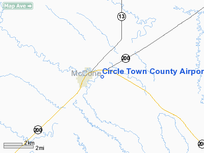
Circle Town County Airport |
Location & QuickFacts
| FAA Information Effective: | 2008-09-25 |
| Airport Identifier: | 4U6 |
| Airport Status: | Operational |
| Longitude/Latitude: | 105-33-42.9950W/47-25-07.0310N
-105.561943/47.418620 (Estimated) |
| Elevation: | 2426 ft / 739.44 m (Surveyed) |
| Land: | 140 acres |
| From nearest city: | 1 nautical miles E of Circle, MT |
| Location: | Mc Cone County, MT |
| Magnetic Variation: | 13E (1985) |
Owner & Manager
| Ownership: | Publicly owned |
| Owner: | Mc Cone County |
| Address: | County Courthouse
Circle, MT 59215 |
| Phone number: | 406-485-3505 |
| Manager: | Jeff Skyberg |
| Address: | Box 336
Circle, MT 59215 |
| Phone number: | 406-485-2481 |
Airport Operations and Facilities
| Airport Use: | Open to public |
| Wind indicator: | Yes
WIND TEE HAS BEEN REMOVED, USE LIGHTED WIND SOCK |
| Segmented Circle: | Yes |
| Control Tower: | No |
| Lighting Schedule: | DUSK-DAWN
ACTVT MIRL RY 12/30 - CTAF. |
| Beacon Color: | Clear-Green (lighted land airport) |
| Landing fee charge: | No |
| Sectional chart: | Billings |
| Region: | ANM - Northwest Mountain |
| Boundary ARTCC: | ZLC - Salt Lake City |
| Tie-in FSS: | GTF - Great Falls |
| FSS on Airport: | No |
| FSS Toll Free: | 1-800-WX-BRIEF |
| NOTAMs Facility: | GTF (NOTAM-d service avaliable) |
| Federal Agreements: | NGY |
Airport Communications
| CTAF: | 122.800 |
| Unicom: | 122.800 |
Airport Services
| Fuel available: | 100LL |
| Airframe Repair: | MAJOR |
| Power Plant Repair: | MAJOR |
| Bottled Oxygen: | NONE |
| Bulk Oxygen: | NONE |
Runway Information
Runway 03/21
| Dimension: | 2500 x 195 ft / 762.0 x 59.4 m |
| Surface: | TURF, Poor Condition
RWY IS ROUGH, WITH LONG GRASS.
UNUSBL IN WET WEATHER.
SOME PAVEMENT SPALLING. TRANSVERSE CRACKS W/ DEPRESSIONS |
| |
Runway 03 |
Runway 21 |
| Traffic Pattern: | Left | Left |
|
Runway 12/30
| Dimension: | 4100 x 75 ft / 1249.7 x 22.9 m |
| Surface: | ASPH, Poor Condition
RWY IS ROUGH, WITH LONG GRASS.
UNUSBL IN WET WEATHER.
SOME PAVEMENT SPALLING. TRANSVERSE CRACKS W/ DEPRESSIONS |
| Surface Treatment: | Porous Friction Course |
| Weight Limit: | Single wheel: 25000 lbs. |
| Edge Lights: | Medium |
| |
Runway 12 |
Runway 30 |
| Traffic Pattern: | Left | Left |
| Markings: | Basic, Fair Condition | Basic, Fair Condition |
| Crossing Height: | 0.00 ft | 20.00 ft |
| VASI: | | 2-box on left side |
| Visual Glide Angle: | 0.00° | 3.00° |
| Obstruction: | 22 ft rr, 895.0 ft from runway, 31:1 slope to clear | , 50:1 slope to clear |
|
Radio Navigation Aids
| ID |
Type |
Name |
Ch |
Freq |
Var |
Dist |
| CRR | NDB | Circle | | 245.00 | 15E | 0.1 nm |
| GDV | NDB | Glendive | | 410.00 | 13E | 35.3 nm |
| OLF | NDB | Wolf Point | | 404.00 | 11E | 41.3 nm |
Remarks
- HAS -8 FT DRAINAGE DITCH 200 FT FM RY 03/21 THLDS.
Images and information placed above are from
http://www.airport-data.com/airport/4U6/
We thank them for the data!
| General Info
|
| Country |
United States
|
| State |
MONTANA
|
| FAA ID |
4U6
|
| Latitude |
47-25-07.031N
|
| Longitude |
105-33-42.995W
|
| Elevation |
2426 feet
|
| Near City |
CIRCLE
|
We don't guarantee the information is fresh and accurate. The data may
be wrong or outdated.
For more up-to-date information please refer to other sources.
|
|


