 |
|
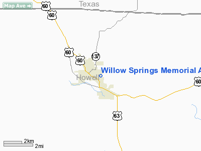
Willow Springs Memorial Airport |
Location & QuickFacts
| FAA Information Effective: | 2008-09-25 |
| Airport Identifier: | 1H5 |
| Airport Status: | Operational |
| Longitude/Latitude: | 091-57-14.6750W/36-59-22.6250N
-91.954076/36.989618 (Estimated) |
| Elevation: | 1247 ft / 380.09 m (Surveyed) |
| Land: | 80 acres |
| From nearest city: | 1 nautical miles E of Willow Springs, MO |
| Location: | Howell County, MO |
| Magnetic Variation: | 03E (1985) |
Owner & Manager
| Ownership: | Publicly owned |
| Owner: | City Of Willow Springs |
| Address: | 123 E Main St
Willow Springs, MO 65793 |
| Phone number: | 417-469-2107 |
| Manager: | Jim Vokac |
| Address: | 3311 Cr 3900
Willow Springs, MO 65793 |
| Phone number: | 417-469-4822
ALTERNATE PHONE NBR 417-855-0092 (CELL). |
Airport Operations and Facilities
| Airport Use: | Open to public |
| Wind indicator: | Yes |
| Segmented Circle: | Yes |
| Control Tower: | No |
| Lighting Schedule: | DUSK-DAWN
ACTVT MIRL RY 17/35 - CTAF. |
| Landing fee charge: | No |
| Sectional chart: | Kansas City |
| Region: | ACE - Central |
| Traffic Pattern Alt: | 800 ft |
| Boundary ARTCC: | ZKC - Kansas City |
| Tie-in FSS: | COU - Columbia |
| FSS on Airport: | No |
| FSS Toll Free: | 1-800-WX-BRIEF |
| NOTAMs Facility: | COU (NOTAM-d service avaliable) |
| Federal Agreements: | 1 |
Airport Communications
Airport Services
| Fuel available: | 100LL
FOR FUEL CALL 417-469-3158 (POLICE DEPT). |
| Airframe Repair: | NONE |
| Power Plant Repair: | NONE |
| Bottled Oxygen: | NONE |
| Bulk Oxygen: | NONE |
Runway Information
Runway 17/35
| Dimension: | 3502 x 60 ft / 1067.4 x 18.3 m |
| Surface: | ASPH, Good Condition |
| Edge Lights: | Medium |
| |
Runway 17 |
Runway 35 |
| Longitude: | 091-57-16.7000W | 091-57-12.6500W |
| Latitude: | 36-59-39.8600N | 36-59-05.3900N |
| Elevation: | 1247.00 ft | 1223.00 ft |
| Traffic Pattern: | Left | Left |
| Markings: | Basic, Good Condition | Basic, Good Condition |
| Obstruction: | 83 ft trees, 980.0 ft from runway, 200 ft right of centerline, 9:1 slope to clear | 77 ft trees, 1400.0 ft from runway, 56 ft right of centerline, 15:1 slope to clear
+1-18 FT BRUSH & TREES 150-200 FT FM RY END; 40-125 FT L; +1-27 FT GND; BRUSH & TREES 0-200 FT FM RY END 25-125 FT R. |
|
Radio Navigation Aids
| ID |
Type |
Name |
Ch |
Freq |
Var |
Dist |
| UNO | NDB | Pomona | | 335.00 | 02E | 7.2 nm |
| MNF | NDB | Mountain View | | 365.00 | 03E | 11.6 nm |
| AOV | NDB | Bilmart | | 341.00 | 02E | 34.8 nm |
| BHN | NDB | Buckhorn | | 391.00 | 03E | 43.1 nm |
| IEB | NDB | Lebanon | | 414.00 | 03E | 48.6 nm |
| TBN | VOR | Forney | | 110.00 | 03E | 46.1 nm |
| HUW | VOR/DME | Hutton | 053X | 111.60 | 02E | 7.6 nm |
| FLP | VOR/DME | Flippin | 075X | 112.80 | 03E | 48.1 nm |
| MAP | VORTAC | Maples | 081X | 113.40 | 06E | 37.0 nm |
| DGD | VORTAC | Dogwood | 031X | 109.40 | 06E | 44.3 nm |
Remarks
- DEER AND WILD TURKEY ON AND INVOF ARPT EARLY AND LATE HOURS.
- ULTRALIGHT ACTIVITY ON & INVOF ARPT.
- TURF OPNS PERMISSIBLE.
- EST PRIOR TO OCT 1959.
Images and information placed above are from
http://www.airport-data.com/airport/1H5/
We thank them for the data!
| General Info
|
| Country |
United States
|
| State |
MISSOURI
|
| FAA ID |
1H5
|
| Latitude |
36-59-22.625N
|
| Longitude |
091-57-14.675W
|
| Elevation |
1247 feet
|
| Near City |
WILLOW SPRINGS
|
We don't guarantee the information is fresh and accurate. The data may
be wrong or outdated.
For more up-to-date information please refer to other sources.
|
|


