 |
|
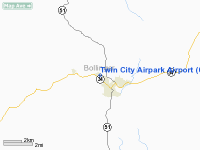
Twin City Airpark Airport |
Location & QuickFacts
| FAA Information Effective: | 2008-09-25 |
| Airport Identifier: | 0T3 |
| Airport Status: | Operational |
| Longitude/Latitude: | 089-59-40.9000W/37-18-47.4000N
-89.994694/37.313167 (Estimated) |
| Elevation: | 421 ft / 128.32 m (Estimated) |
| Land: | 40 acres |
| From nearest city: | 1 nautical miles W of Marble Hill, MO |
| Location: | Bollinger County, MO |
| Magnetic Variation: | 02E (1985) |
Owner & Manager
| Ownership: | Publicly owned |
| Owner: | Marble Hill |
| Address: | 606 Hwy 34 West, Po Box 799
Marble Hill, MO 63764 |
| Phone number: | 573-238-3622 |
| Manager: | Jennings Bond |
| Address: | Box 590
Marble Hill, MO 63764 |
| Phone number: | 573-238-2601 |
Airport Operations and Facilities
| Airport Use: | Open to public |
| Wind indicator: | Yes |
| Segmented Circle: | No |
| Control Tower: | No |
| Lighting Schedule: | RDO-CTL
ACTIVATE LIRL RWY 12/30 - 122.8. |
| Landing fee charge: | No |
| Sectional chart: | St Louis |
| Region: | ACE - Central |
| Boundary ARTCC: | ZKC - Kansas City |
| Responsible ARTCC: | ZME - Memphis |
| Tie-in FSS: | STL - Saint Louis |
| FSS on Airport: | No |
| FSS Toll Free: | 1-800-WX-BRIEF |
| NOTAMs Facility: | STL (NOTAM-d service avaliable) |
Airport Communications
Airport Services
| Airframe Repair: | NONE |
| Power Plant Repair: | NONE |
Runway Information
Runway 12/30
| Dimension: | 2600 x 70 ft / 792.5 x 21.3 m |
| Surface: | TURF, Fair Condition |
| Edge Lights: | Non-standard lighting system
INCORRECT SPACING & INSUF NUMBER OF EDGE & THLD LGTS. |
| |
Runway 12 |
Runway 30 |
| Longitude: | 089-59-54.5500W | 089-59-27.2400W |
| Latitude: | 37-18-54.1900N | 37-18-40.5900N |
| Traffic Pattern: | Left | Left |
| Obstruction: | 58 ft trees, 820.0 ft from runway, 92 ft right of centerline, 14:1 slope to clear | 92 ft trees, 1820.0 ft from runway, 20 ft left of centerline, 20:1 slope to clear |
|
Radio Navigation Aids
| ID |
Type |
Name |
Ch |
Freq |
Var |
Dist |
| DXE | NDB | Dexter | | 423.00 | 00E | 31.7 nm |
| PRI | NDB | Perrine | | 367.00 | 02E | 34.2 nm |
| CIR | NDB | Cairo | | 397.00 | 00E | 39.9 nm |
| CHQ | NDB | Charleston | | 208.00 | 01E | 41.6 nm |
| FD | NDB | Earli | | 278.00 | 03E | 41.9 nm |
| PJY | NDB | Pinckneyville | | 215.00 | 00E | 49.9 nm |
| CGI | VOR/DME | Cape Girardeau | 076X | 112.90 | 01E | 20.8 nm |
| FAM | VORTAC | Farmington | 104X | 115.70 | 01E | 24.5 nm |
| MAW | VORTAC | Malden | 049X | 111.20 | 03E | 45.7 nm |
Remarks
- WILDLIFE ON & INVOF ARPT.
- NSTD RWY SAFETY AREAS BYND EACH RWY END; INSUF LENGTH, INCORRECT TERRAIN GRADES, FENCE, DITCH, BRUSH, SMALL TREES.
- CROPS ARE LOCATED VERY CLOSE TO RWY EDGES.
Images and information placed above are from
http://www.airport-data.com/airport/0T3/
We thank them for the data!
| General Info
|
| Country |
United States
|
| State |
MISSOURI
|
| FAA ID |
0T3
|
| Latitude |
37-18-50.194N
|
| Longitude |
089-59-50.368W
|
| Elevation |
421 feet
|
| Near City |
MARBLE HILL
|
We don't guarantee the information is fresh and accurate. The data may
be wrong or outdated.
For more up-to-date information please refer to other sources.
|
|


