|
|
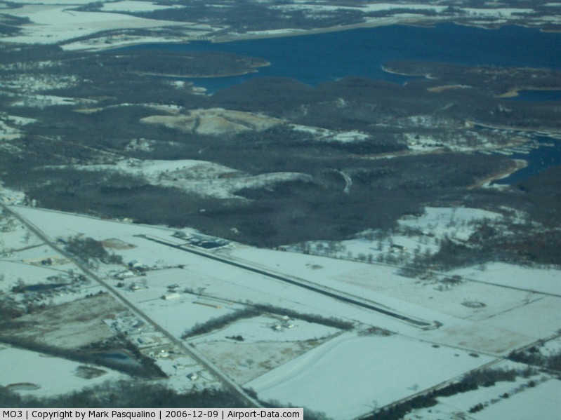
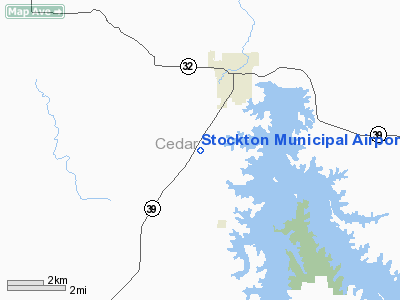
Stockton Municipal Airport |
|
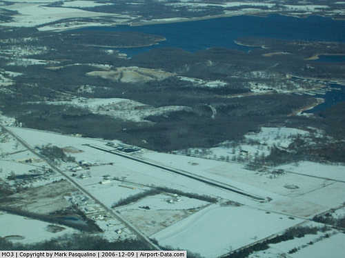 |
(Click on the photo to enlarge) |
Location & QuickFacts
| FAA Information Effective: | 2008-09-25 |
| Airport Identifier: | MO3 |
| Airport Status: | Operational |
| Longitude/Latitude: | 093-49-00.5610W/37-39-36.9440N
-93.816823/37.660262 (Estimated) |
| Elevation: | 1042 ft / 317.60 m (Surveyed) |
| Land: | 162 acres |
| From nearest city: | 3 nautical miles SW of Stockton, MO |
| Location: | Cedar County, MO |
| Magnetic Variation: | 03E (2000) |
Owner & Manager
| Ownership: | Publicly owned |
| Owner: | City Of Stockton |
| Address: | 201 S High Box 590
Stockton, MO 65785 |
| Phone number: | 417-276-5210 |
| Manager: | Raymond Heryford
CITY OF STOCKTON/CITY SUPERINTENDANT. |
| Address: | 201 S High Box 590
Stockton, MO 65785 |
| Phone number: | 417-276-5210 |
Airport Operations and Facilities
| Airport Use: | Open to public |
| Wind indicator: | Yes |
| Segmented Circle: | No |
| Control Tower: | No |
| Lighting Schedule: | DUSK-DAWN |
| Beacon Color: | Clear-Green (lighted land airport)
ROTG BCN OTS INDEFLY. |
| Landing fee charge: | No |
| Sectional chart: | Kansas City |
| Region: | ACE - Central |
| Boundary ARTCC: | ZKC - Kansas City |
| Tie-in FSS: | COU - Columbia |
| FSS on Airport: | No |
| FSS Toll Free: | 1-800-WX-BRIEF |
| NOTAMs Facility: | COU (NOTAM-d service avaliable) |
Airport Communications
Airport Services
| Fuel available: | 100LL
FOR FUEL CALL NR POSTED ON PUMPS. |
| Airframe Repair: | NONE |
| Power Plant Repair: | NONE |
| Bottled Oxygen: | NONE |
| Bulk Oxygen: | NONE |
Runway Information
Runway 01/19
| Dimension: | 3060 x 50 ft / 932.7 x 15.2 m |
| Surface: | ASPH, Fair Condition |
| Edge Lights: | Non-standard lighting system
NSTD LIRL; LGTS ON SIDES OF RY LCTD 18-30 FT FM PAVEMENT. THLD LGTS SPACED INCORRECTLY. |
| |
Runway 01 |
Runway 19 |
| Longitude: | 093-49-05.9880W | 093-48-55.2110W |
| Latitude: | 37-39-22.4780N | 37-39-51.4910N |
| Elevation: | 1034.00 ft | 1037.00 ft |
| Alignment: | 16 | 127 |
| Traffic Pattern: | Left | Left |
| Markings: | Non-precision instrument, Fair Condition | Non-precision instrument, Fair Condition |
| Obstruction: | 32 ft trees, 800.0 ft from runway, 18:1 slope to clear
RWY 01 +1-3 FT WEEDS & BRUSH 10-40 FT FM RY END 0-15 FT L. | 49 ft trees, 1045.0 ft from runway, 80 ft left of centerline, 17:1 slope to clear
+1-3' TALL GRASS, 0-200 FT FM RY END, L & R. |
|
Radio Navigation Aids
| ID |
Type |
Name |
Ch |
Freq |
Var |
Dist |
| LLU | NDB | Spring River | | 356.00 | 05E | 25.7 nm |
| EAD | NDB | Nevada | | 209.00 | 06E | 26.0 nm |
| ILJ | NDB | Willard | | 254.00 | 03E | 28.1 nm |
| GLY | NDB | Golden Valley | | 388.00 | 04E | 42.4 nm |
| PTS | NDB | Pittsburg | | 365.00 | 05E | 45.3 nm |
| FSK | NDB | Fort Scott | | 379.00 | 05E | 45.8 nm |
| SGF | VORTAC | Springfield | 116X | 116.90 | 04E | 29.4 nm |
| BUM | VORTAC | Butler | 106X | 115.90 | 07E | 48.6 nm |
Remarks
- WILDLIFE ON & INVOF ARPT.
- INSUFFICIENT RY SAFETY AREA AT RY 01 END. LARGE DROPOFF WITH ROCKS & DEBRIS & INCORRECT GRADE.
Images and information placed above are from
http://www.airport-data.com/airport/MO3/
We thank them for the data!
| General Info
|
| Country |
United States
|
| State |
MISSOURI
|
| FAA ID |
MO3
|
| Latitude |
37-39-36.944N
|
| Longitude |
093-49-00.561W
|
| Elevation |
1042 feet
|
| Near City |
STOCKTON
|
We don't guarantee the information is fresh and accurate. The data may
be wrong or outdated.
For more up-to-date information please refer to other sources.
|
|