 |
|
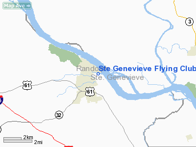
Ste Genevieve Flying Club Airport |
Location & QuickFacts
| FAA Information Effective: | 2008-09-25 |
| Airport Identifier: | 6MO2 |
| Airport Status: | Operational |
| Longitude/Latitude: | 090-02-00.4020W/37-59-10.1890N
-90.033445/37.986164 (Estimated) |
| Elevation: | 380 ft / 115.82 m (Estimated) |
| Land: | 8 acres |
| From nearest city: | 0 nautical miles E of Ste Genevieve, MO |
| Location: | Ste Genevieve County, MO |
| Magnetic Variation: | 02E (1985) |
Owner & Manager
| Ownership: | Privately owned |
| Owner: | Ste Genevieve Flying Club |
| Address: | 6 Pleasant View Drive
Ste. Genevieve, MO 63670 |
| Phone number: | 573-883-3541 |
| Manager: | Greg Gremminger |
| Address: | 17225 Pleasant View Drive
Ste. Genevieve, MO 63670 |
| Phone number: | 573-883-3541 |
Airport Operations and Facilities
| Airport Use: | Private |
| Wind indicator: | Yes |
| Segmented Circle: | No |
| Control Tower: | No |
| Landing fee charge: | No |
| Sectional chart: | St Louis |
| Region: | ACE - Central |
| Boundary ARTCC: | ZKC - Kansas City |
| Tie-in FSS: | STL - Saint Louis |
| FSS on Airport: | No |
| FSS Toll Free: | 1-800-WX-BRIEF |
Airport Services
| Airframe Repair: | NONE |
| Power Plant Repair: | NONE |
Runway Information
Runway 13/31
| Dimension: | 1600 x 90 ft / 487.7 x 27.4 m |
| Surface: | TURF, Fair Condition |
| |
Runway 13 |
Runway 31 |
| Traffic Pattern: | Left | Right |
| Obstruction: | 85 ft trees, 590.0 ft from runway, 150 ft right of centerline, 6:1 slope to clear | 85 ft trees, 1485.0 ft from runway, 220 ft left of centerline, 17:1 slope to clear |
|
Radio Navigation Aids
| ID |
Type |
Name |
Ch |
Freq |
Var |
Dist |
| SAR | NDB | Sparta | | 239.00 | 01E | 18.4 nm |
| FES | NDB | Festus | | 269.00 | 01E | 21.0 nm |
| PRI | NDB | Perrine | | 367.00 | 02E | 23.0 nm |
| BL | NDB | Belleville | | 362.00 | 02E | 31.6 nm |
| PJY | NDB | Pinckneyville | | 215.00 | 00E | 31.8 nm |
| SKE | TACAN | Scott | 059X | | 02E | 34.7 nm |
| CSX | VOR/DME | Cardinal | 111Y | 116.45 | 00E | 48.6 nm |
| FAM | VORTAC | Farmington | 104X | 115.70 | 01E | 21.1 nm |
| TOY | VORTAC | Troy | 107X | 116.00 | 04E | 45.6 nm |
| ENL | VORTAC | Centralia | 097X | 115.00 | 04E | 48.8 nm |
| STL | VOT | St Louis Lambert | | 111.00 | | 48.4 nm |
Remarks
- FLOODS IN SPRINGS.
- RWY 13/31 CONDITION UNEVEN WITH HIGH WEEDS.
- ULTRALIGHT ACTVTY ON AND INVOF ARPT.
Images and information placed above are from
http://www.airport-data.com/airport/6MO2/
We thank them for the data!
| General Info
|
| Country |
United States
|
| State |
MISSOURI
|
| FAA ID |
6MO2
|
| Latitude |
37-59-10.189N
|
| Longitude |
090-02-00.402W
|
| Elevation |
380 feet
|
| Near City |
STE GENEVIEVE
|
We don't guarantee the information is fresh and accurate. The data may
be wrong or outdated.
For more up-to-date information please refer to other sources.
|
|


