 |
|
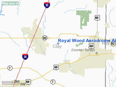
Royal Wood Aerodrome Airport |
Location & QuickFacts
| FAA Information Effective: | 2008-09-25 |
| Airport Identifier: | 20MO |
| Airport Status: | Operational |
| Longitude/Latitude: | 094-19-00.8080W/39-21-30.0110N
-94.316891/39.358336 (Estimated) |
| Elevation: | 860 ft / 262.13 m (Estimated) |
| Land: | 60 acres |
| From nearest city: | 3 nautical miles SE of Kearney, MO |
| Location: | Clay County, MO |
| Magnetic Variation: | 05E (1985) |
Owner & Manager
| Ownership: | Privately owned |
| Owner: | Royal Wood |
| Address: | 21703 Ne 148th Street
Kearney, MO 64060 |
| Phone number: | 816-628-5010 |
| Manager: | William Dunlop |
| Address: | 21703 Ne 148th Street
Kearney, MO 64060 |
| Phone number: | 816-628-5010 |
Airport Operations and Facilities
| Airport Use: | Private |
| Wind indicator: | Yes |
| Segmented Circle: | No |
| Control Tower: | No |
| Lighting Schedule: | RDO-CTL
FOR LIRL RWY 17/35 KEY 122.8 5 TIMES. |
| Landing fee charge: | No |
| Sectional chart: | Kansas City |
| Region: | ACE - Central |
| Boundary ARTCC: | ZKC - Kansas City |
| Tie-in FSS: | COU - Columbia |
| FSS on Airport: | No |
| FSS Toll Free: | 1-800-WX-BRIEF |
Runway Information
Runway 17/35
| Dimension: | 3000 x 60 ft / 914.4 x 18.3 m |
| Surface: | TURF, |
| Edge Lights: | Low |
| |
Runway 17 |
Runway 35 |
| Traffic Pattern: | Left | Left |
|
Radio Navigation Aids
| ID |
Type |
Name |
Ch |
Freq |
Var |
Dist |
| GPH | NDB | Mosby | | 284.00 | 03E | 0.9 nm |
| DO | NDB | Dotte | | 359.00 | 05E | 21.8 nm |
| EZZ | NDB | Cameron | | 394.00 | 03E | 22.4 nm |
| GKB | NDB | Norge | | 517.00 | 05E | 23.8 nm |
| GQ | NDB | Norge | | 517.00 | 05E | 23.8 nm |
| LXT | NDB | Lesumit | | 263.00 | 04E | 24.0 nm |
| AZN | NDB | Amazon | | 233.00 | 06E | 41.8 nm |
| CHT | NDB | Chillicothe | | 375.00 | 03E | 45.7 nm |
| RIS | VOR/DME | Riverside | 051X | 111.40 | 05E | 19.3 nm |
| BQS | VOR/DME | Braymer | 049X | 111.20 | 03E | 26.2 nm |
| OJC | VOR/DME | Johnson County | 077X | 113.00 | 06E | 36.8 nm |
| ANX | VORTAC | Napoleon | 087X | 114.00 | 07E | 18.1 nm |
| MCI | VORTAC | Kansas City | 079Y | 113.25 | 05E | 20.0 nm |
| STJ | VORTAC | St Joseph | 102X | 115.50 | 08E | 45.9 nm |
| MKC | VOT | Kansas City Downtown | | 108.60 | | 19.3 nm |
Remarks
- RWY SOFT WHEN WET.
- 70' PLINE 600' WEST & PARALLEL TO RWY.
- BE ALERT IN TFC PATTERN DUE TO PVT USE ARPT WITHIN 2NM NNW OF ARPT.
- PROVIED A MINIMUM APCH RATIO OF 20:1 & A 7:1 TRANSITIONAL SURFACE IS MAINTAINED FOR EACH RWY.
Images and information placed above are from
http://www.airport-data.com/airport/20MO/
We thank them for the data!
| General Info
|
| Country |
United States
|
| State |
MISSOURI
|
| FAA ID |
20MO
|
| Latitude |
39-21-30.011N
|
| Longitude |
094-19-00.808W
|
| Elevation |
860 feet
|
| Near City |
KEARNEY
|
We don't guarantee the information is fresh and accurate. The data may
be wrong or outdated.
For more up-to-date information please refer to other sources.
|
|


