 |
|
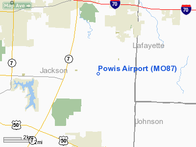
Location & QuickFacts
| FAA Information Effective: | 2008-09-25 |
| Airport Identifier: | MO87 |
| Airport Status: | Operational |
| Longitude/Latitude: | 094-09-42.8060W/38-56-45.0280N
-94.161891/38.945841 (Estimated) |
| Elevation: | 879 ft / 267.92 m (Estimated) |
| Land: | 23 acres |
| From nearest city: | 5 nautical miles NE of Oak Grove, MO |
| Location: | Jackson County, MO |
| Magnetic Variation: | 05E (1985) |
Owner & Manager
| Ownership: | Privately owned |
| Owner: | Mike Powis |
| Address: | 9203 Stillhouse Rd.
Oak Grove, MO 64075 |
| Phone number: | 516-625-7004 |
| Address: |
|
Airport Operations and Facilities
| Airport Use: | Private |
| Segmented Circle: | No |
| Control Tower: | No |
| Sectional chart: | Kansas City |
| Region: | ACE - Central |
| Boundary ARTCC: | ZKC - Kansas City |
| Tie-in FSS: | COU - Columbia |
| FSS on Airport: | No |
| FSS Toll Free: | 1-800-WX-BRIEF |
Runway Information
Runway 18/36
| Dimension: | 1300 x 75 ft / 396.2 x 22.9 m |
| Surface: | TURF, |
| |
Runway 18 |
Runway 36 |
| Traffic Pattern: | Left | Left |
| Obstruction: | 15 ft road | |
|
Radio Navigation Aids
| ID |
Type |
Name |
Ch |
Freq |
Var |
Dist |
| LXT | NDB | Lesumit | | 263.00 | 04E | 9.8 nm |
| GQ | NDB | Norge | | 517.00 | 05E | 24.1 nm |
| GKB | NDB | Norge | | 517.00 | 05E | 24.1 nm |
| GPH | NDB | Mosby | | 284.00 | 03E | 25.0 nm |
| DO | NDB | Dotte | | 359.00 | 05E | 32.0 nm |
| HCK | NDB | Hawks | | 296.00 | 04E | 33.6 nm |
| GLY | NDB | Golden Valley | | 388.00 | 04E | 41.8 nm |
| PUR | NDB | Marshall | | 371.00 | 03E | 45.5 nm |
| EZZ | NDB | Cameron | | 394.00 | 03E | 47.4 nm |
| DMO | NDB | Sedalia | | 281.00 | 03E | 48.4 nm |
| SZL | TACAN | Whiteman | 035X | | 04E | 31.3 nm |
| RIS | VOR/DME | Riverside | 051X | 111.40 | 05E | 22.8 nm |
| OJC | VOR/DME | Johnson County | 077X | 113.00 | 06E | 27.6 nm |
| BQS | VOR/DME | Braymer | 049X | 111.20 | 03E | 43.3 nm |
| ANX | VORTAC | Napoleon | 087X | 114.00 | 07E | 9.1 nm |
| MCI | VORTAC | Kansas City | 079Y | 113.25 | 05E | 33.7 nm |
| BUM | VORTAC | Butler | 106X | 115.90 | 07E | 43.3 nm |
| MKC | VOT | Kansas City Downtown | | 108.60 | | 23.0 nm |
Remarks
- OWNER DESIRES ARPT NOT TO BE CHARTED.
- APCH TO EACH RY MAINTAINED FOR A MINIMUM 20:1 GLILDE SLOPE; ARPT TRANSITIONAL SFC MAINTAINED FOR 7:1 SLOPE.
Images and information placed above are from
http://www.airport-data.com/airport/MO87/
We thank them for the data!
| General Info
|
| Country |
United States
|
| State |
MISSOURI
|
| FAA ID |
MO87
|
| Latitude |
38-56-45.028N
|
| Longitude |
094-09-42.806W
|
| Elevation |
879 feet
|
| Near City |
OAK GROVE
|
We don't guarantee the information is fresh and accurate. The data may
be wrong or outdated.
For more up-to-date information please refer to other sources.
|
|


