 |
|
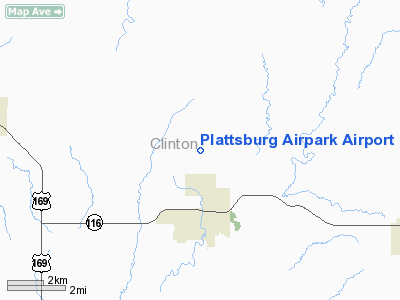
Plattsburg Airpark Airport |
Location & QuickFacts
| FAA Information Effective: | 2008-09-25 |
| Airport Identifier: | 5MO |
| Airport Status: | Operational |
| Longitude/Latitude: | 094-27-42.2000W/39-35-40.2000N
-94.461722/39.594500 (Estimated) |
| Elevation: | 1020 ft / 310.90 m (Estimated) |
| Land: | 13 acres |
| From nearest city: | 2 nautical miles N of Plattsburg, MO |
| Location: | Clinton County, MO |
| Magnetic Variation: | 05E (1985) |
Owner & Manager
| Ownership: | Privately owned |
| Owner: | Virgil & Joyce Vetter |
| Address: | 2756 Northwest Y Hwy
Plattsburg, MO 64477 |
| Phone number: | 816-930-2648 |
| Manager: | Virgil Vetter |
| Address: | 2756 Northwest Y Hwy
Plattsburg, MO 64477 |
| Phone number: | 816-930-2648 |
Airport Operations and Facilities
| Airport Use: | Open to public |
| Wind indicator: | Yes |
| Segmented Circle: | No |
| Control Tower: | No |
| Landing fee charge: | No |
| Sectional chart: | Kansas City |
| Region: | ACE - Central |
| Boundary ARTCC: | ZKC - Kansas City |
| Tie-in FSS: | COU - Columbia |
| FSS on Airport: | No |
| FSS Toll Free: | 1-800-WX-BRIEF |
| NOTAMs Facility: | COU (NOTAM-d service avaliable) |
Airport Communications
Airport Services
| Airframe Repair: | MAJOR |
| Power Plant Repair: | MAJOR |
| Bottled Oxygen: | NONE |
| Bulk Oxygen: | NONE |
Runway Information
Runway 18/36
| Dimension: | 2100 x 20 ft / 640.1 x 6.1 m
ASPH WIDTH VARIANCE 6-20 FT. |
| Surface: | ASPH-TURF, Poor Condition
S 510 FT & N 70 FT OF TURF IN GOOD COND; ASPH HAS POT HOLES WITH LOOSE AGGREGATE & VEGETATION GROWING IN CRACKS. |
| |
Runway 18 |
Runway 36 |
| Longitude: | 094-27-41.8600W | 094-27-42.5700W |
| Latitude: | 39-35-50.5600N | 39-35-29.8100N |
| Traffic Pattern: | Left | Left |
| Obstruction: | 5 ft fence, 40.0 ft from runway, 8:1 slope to clear | 41 ft trees, 423.0 ft from runway, 122 ft right of centerline, 10:1 slope to clear |
|
Radio Navigation Aids
| ID |
Type |
Name |
Ch |
Freq |
Var |
Dist |
| EZZ | NDB | Cameron | | 394.00 | 03E | 11.9 nm |
| GPH | NDB | Mosby | | 284.00 | 03E | 16.6 nm |
| DO | NDB | Dotte | | 359.00 | 05E | 26.1 nm |
| AZN | NDB | Amazon | | 233.00 | 06E | 27.0 nm |
| GQ | NDB | Norge | | 517.00 | 05E | 33.3 nm |
| GKB | NDB | Norge | | 517.00 | 05E | 33.3 nm |
| LXT | NDB | Lesumit | | 263.00 | 04E | 38.3 nm |
| CHT | NDB | Chillicothe | | 375.00 | 03E | 46.1 nm |
| TRX | NDB | Trenton | | 400.00 | 03E | 49.6 nm |
| EVU | NDB | Emville | | 317.00 | 05E | 49.9 nm |
| BQS | VOR/DME | Braymer | 049X | 111.20 | 03E | 27.2 nm |
| RIS | VOR/DME | Riverside | 051X | 111.40 | 05E | 29.2 nm |
| RBA | VOR/DME | Robinson | 019X | 108.20 | 04E | 47.0 nm |
| OJC | VOR/DME | Johnson County | 077X | 113.00 | 06E | 47.1 nm |
| MCI | VORTAC | Kansas City | 079Y | 113.25 | 05E | 22.6 nm |
| STJ | VORTAC | St Joseph | 102X | 115.50 | 08E | 30.7 nm |
| ANX | VORTAC | Napoleon | 087X | 114.00 | 07E | 33.8 nm |
| MKC | VOT | Kansas City Downtown | | 108.60 | | 29.0 nm |
Remarks
- WILDLIFE ON & INVOF ARPT; LARGE FLOCKS OF GEESE ON LAKE.
Images and information placed above are from
http://www.airport-data.com/airport/5MO/
We thank them for the data!
| General Info
|
| Country |
United States
|
| State |
MISSOURI
|
| FAA ID |
5MO
|
| Latitude |
39-35-39.995N
|
| Longitude |
094-27-45.823W
|
| Elevation |
1020 feet
|
| Near City |
PLATTSBURG
|
We don't guarantee the information is fresh and accurate. The data may
be wrong or outdated.
For more up-to-date information please refer to other sources.
|
|


