 |
|
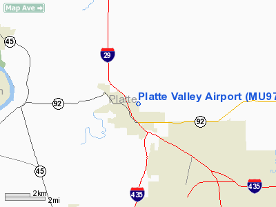
Location & QuickFacts
| FAA Information Effective: | 2008-09-25 |
| Airport Identifier: | MU97 |
| Airport Status: | Operational |
| Longitude/Latitude: | 094-45-42.0000W/39-22-03.0000N
-94.761667/39.367500 (Estimated) |
| Elevation: | 920 ft / 280.42 m (Estimated) |
| Land: | 0 acres |
| From nearest city: | 2 nautical miles E of Platte City, MO |
| Location: | Platte County, MO |
| Magnetic Variation: | 05E (1990) |
Owner & Manager
| Ownership: | Privately owned |
| Owner: | John & Jeff Morelli |
| Address: | Route 1, Box 250
Platte City, MO 64079 |
| Phone number: | 816-431-2264 |
| Manager: | John & Jeff Morelli |
| Address: | Route 1, Box 250
Platte City, MO 64079 |
| Phone number: | 816-431-2264 |
Airport Operations and Facilities
| Airport Use: | Private |
| Segmented Circle: | No |
| Control Tower: | No |
| Sectional chart: | Kansas City |
| Region: | ACE - Central |
| Boundary ARTCC: | ZKC - Kansas City |
| Tie-in FSS: | COU - Columbia |
| FSS on Airport: | No |
| FSS Toll Free: | 1-800-WX-BRIEF |
Runway Information
Runway 15/33
| Dimension: | 2000 x 50 ft / 609.6 x 15.2 m |
| Surface: | TURF, |
| |
Runway 15 |
Runway 33 |
| Traffic Pattern: | Left | Left |
|
Radio Navigation Aids
| ID |
Type |
Name |
Ch |
Freq |
Var |
Dist |
| DO | NDB | Dotte | | 359.00 | 05E | 8.8 nm |
| GQ | NDB | Norge | | 517.00 | 05E | 19.1 nm |
| GKB | NDB | Norge | | 517.00 | 05E | 19.1 nm |
| GPH | NDB | Mosby | | 284.00 | 03E | 21.1 nm |
| LXT | NDB | Lesumit | | 263.00 | 04E | 30.5 nm |
| EZZ | NDB | Cameron | | 394.00 | 03E | 31.4 nm |
| AZN | NDB | Amazon | | 233.00 | 06E | 31.8 nm |
| TO | NDB | Biloy | | 521.00 | 05E | 45.6 nm |
| FOE | TACAN | Forbes | 053X | | 05E | 48.9 nm |
| RIS | VOR/DME | Riverside | 051X | 111.40 | 05E | 16.7 nm |
| OJC | VOR/DME | Johnson County | 077X | 113.00 | 06E | 31.7 nm |
| RBA | VOR/DME | Robinson | 019X | 108.20 | 04E | 42.2 nm |
| BQS | VOR/DME | Braymer | 049X | 111.20 | 03E | 44.0 nm |
| MCI | VORTAC | Kansas City | 079Y | 113.25 | 05E | 5.1 nm |
| ANX | VORTAC | Napoleon | 087X | 114.00 | 07E | 33.7 nm |
| STJ | VORTAC | St Joseph | 102X | 115.50 | 08E | 36.4 nm |
| TOP | VORTAC | Topeka | 125X | 117.80 | 05E | 39.2 nm |
| MKC | VOT | Kansas City Downtown | | 108.60 | | 16.5 nm |
| FOE | VOT | Forbes | | 111.00 | | 49.0 nm |
Remarks
- PROVIDED APCH TO EACH RY MNTND FOR A MINIMUM 20:1 GLIDE ANGLE AND TRANSITIONAL SURFACE MNTND FOR A 7:1 SLOPE.
Images and information placed above are from
http://www.airport-data.com/airport/MU97/
We thank them for the data!
| General Info
|
| Country |
United States
|
| State |
MISSOURI
|
| FAA ID |
MU97
|
| Latitude |
39-22-03.000N
|
| Longitude |
094-45-42.000W
|
| Elevation |
920 feet
|
| Near City |
PLATTE CITY
|
We don't guarantee the information is fresh and accurate. The data may
be wrong or outdated.
For more up-to-date information please refer to other sources.
|
|


