 |
|
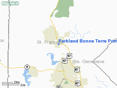
Parkland Bonne Terre Primary Care Center Heliport |
Location & QuickFacts
| FAA Information Effective: | 2008-09-25 |
| Airport Identifier: | 99MO |
| Airport Status: | Operational |
| Longitude/Latitude: | 090-32-00.4500W/37-54-30.1800N
-90.533458/37.908383 (Estimated) |
| Elevation: | 850 ft / 259.08 m (Estimated) |
| Land: | 0 acres |
| From nearest city: | 1 nautical miles S of Bonne Terre, MO |
| Location: | St Francois County, MO |
| Magnetic Variation: | 01E (1995) |
Owner & Manager
| Ownership: | Privately owned |
| Owner: | Parkland Health Center |
| Address: | 7245 Vo Tech Road
Bonne Terre, MO 63628 |
| Phone number: | 573-760-8163 |
| Manager: | Ron Mc Spadden |
| Address: | 1101 West Liberty
Farmington, MO 63640 |
| Phone number: | 573-358-4100 |
Airport Operations and Facilities
| Airport Use: | Private
FOR MEDICAL USE ONLY. |
| Wind indicator: | Yes |
| Segmented Circle: | No |
| Control Tower: | No |
| Lighting Schedule: | PHONE REQ
FOR PERIMETER LIGHTS CALL 573-760-8163. |
| Landing fee charge: | No |
| Sectional chart: | St Louis |
| Region: | ACE - Central |
| Boundary ARTCC: | ZKC - Kansas City |
| Tie-in FSS: | COU - Columbia |
| FSS on Airport: | No |
| FSS Toll Free: | 1-800-WX-BRIEF |
Runway Information
Helipad H1
| Dimension: | 40 x 40 ft / 12.2 x 12.2 m |
| Surface: | ASPH, |
| |
Runway H1 |
Runway |
| Traffic Pattern: | Left | Left |
|
Radio Navigation Aids
| ID |
Type |
Name |
Ch |
Freq |
Var |
Dist |
| PRI | NDB | Perrine | | 367.00 | 02E | 9.9 nm |
| FES | NDB | Festus | | 269.00 | 01E | 18.6 nm |
| UUV | NDB | Sullivan | | 356.00 | 02E | 35.7 nm |
| SAR | NDB | Sparta | | 239.00 | 01E | 41.9 nm |
| UBX | NDB | Cuba | | 380.00 | 01E | 43.4 nm |
| BL | NDB | Belleville | | 362.00 | 02E | 49.7 nm |
| FAM | VORTAC | Farmington | 104X | 115.70 | 01E | 20.0 nm |
| SUS | VOT | Spirit Of St Louis | | 112.20 | | 45.7 nm |
Remarks
- OWNER DESIRES ARPT NOT BE CHARTED.
- PRVDD ALL APCH/DEP PATHS TO LANDING AREA 8:1 GLIDE SLOPE; MAINTAIN CLEAR TRANSITIONAL SURFACES FOR A MINIMUM 2:1 GLIDE SLOPE.
Images and information placed above are from
http://www.airport-data.com/airport/99MO/
We thank them for the data!
| General Info
|
| Country |
United States
|
| State |
MISSOURI
|
| FAA ID |
99MO
|
| Latitude |
37-54-30.180N
|
| Longitude |
090-32-00.450W
|
| Elevation |
850 feet
|
| Near City |
BONNE TERRE
|
We don't guarantee the information is fresh and accurate. The data may
be wrong or outdated.
For more up-to-date information please refer to other sources.
|
|


