 |
|
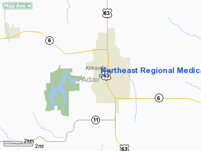
Northeast Regional Medical Center Heliport |
Location & QuickFacts
| FAA Information Effective: | 2008-09-25 |
| Airport Identifier: | MU92 |
| Airport Status: | Operational |
| Longitude/Latitude: | 092-35-27.1000W/40-11-26.1000N
-92.590861/40.190583 (Estimated) |
| Elevation: | 975 ft / 297.18 m () |
| Land: | 0 acres |
| From nearest city: | 1 nautical miles N of Kirksville, MO |
| Location: | Adair County, MO |
| Magnetic Variation: | 02E (2000) |
Owner & Manager
| Ownership: | Privately owned |
| Owner: | Northeast Regional Medical Center |
| Address: | 315 South Osteopathy
Kirksville, MO 63501-8599 |
| Phone number: | 660-785-1100 |
| Manager: | Carrol Harden; Facilities Director |
| Address: | 315 South Osteopathy
Kirksville, MO 63501-8599 |
| Phone number: | 660-785-1239 |
Airport Operations and Facilities
| Airport Use: | Private |
| Wind indicator: | Yes |
| Segmented Circle: | No |
| Control Tower: | No |
| Lighting Schedule: | PHONE REQ
FOR ROTG BCN CALL 660-785-1100. |
| Beacon Color: | Clear (unlighted land airport) |
| Sectional chart: | Chicago |
| Region: | ACE - Central |
| Boundary ARTCC: | ZKC - Kansas City |
| Tie-in FSS: | COU - Columbia |
| FSS Toll Free: | 1-800-WX-BRIEF |
Runway Information
Helipad H1
| Dimension: | 40 x 40 ft / 12.2 x 12.2 m
40 FT DIAMETER CONCRETE PAD. |
| Surface: | CONC, |
| |
Runway H1 |
Runway |
| Traffic Pattern: | Left | Left |
| Markings: | Basic, | , |
|
Radio Navigation Aids
| ID |
Type |
Name |
Ch |
Freq |
Var |
Dist |
| TVK | NDB | Centerville | | 290.00 | 04E | 33.0 nm |
| BEX | NDB | Bloomfield | | 269.00 | 02E | 34.1 nm |
| BZK | NDB | Brookfield | | 383.00 | 03E | 35.0 nm |
| TRX | NDB | Trenton | | 400.00 | 03E | 46.5 nm |
| CHT | NDB | Chillicothe | | 375.00 | 03E | 48.5 nm |
| MCM | VOR/DME | Macon | 076X | 112.90 | 06E | 32.6 nm |
| IRK | VORTAC | Kirksville | 093X | 114.60 | 06E | 3.3 nm |
Remarks
- PRVDD CLEAR OF OBSTRUCTIONS; INGRESS/EGRESS ROUTES PERFORMED AT 120 DEGREES TRUE MAGNETIC HEADING; OBSTRUCTIONS MKD/LGTD/REMOVED; CONTROL PUBLIC ACCESS; ADQUACY OF FIRE EQUIPMENT.
Images and information placed above are from
http://www.airport-data.com/airport/MU92/
We thank them for the data!
| General Info
|
| Country |
United States
|
| State |
MISSOURI
|
| FAA ID |
MU92
|
| Latitude |
40-11-26.100N
|
| Longitude |
092-35-27.100W
|
| Elevation |
975 feet
|
| Near City |
KIRKSVILLE
|
We don't guarantee the information is fresh and accurate. The data may
be wrong or outdated.
For more up-to-date information please refer to other sources.
|
|


