 |
|
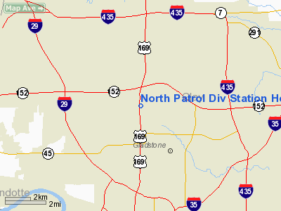
North Patrol Div Station Heliport |
Location & QuickFacts
| FAA Information Effective: | 2008-09-25 |
| Airport Identifier: | 19MO |
| Airport Status: | Operational |
| Longitude/Latitude: | 094-35-20.8400W/39-14-40.0070N
-94.589122/39.244446 (Estimated) |
| Elevation: | 955 ft / 291.08 m (Estimated) |
| Land: | 0 acres |
| From nearest city: | 0 nautical miles N of Kansas City, MO |
| Location: | Clay County, MO |
| Magnetic Variation: | 05E (1985) |
Owner & Manager
| Ownership: | Publicly owned |
| Owner: | Kansas City Mo Police Dep |
| Address: | 1125 Locust
Kansas City, MO 64106 |
| Phone number: | 816-234-5540 |
| Manager: | D. Miller |
| Address: | 4601 Eastern
Kansas City, MO 64106 |
| Phone number: | 816-861-1600 |
Airport Operations and Facilities
| Airport Use: | Private |
| Wind indicator: | Yes |
| Segmented Circle: | No |
| Control Tower: | No |
| Landing fee charge: | No |
| Sectional chart: | Kansas City |
| Region: | ACE - Central |
| Boundary ARTCC: | ZKC - Kansas City |
| Tie-in FSS: | COU - Columbia |
| FSS on Airport: | No |
| FSS Toll Free: | 1-800-WX-BRIEF |
Runway Information
Helipad H1
| Dimension: | 15 x 15 ft / 4.6 x 4.6 m |
| Surface: | CONC, |
| |
Runway H1 |
Runway |
| Traffic Pattern: | Left | Left |
|
Radio Navigation Aids
| ID |
Type |
Name |
Ch |
Freq |
Var |
Dist |
| DO | NDB | Dotte | | 359.00 | 05E | 7.6 nm |
| GKB | NDB | Norge | | 517.00 | 05E | 11.4 nm |
| GQ | NDB | Norge | | 517.00 | 05E | 11.4 nm |
| GPH | NDB | Mosby | | 284.00 | 03E | 14.5 nm |
| LXT | NDB | Lesumit | | 263.00 | 04E | 19.8 nm |
| EZZ | NDB | Cameron | | 394.00 | 03E | 32.6 nm |
| AZN | NDB | Amazon | | 233.00 | 06E | 41.2 nm |
| RIS | VOR/DME | Riverside | 051X | 111.40 | 05E | 7.5 nm |
| OJC | VOR/DME | Johnson County | 077X | 113.00 | 06E | 25.2 nm |
| BQS | VOR/DME | Braymer | 049X | 111.20 | 03E | 40.5 nm |
| MCI | VORTAC | Kansas City | 079Y | 113.25 | 05E | 7.3 nm |
| ANX | VORTAC | Napoleon | 087X | 114.00 | 07E | 23.2 nm |
| TOP | VORTAC | Topeka | 125X | 117.80 | 05E | 45.2 nm |
| STJ | VORTAC | St Joseph | 102X | 115.50 | 08E | 45.8 nm |
| MKC | VOT | Kansas City Downtown | | 108.60 | | 7.3 nm |
Remarks
- OWNER DESIRES ARPT NOT BE CHARTED.
- PRVDD SPL VFR CONDS ADHERED TO & APCH/DEP PATHS TO LNDG AREA MAINT FOR MIN 8:1 GLIDE SLOPE & TRSNL SFC MAINT FOR 2:1 SLOPE.
Images and information placed above are from
http://www.airport-data.com/airport/19MO/
We thank them for the data!
| General Info
|
| Country |
United States
|
| State |
MISSOURI
|
| FAA ID |
19MO
|
| Latitude |
39-14-40.007N
|
| Longitude |
094-35-20.840W
|
| Elevation |
955 feet
|
| Near City |
KANSAS CITY
|
We don't guarantee the information is fresh and accurate. The data may
be wrong or outdated.
For more up-to-date information please refer to other sources.
|
|


