 |
|
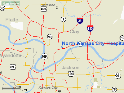
North Kansas City Hospital Heliport |
Location & QuickFacts
| FAA Information Effective: | 2008-09-25 |
| Airport Identifier: | 83MO |
| Airport Status: | Operational |
| Longitude/Latitude: | 094-33-04.8370W/39-08-58.0130N
-94.551344/39.149448 (Estimated) |
| Elevation: | 411 ft / 125.27 m (Estimated) |
| Land: | 0 acres |
| From nearest city: | 0 nautical miles SW of North Kansas City, MO |
| Location: | Clay County, MO |
| Magnetic Variation: | 05E (1985) |
Owner & Manager
| Ownership: | Privately owned |
| Owner: | North Kansas City Hospital |
| Address: | 2800 Clay Edwards Dr
North Kansas City, MO 64116 |
| Phone number: | 816-691-2000 |
| Manager: | Kenneth Williams |
| Address: | 2800 Clay Edwards Dr.
North Kansas City, MO 64116 |
| Phone number: | 816-691-2000 |
Airport Operations and Facilities
| Airport Use: | Private
MEDICAL. |
| Wind indicator: | Yes |
| Segmented Circle: | Yes |
| Control Tower: | No |
| Lighting Schedule: | PHONE REQ
FOR HELIPAD PERIMETER LGTS CALL 816-346-7000. |
| Landing fee charge: | No |
| Sectional chart: | Kansas City |
| Region: | ACE - Central |
| Boundary ARTCC: | ZKC - Kansas City |
| Tie-in FSS: | COU - Columbia |
| FSS on Airport: | No |
| FSS Toll Free: | 1-800-WX-BRIEF |
Runway Information
Helipad H1
| Dimension: | 45 x 45 ft / 13.7 x 13.7 m |
| Surface: | CONC, |
| |
Runway H1 |
Runway |
| Traffic Pattern: | Left | Left |
|
Radio Navigation Aids
| ID |
Type |
Name |
Ch |
Freq |
Var |
Dist |
| GKB | NDB | Norge | | 517.00 | 05E | 7.2 nm |
| GQ | NDB | Norge | | 517.00 | 05E | 7.2 nm |
| DO | NDB | Dotte | | 359.00 | 05E | 10.2 nm |
| LXT | NDB | Lesumit | | 263.00 | 04E | 14.1 nm |
| GPH | NDB | Mosby | | 284.00 | 03E | 16.4 nm |
| EZZ | NDB | Cameron | | 394.00 | 03E | 37.2 nm |
| AZN | NDB | Amazon | | 233.00 | 06E | 47.1 nm |
| RIS | VOR/DME | Riverside | 051X | 111.40 | 05E | 2.7 nm |
| OJC | VOR/DME | Johnson County | 077X | 113.00 | 06E | 20.5 nm |
| BQS | VOR/DME | Braymer | 049X | 111.20 | 03E | 42.7 nm |
| MCI | VORTAC | Kansas City | 079Y | 113.25 | 05E | 11.9 nm |
| ANX | VORTAC | Napoleon | 087X | 114.00 | 07E | 20.0 nm |
| TOP | VORTAC | Topeka | 125X | 117.80 | 05E | 46.5 nm |
| MKC | VOT | Kansas City Downtown | | 108.60 | | 2.7 nm |
Remarks
- OWNER DESIRES HELIPORT NOT BE CHARTED.
- (E111-1) CONT: EXISTING PAD IS ABNDD UPON ACTVTN OF THIS SITE.
- CONDL-PRVDD ALL TKOF/LNDGS ARE CONDUCTED TO/FROM S & SE; THE 3 LGT STDS OBSTG INGRESS/EGRESS ARE REMOVED; PLINES N & E ARE OBSTN MKD; WIND SOCK IS INSTALLED. APCH/DEP PATHS ARE MAINTD FOR A MIN 8:1 GLIDE SLOPE AND THE TRSN SFC BE MAINTD FOR A MIN 2:1 SLOPE;
Images and information placed above are from
http://www.airport-data.com/airport/83MO/
We thank them for the data!
| General Info
|
| Country |
United States
|
| State |
MISSOURI
|
| FAA ID |
83MO
|
| Latitude |
39-08-58.013N
|
| Longitude |
094-33-04.837W
|
| Elevation |
411 feet
|
| Near City |
NORTH KANSAS CITY
|
We don't guarantee the information is fresh and accurate. The data may
be wrong or outdated.
For more up-to-date information please refer to other sources.
|
|


