 |
|
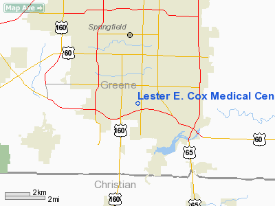
Lester E. Cox Medical Center South Heliport |
Location & QuickFacts
| FAA Information Effective: | 2008-09-25 |
| Airport Identifier: | 56MU |
| Airport Status: | Operational |
| Longitude/Latitude: | 093-16-50.6720W/37-08-47.1790N
-93.280742/37.146439 (Estimated) |
| Elevation: | 1270 ft / 387.10 m (Estimated) |
| Land: | 0 acres |
| From nearest city: | 0 nautical miles S of Springfield, MO |
| Location: | Greene County, MO |
| Magnetic Variation: | 04E (1985) |
Owner & Manager
| Ownership: | Privately owned |
| Owner: | Lester E. Cox Medical Center |
| Address: | 3801 S. National
Springfield, MO 65802 |
| Phone number: | 417-885-2000 |
| Manager: | Robert H. Bezanson, Admin. |
| Address: | 3801 S. National
Springfield, MO 65807 |
| Phone number: | 417-885-6107 |
Airport Operations and Facilities
| Airport Use: | Private
MEDICAL. |
| Wind indicator: | Yes |
| Segmented Circle: | No |
| Control Tower: | No |
| Landing fee charge: | No |
| Sectional chart: | Kansas City |
| Region: | ACE - Central |
| Boundary ARTCC: | ZKC - Kansas City |
| Tie-in FSS: | COU - Columbia |
| FSS on Airport: | No |
| FSS Toll Free: | 1-800-WX-BRIEF |
Airport Communications
Runway Information
Helipad H1
| Dimension: | 30 x 30 ft / 9.1 x 9.1 m |
| Surface: | ASPH, |
| |
Runway H1 |
Runway |
| Traffic Pattern: | Left | Left |
|
Helipad H2
| Dimension: | 45 x 45 ft / 13.7 x 13.7 m |
| Surface: | CONC, |
| |
Runway H2 |
Runway |
| Traffic Pattern: | Left | Left |
|
Radio Navigation Aids
| ID |
Type |
Name |
Ch |
Freq |
Var |
Dist |
| ILJ | NDB | Willard | | 254.00 | 03E | 12.0 nm |
| AOV | NDB | Bilmart | | 341.00 | 02E | 30.8 nm |
| PLK | NDB | Point Lookout/dcmsnd | | 204.00 | 03E | 31.3 nm |
| IEB | NDB | Lebanon | | 414.00 | 03E | 39.2 nm |
| HRO | VOR/DME | Harrison | 072X | 112.50 | 04E | 49.9 nm |
| SGF | VORTAC | Springfield | 116X | 116.90 | 04E | 12.8 nm |
| DGD | VORTAC | Dogwood | 031X | 109.40 | 06E | 20.7 nm |
Remarks
- PRVDD CLEAR APCH/DEP PATHS FOR A MIN 8:1 GLIDE SLOPE; A CLEAR TRANSITIONAL SFC FOR A MIN 2:1 SLOPE; THIS SITE ABD ONCE NEW HELIPAD IS ACTIVATED; PRIOR TO ACTIVATION SOME TREES ARE TO BE REMOVED AND 2 LGT POLES ARE REPLACED WITH HELIPORT LGTS.
Images and information placed above are from
http://www.airport-data.com/airport/56MU/
We thank them for the data!
| General Info
|
| Country |
United States
|
| State |
MISSOURI
|
| FAA ID |
56MU
|
| Latitude |
37-08-47.179N
|
| Longitude |
093-16-50.672W
|
| Elevation |
1270 feet
|
| Near City |
SPRINGFIELD
|
We don't guarantee the information is fresh and accurate. The data may
be wrong or outdated.
For more up-to-date information please refer to other sources.
|
|


