 |
|
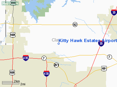
Kitty Hawk Estates Airport |
Location & QuickFacts
| FAA Information Effective: | 2008-09-25 |
| Airport Identifier: | 3MO6 |
| Airport Status: | Operational |
| Longitude/Latitude: | 094-29-00.8270W/39-20-08.0040N
-94.483563/39.335557 (Estimated) |
| Elevation: | 1000 ft / 304.80 m (Estimated) |
| Land: | 0 acres |
| From nearest city: | 6 nautical miles SW of Kearney, MO |
| Location: | Clay County, MO |
| Magnetic Variation: | 05E (1985) |
Owner & Manager
| Ownership: | Privately owned |
| Owner: | Jerry W. Sullivan
RUSTIC DEVELOPMENT CO |
| Address: | 9812 E. 87th
Raytown, MO 64138 |
| Phone number: | 816-737-1351 |
| Manager: | Jerry W. Sullivan |
| Address: | 9812 E. 87th
Raytown, MO 64138 |
| Phone number: | 816-781-6896 |
Airport Operations and Facilities
| Airport Use: | Private |
| Wind indicator: | Yes |
| Segmented Circle: | No |
| Control Tower: | No |
| Landing fee charge: | No |
| Sectional chart: | Kansas City |
| Region: | ACE - Central |
| Boundary ARTCC: | ZKC - Kansas City |
| Tie-in FSS: | COU - Columbia |
| FSS on Airport: | No |
| FSS Toll Free: | 1-800-WX-BRIEF |
Airport Services
| Airframe Repair: | NONE |
| Power Plant Repair: | NONE |
Runway Information
Runway N/S
| Dimension: | 2200 x 60 ft / 670.6 x 18.3 m |
| Surface: | TURF, |
| |
Runway N |
Runway S |
| Traffic Pattern: | Right | Left |
|
Radio Navigation Aids
| ID |
Type |
Name |
Ch |
Freq |
Var |
Dist |
| GPH | NDB | Mosby | | 284.00 | 03E | 8.2 nm |
| DO | NDB | Dotte | | 359.00 | 05E | 14.2 nm |
| GQ | NDB | Norge | | 517.00 | 05E | 18.3 nm |
| GKB | NDB | Norge | | 517.00 | 05E | 18.3 nm |
| LXT | NDB | Lesumit | | 263.00 | 04E | 23.1 nm |
| EZZ | NDB | Cameron | | 394.00 | 03E | 25.6 nm |
| AZN | NDB | Amazon | | 233.00 | 06E | 38.4 nm |
| RIS | VOR/DME | Riverside | 051X | 111.40 | 05E | 14.0 nm |
| OJC | VOR/DME | Johnson County | 077X | 113.00 | 06E | 32.0 nm |
| BQS | VOR/DME | Braymer | 049X | 111.20 | 03E | 33.3 nm |
| MCI | VORTAC | Kansas City | 079Y | 113.25 | 05E | 12.2 nm |
| ANX | VORTAC | Napoleon | 087X | 114.00 | 07E | 21.9 nm |
| STJ | VORTAC | St Joseph | 102X | 115.50 | 08E | 42.8 nm |
| MKC | VOT | Kansas City Downtown | | 108.60 | | 13.8 nm |
Images and information placed above are from
http://www.airport-data.com/airport/3MO6/
We thank them for the data!
| General Info
|
| Country |
United States
|
| State |
MISSOURI
|
| FAA ID |
3MO6
|
| Latitude |
39-20-08.004N
|
| Longitude |
094-29-00.827W
|
| Elevation |
1000 feet
|
| Near City |
KEARNEY
|
We don't guarantee the information is fresh and accurate. The data may
be wrong or outdated.
For more up-to-date information please refer to other sources.
|
|


