 |
|
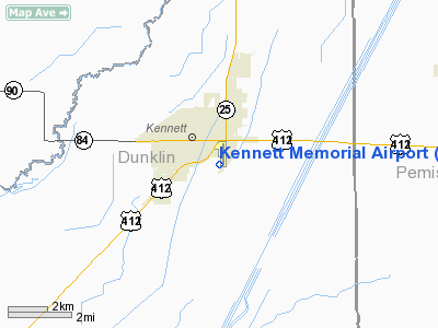
Location & QuickFacts
| FAA Information Effective: | 2008-09-25 |
| Airport Identifier: | TKX |
| Airport Status: | Operational |
| Longitude/Latitude: | 090-02-11.9080W/36-13-33.1030N
-90.036641/36.225862 (Estimated) |
| Elevation: | 262 ft / 79.86 m (Surveyed) |
| Land: | 337 acres |
| From nearest city: | 1 nautical miles SE of Kennett, MO |
| Location: | Dunklin County, MO |
| Magnetic Variation: | 00E (2000) |
Owner & Manager
| Ownership: | Publicly owned |
| Owner: | City Of Kennett |
| Address: | 200 Cedar St.
Kennett, MO 63857 |
| Phone number: | 573-888-9001 |
| Manager: | Joe Sherrod |
| Address: | 400 Airport Rd
Kennett, MO 63857 |
| Phone number: | 573-888-1339 |
Airport Operations and Facilities
| Airport Use: | Open to public |
| Wind indicator: | Yes |
| Segmented Circle: | Yes |
| Control Tower: | No |
| Lighting Schedule: | DUSK-DAWN
MIRL RYS 18/36 & 02/20 ON LOW INTST DUSK-0300; TO INCR INTST & ACTVT MIRL RYS 18/36 & 02/20 & REIL RYS 02; 20 & 36 FM 2300-DAWN - CTAF. PAPI RYS 02 & 20 ON 24 HRS. |
| Beacon Color: | Clear-Green (lighted land airport) |
| Landing fee charge: | No |
| Sectional chart: | St Louis |
| Region: | ACE - Central |
| Boundary ARTCC: | ZME - Memphis |
| Tie-in FSS: | STL - Saint Louis |
| FSS on Airport: | No |
| FSS Toll Free: | 1-800-WX-BRIEF |
| NOTAMs Facility: | STL (NOTAM-d service avaliable) |
| Federal Agreements: | NGY |
Airport Communications
| CTAF: | 122.800 |
| Unicom: | 122.800 |
Airport Services
| Fuel available: | 100LLA |
| Airframe Repair: | MAJOR |
| Power Plant Repair: | MAJOR |
| Bottled Oxygen: | NONE |
| Bulk Oxygen: | NONE |
Runway Information
Runway 02/20
| Dimension: | 5000 x 75 ft / 1524.0 x 22.9 m |
| Surface: | CONC, Good Condition |
| Edge Lights: | Medium
RY 18/36 NSTD MIRL; INCORRECT SPACING OF RY 36 THLD LIGHTS. |
| |
Runway 02 |
Runway 20 |
| Longitude: | 090-02-26.0386W | 090-02-07.3148W |
| Latitude: | 36-13-01.9662N | 36-13-49.0270N |
| Elevation: | 258.00 ft | 258.00 ft |
| Alignment: | 18 | 127 |
| Traffic Pattern: | Right | Left |
| Markings: | Non-precision instrument, Good Condition | Non-precision instrument, Good Condition |
| Crossing Height: | 40.00 ft | 40.00 ft |
| VASI: | 4-light PAPI on left side | 4-light PAPI on left side |
| Visual Glide Angle: | 3.00° | 3.00° |
| Runway End Identifier: | Yes | Yes |
| Obstruction: | 41 ft tree, 1056.0 ft from runway, 324 ft left of centerline, 20:1 slope to clear | 53 ft trees, 2656.0 ft from runway, 334 ft left of centerline, 46:1 slope to clear |
|
Runway 18/36
| Dimension: | 3012 x 75 ft / 918.1 x 22.9 m |
| Surface: | ASPH, Fair Condition |
| Weight Limit: | Single wheel: 10000 lbs. |
| Edge Lights: | Non-standard lighting system
RY 18/36 NSTD MIRL; INCORRECT SPACING OF RY 36 THLD LIGHTS. |
| |
Runway 18 |
Runway 36 |
| Longitude: | 090-02-04.4657W | 090-02-03.5166W |
| Latitude: | 36-14-00.6166N | 36-13-30.8405N |
| Elevation: | 260.00 ft | 258.00 ft |
| Alignment: | 127 | 127 |
| Traffic Pattern: | Left | Left |
| Markings: | Basic, Good Condition | Basic, Good Condition |
| Runway End Identifier: | | Yes
NSTD REIL RY 36; TOO CLOSE TO RY EDGE. |
| Centerline Lights: | | No |
| Touchdown Lights: | | No |
| Obstruction: | 44 ft tree, 1336.0 ft from runway, 225 ft right of centerline, 25:1 slope to clear | 33 ft trees, 543.0 ft from runway, 140 ft right of centerline, 10:1 slope to clear |
|
Radio Navigation Aids
| ID |
Type |
Name |
Ch |
Freq |
Var |
Dist |
| TKX | NDB | Kennett | | 358.00 | 00E | 0.2 nm |
| IUI | NDB | Hicks | | 350.00 | 01E | 19.9 nm |
| MXA | NDB | Manila | | 282.00 | 01E | 20.9 nm |
| PGR | NDB | Paragould | | 383.00 | 01E | 25.0 nm |
| FD | NDB | Earli | | 278.00 | 03E | 30.1 nm |
| BPW | NDB | Osceola | | 239.00 | 02E | 32.1 nm |
| DNT | NDB | Nally Dunston | | 343.00 | 01W | 33.6 nm |
| DXE | NDB | Dexter | | 423.00 | 00E | 34.1 nm |
| TNZ | NDB | Lawrence County | | 227.00 | 01E | 43.0 nm |
| COO | NDB | Covington | | 326.00 | 02E | 44.1 nm |
| CHQ | NDB | Charleston | | 208.00 | 01E | 49.6 nm |
| GOJ | VOR | Gosnell | | 111.80 | 01E | 17.2 nm |
| JBR | VOR/DME | Jonesboro | 023X | 108.60 | 02E | 34.1 nm |
| MAW | VORTAC | Malden | 049X | 111.20 | 03E | 20.7 nm |
| DYR | VORTAC | Dyersburg | 115X | 116.80 | 03E | 37.1 nm |
| ARG | VORTAC | Walnut Ridge | 092X | 114.50 | 04E | 45.0 nm |
Remarks
- AIRPORT PHONE (573) 888-1339.
- MIRL RY 18/36 OTS INDEFLY.
Images and information placed above are from
http://www.airport-data.com/airport/TKX/
We thank them for the data!
| General Info
|
| Country |
United States
|
| State |
MISSOURI
|
| FAA ID |
TKX
|
| Latitude |
36-13-51.135N
|
| Longitude |
090-02-04.805W
|
| Elevation |
262 feet
|
| Near City |
KENNETT
|
We don't guarantee the information is fresh and accurate. The data may
be wrong or outdated.
For more up-to-date information please refer to other sources.
|
|


