 |
|
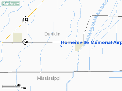
Hornersville Memorial Airport |
Location & QuickFacts
| FAA Information Effective: | 2008-09-25 |
| Airport Identifier: | 37M |
| Airport Status: | Operational |
| Longitude/Latitude: | 090-09-02.7000W/36-02-27.3000N
-90.150750/36.040917 (Estimated) |
| Elevation: | 248 ft / 75.59 m (Estimated) |
| Land: | 100 acres |
| From nearest city: | 2 nautical miles W of Hornersville, MO |
| Location: | Dunklin County, MO |
| Magnetic Variation: | 02E (1985) |
Owner & Manager
| Ownership: | Publicly owned |
| Owner: | City Of Hornersville |
| Address: | Box 219 - 300 Main
Hornersville, MO 63855 |
| Phone number: | 573-737-2616 |
| Manager: | Bruce Miller |
| Address: | Box 219 - 300 Main
Hornersville, MO 63855 |
| Phone number: | 573-737-2616 |
Airport Operations and Facilities
| Airport Use: | Open to public |
| Wind indicator: | Yes |
| Segmented Circle: | No |
| Control Tower: | No |
| Lighting Schedule: | DUSK-DAWN |
| Beacon Color: | Clear-Green (lighted land airport)
ROTG BCN OTS INDEFLY. |
| Landing fee charge: | No |
| Sectional chart: | St Louis |
| Region: | ACE - Central |
| Boundary ARTCC: | ZME - Memphis |
| Tie-in FSS: | STL - Saint Louis |
| FSS on Airport: | No |
| FSS Toll Free: | 1-800-WX-BRIEF |
| NOTAMs Facility: | STL (NOTAM-d service avaliable) |
| Federal Agreements: | P1 |
Airport Communications
Airport Services
Runway Information
Runway 18/36
| Dimension: | 2648 x 47 ft / 807.1 x 14.3 m
RY 18/36 WIDTH VARIANCE 47-50 FT. |
| Surface: | ASPH, Fair Condition |
| |
Runway 18 |
Runway 36 |
| Longitude: | 090-09-02.6900W | 090-09-02.7300W |
| Latitude: | 36-02-40.3700N | 36-02-14.1800N |
| Traffic Pattern: | Left | Left |
| Markings: | Basic, Poor Condition
MARKINGS FADED. | Basic, Fair Condition |
| Obstruction: | 25 ft pline, 725.0 ft from runway, 21:1 slope to clear | 48 ft trees, 2138.0 ft from runway, 150 ft right of centerline, 40:1 slope to clear |
|
Radio Navigation Aids
| ID |
Type |
Name |
Ch |
Freq |
Var |
Dist |
| MXA | NDB | Manila | | 282.00 | 01E | 9.0 nm |
| TKX | NDB | Kennett | | 358.00 | 00E | 12.5 nm |
| IUI | NDB | Hicks | | 350.00 | 01E | 16.6 nm |
| PGR | NDB | Paragould | | 383.00 | 01E | 17.6 nm |
| BPW | NDB | Osceola | | 239.00 | 02E | 22.0 nm |
| DNT | NDB | Nally Dunston | | 343.00 | 01W | 36.3 nm |
| COO | NDB | Covington | | 326.00 | 02E | 38.6 nm |
| FD | NDB | Earli | | 278.00 | 03E | 38.7 nm |
| TNZ | NDB | Lawrence County | | 227.00 | 01E | 38.8 nm |
| DXE | NDB | Dexter | | 423.00 | 00E | 46.0 nm |
| MIG | NDB | Millington | | 232.00 | 04E | 47.0 nm |
| GOJ | VOR | Gosnell | | 111.80 | 01E | 11.5 nm |
| JBR | VOR/DME | Jonesboro | 023X | 108.60 | 02E | 23.5 nm |
| GQE | VOR/DME | Gilmore | 077X | 113.00 | 04E | 44.7 nm |
| MAW | VORTAC | Malden | 049X | 111.20 | 03E | 33.0 nm |
| ARG | VORTAC | Walnut Ridge | 092X | 114.50 | 04E | 39.2 nm |
| DYR | VORTAC | Dyersburg | 115X | 116.80 | 03E | 40.5 nm |
Remarks
- CROP DUSTING OPERATIONS ON & INVOF ARPT.
- BE ALERT TO LARGE IRRIGATION SYSTEM ON WEST SIDE OF RY.
- NIGHT OPERATIONS NOT RECOMMENDED AT THIS AIRPORT.
- ESTABD PRIOR OCT 1959.
Images and information placed above are from
http://www.airport-data.com/airport/37M/
We thank them for the data!
| General Info
|
| Country |
United States
|
| State |
MISSOURI
|
| FAA ID |
37M
|
| Latitude |
36-02-30.249N
|
| Longitude |
090-09-00.342W
|
| Elevation |
248 feet
|
| Near City |
HORNERSVILLE
|
We don't guarantee the information is fresh and accurate. The data may
be wrong or outdated.
For more up-to-date information please refer to other sources.
|
|


