|
|
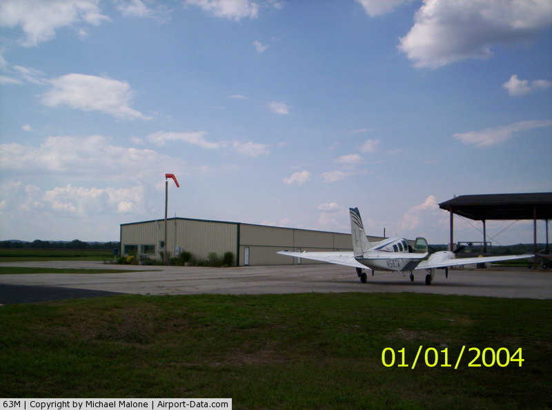
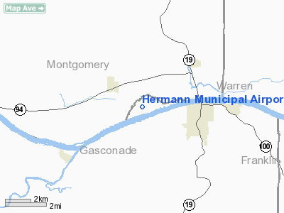
Hermann Municipal Airport |
|
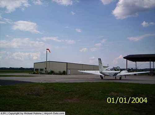 |
(Click on the photo to enlarge) |
Location & QuickFacts
| FAA Information Effective: | 2008-09-25 |
| Airport Identifier: | 63M |
| Airport Status: | Operational |
| Longitude/Latitude: | 091-29-25.9950W/38-42-18.6050N
-91.490554/38.705168 (Estimated) |
| Elevation: | 507 ft / 154.53 m (Surveyed) |
| Land: | 68 acres |
| From nearest city: | 3 nautical miles NW of Hermann, MO |
| Location: | Gasconade County, MO |
| Magnetic Variation: | 03E (1985) |
Owner & Manager
| Ownership: | Publicly owned |
| Owner: | City Of Hermann |
| Address: | 207 Schiller St.
Hermann, MO 65041 |
| Phone number: | 573-486-5400 |
| Manager: | Gary Geisler |
| Address: | 228 E. 1st Street
Hermann, MO 65041 |
| Phone number: | 573-486-3370 |
Airport Operations and Facilities
| Airport Use: | Open to public |
| Wind indicator: | Yes |
| Segmented Circle: | Yes |
| Control Tower: | No |
| Lighting Schedule: | RDO-CTL
ACTIVATE MIRL RY 07/25, PAPI RY 25 - CTAF. |
| Landing fee charge: | No |
| Sectional chart: | Kansas City |
| Region: | ACE - Central |
| Boundary ARTCC: | ZKC - Kansas City |
| Tie-in FSS: | STL - Saint Louis |
| FSS Toll Free: | 1-800-WX-BRIEF |
| NOTAMs Facility: | STL (NOTAM-d service avaliable) |
Airport Communications
Airport Services
| Airframe Repair: | NONE |
| Power Plant Repair: | NONE |
| Bottled Oxygen: | NONE |
| Bulk Oxygen: | NONE |
Runway Information
Runway 07/25
| Dimension: | 3198 x 50 ft / 974.8 x 15.2 m |
| Surface: | ASPH, Good Condition |
| Edge Lights: | Medium |
| |
Runway 07 |
Runway 25 |
| Longitude: | 091-29-44.6100W | 091-29-07.3800W |
| Latitude: | 38-42-12.5300N | 38-42-24.6800N |
| Elevation: | 506.00 ft | 508.00 ft |
| Traffic Pattern: | Left | Right |
| Markings: | Non-precision instrument, Fair Condition
RY NRS FADED. | Non-precision instrument, Good Condition
RY NRS FADED. |
| Crossing Height: | 0.00 ft | 20.00 ft |
| VASI: | | 2-light PAPI on left side |
| Visual Glide Angle: | 0.00° | 3.00° |
| Obstruction: | , 50:1 slope to clear
+1-7 FT CROPS, 180 FT FM RY END, L & R. | 53 ft pline, 2620.0 ft from runway, 45:1 slope to clear
+1-13 FT CROPS & ROAD, 70 FT FM RY END, L & R. |
|
Radio Navigation Aids
| ID |
Type |
Name |
Ch |
Freq |
Var |
Dist |
| FTT | NDB | Guthrie | | 317.00 | 03E | 25.5 nm |
| JE | NDB | Algoa | | 397.00 | 03E | 28.9 nm |
| UUV | NDB | Sullivan | | 356.00 | 02E | 32.1 nm |
| ONH | NDB | Noah | | 515.00 | 03E | 35.6 nm |
| UBX | NDB | Cuba | | 380.00 | 01E | 38.6 nm |
| LM | NDB | Oblio | | 338.00 | 00E | 48.0 nm |
| VIH | VOR/DME | Vichy | 124X | 117.70 | 06E | 34.7 nm |
| COU | VOR/DME | Columbia | 039X | 110.20 | 03E | 34.7 nm |
| FTZ | VORTAC | Foristell | 045X | 110.80 | 05E | 24.4 nm |
| HLV | VORTAC | Hallsville | 089X | 114.20 | 06E | 38.6 nm |
| STL | VORTAC | St Louis | 121X | 117.40 | 01E | 48.2 nm |
| JEF | VOT | Jefferson City | | 112.00 | | 31.7 nm |
| SUS | VOT | Spirit Of St Louis | | 112.20 | | 39.4 nm |
Remarks
- BIRDS ON AND IN VICINITY OF ARPT.
- NTSD RY SAFETY AREA CLEARING BYND EACH RY END; ROAD AND CROPS AT RY 25 END; CROPS AT RY 07 END.
- BE ALERT TO LARGE AGRICULTURAL IRRIGATION SYSTEM DURING SPRING AND SUMMER MONTHS, APRX 300-400 FT FM RY 25 END.
Images and information placed above are from
http://www.airport-data.com/airport/63M/
We thank them for the data!
| General Info
|
| Country |
United States
|
| State |
MISSOURI
|
| FAA ID |
63M
|
| Latitude |
38-42-19.160N
|
| Longitude |
091-29-24.590W
|
| Elevation |
510 feet
|
| Near City |
HERMANN
|
We don't guarantee the information is fresh and accurate. The data may
be wrong or outdated.
For more up-to-date information please refer to other sources.
|
|