 |
|
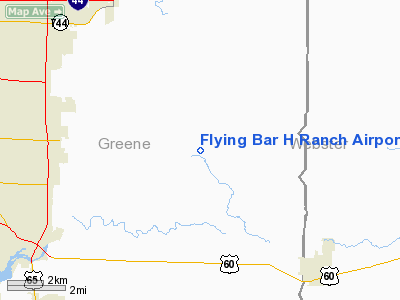
Flying Bar H Ranch Airport |
Location & QuickFacts
| FAA Information Effective: | 2008-09-25 |
| Airport Identifier: | MO2 |
| Airport Status: | Operational |
| Longitude/Latitude: | 093-07-44.1600W/37-10-30.5400N
-93.128933/37.175150 (Estimated) |
| Elevation: | 1375 ft / 419.10 m (Estimated) |
| Land: | 12 acres |
| From nearest city: | 8 nautical miles E of Springfield, MO |
| Location: | Greene County, MO |
| Magnetic Variation: | 04E (1985) |
Owner & Manager
| Ownership: | Privately owned |
| Owner: | David W Hall |
| Address: | 2204 S Farm Rd 225
Rogersville, MO 65742 |
| Phone number: | 417-887-5483 |
| Manager: | David W. Hall |
| Address: | 2204 S Farm Rd 225
Rogersville, MO 65742 |
| Phone number: | 417-882-9090 |
Airport Operations and Facilities
| Airport Use: | Open to public |
| Wind indicator: | Yes |
| Segmented Circle: | No |
| Control Tower: | No |
| Landing fee charge: | No |
| Sectional chart: | Kansas City |
| Region: | ACE - Central |
| Boundary ARTCC: | ZKC - Kansas City |
| Tie-in FSS: | COU - Columbia |
| FSS on Airport: | No |
| FSS Toll Free: | 1-800-WX-BRIEF |
| NOTAMs Facility: | COU (NOTAM-d service avaliable) |
Airport Communications
Airport Services
| Airframe Repair: | NONE |
| Power Plant Repair: | NONE |
| Bottled Oxygen: | NONE |
| Bulk Oxygen: | NONE |
Runway Information
Runway 06/24
| Dimension: | 2640 x 70 ft / 804.7 x 21.3 m |
| Surface: | TURF, Fair Condition
ROLLING & UNEVEN |
| |
Runway 06 |
Runway 24 |
| Longitude: | 093-07-58.6200W | 093-07-30.6600W |
| Latitude: | 37-10-24.3600N | 37-10-37.1400N |
| Elevation: | 1380.00 ft | 1365.00 ft |
| Traffic Pattern: | Left | Left |
| Obstruction: | 67 ft trees, 15.0 ft from runway, 110 ft left of centerline | 96 ft trees, 70.0 ft from runway |
|
Radio Navigation Aids
| ID |
Type |
Name |
Ch |
Freq |
Var |
Dist |
| ILJ | NDB | Willard | | 254.00 | 03E | 16.7 nm |
| AOV | NDB | Bilmart | | 341.00 | 02E | 24.9 nm |
| IEB | NDB | Lebanon | | 414.00 | 03E | 32.8 nm |
| PLK | NDB | Point Lookout/dcmsnd | | 204.00 | 03E | 33.3 nm |
| SGF | VORTAC | Springfield | 116X | 116.90 | 04E | 14.6 nm |
| DGD | VORTAC | Dogwood | 031X | 109.40 | 06E | 15.1 nm |
Remarks
- WILDLIFE ON & INVOF ARPT.
- AFTER HEAVY RAINS CALL 417-887-5483 FOR RY CONDS.
- LARGE TREES AT NE END OF RY & LARGE TREES ON SIDES OF RY AT SW END.
- OWNER RECOMMENDS LANDING & DEP TO THE SW WINDS PERMITTING.
- NTSD RY SAFETY AREAS BYND EACH RY END & ALONG RY EDGES; INCORRECT TERRAIN GRADES, NO OVERRUN AT EACH END, LARGE DROP OFF AT RY 06 THLD.
Images and information placed above are from
http://www.airport-data.com/airport/MO2/
We thank them for the data!
| General Info
|
| Country |
United States
|
| State |
MISSOURI
|
| FAA ID |
MO2
|
| Latitude |
37-11-00.176N
|
| Longitude |
093-08-00.654W
|
| Elevation |
1375 feet
|
| Near City |
SPRINGFIELD
|
We don't guarantee the information is fresh and accurate. The data may
be wrong or outdated.
For more up-to-date information please refer to other sources.
|
|


