 |
|
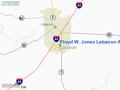
Floyd W. Jones Lebanon Airport |
Location & QuickFacts
| FAA Information Effective: | 2008-09-25 |
| Airport Identifier: | LBO |
| Airport Status: | Operational |
| Longitude/Latitude: | 092-39-08.8000W/37-38-54.0000N
-92.652444/37.648333 (Estimated) |
| Elevation: | 1321 ft / 402.64 m (Surveyed) |
| Land: | 277 acres |
| From nearest city: | 3 nautical miles S of Lebanon, MO |
| Location: | Laclede County, MO |
| Magnetic Variation: | 03E (1990) |
Owner & Manager
| Ownership: | Publicly owned |
| Owner: | City Of Lebanon |
| Address: | 400 S Madison Box 111
Lebanon, MO 65536 |
| Phone number: | 417-532-2156 |
| Manager: | Dave Ward |
| Address: | 2415 S Jefferson
Lebanon, MO 65536 |
| Phone number: | 417-532-7879 |
Airport Operations and Facilities
| Airport Use: | Open to public |
| Wind indicator: | Yes |
| Segmented Circle: | No |
| Control Tower: | No |
| Lighting Schedule: | DUSK-DAWN
MIRL RY 18/36 PRESET LOW INTST; TO INCR INTST & ACTVT REIL RY 36 - CTAF. |
| Beacon Color: | Clear-Green (lighted land airport) |
| Landing fee charge: | No |
| Sectional chart: | Kansas City |
| Region: | ACE - Central |
| Boundary ARTCC: | ZKC - Kansas City |
| Tie-in FSS: | COU - Columbia |
| FSS on Airport: | No |
| FSS Toll Free: | 1-800-WX-BRIEF |
| NOTAMs Facility: | COU (NOTAM-d service avaliable) |
| Federal Agreements: | NGY |
Airport Communications
| CTAF: | 122.800 |
| Unicom: | 122.800 |
Airport Services
| Fuel available: | 100LLA1+
FOR FUEL AFTER HRS, CALL NBR POSTED ON TERMINAL DOOR. |
| Airframe Repair: | NONE |
| Power Plant Repair: | NONE |
| Bottled Oxygen: | NONE |
| Bulk Oxygen: | NONE |
Runway Information
Runway 18/36
| Dimension: | 5000 x 75 ft / 1524.0 x 22.9 m |
| Surface: | ASPH, Good Condition |
| Weight Limit: | Single wheel: 33000 lbs.
Dual wheel: 54000 lbs. |
| Edge Lights: | Medium |
| |
Runway 18 |
Runway 36 |
| Longitude: | 092-39-07.8307W | 092-39-09.6735W |
| Latitude: | 37-39-18.6641N | 37-38-29.2601N |
| Elevation: | 1306.00 ft | 1319.00 ft |
| Alignment: | 127 | 2 |
| ILS Type: | | SDF/DME
|
| Traffic Pattern: | Left | Left |
| Markings: | Non-precision instrument, Good Condition
RWY 18 MARKINGS FADED. | Non-precision instrument, Good Condition
RWY 36 MARKINGS FADED. |
| Crossing Height: | 37.00 ft | 27.00 ft |
| VASI: | pulsating/steady burning on left side
OTS INDEFLY. | pulsating/steady burning on left side |
| Visual Glide Angle: | 3.00° | 3.00° |
| Runway End Identifier: | | Yes |
| Obstruction: | 27 ft trees, 793.0 ft from runway, 62 ft left of centerline, 21:1 slope to clear | 8 ft pline, 403.0 ft from runway, 205 ft right of centerline, 25:1 slope to clear |
|
Radio Navigation Aids
| ID |
Type |
Name |
Ch |
Freq |
Var |
Dist |
| IEB | NDB | Lebanon | | 414.00 | 03E | 4.6 nm |
| BHN | NDB | Buckhorn | | 391.00 | 03E | 26.3 nm |
| AIZ | NDB | Kaiser | | 377.00 | 05E | 27.4 nm |
| AOV | NDB | Bilmart | | 341.00 | 02E | 40.8 nm |
| ILJ | NDB | Willard | | 254.00 | 03E | 43.1 nm |
| TBN | VOR | Forney | | 110.00 | 03E | 25.1 nm |
| SHY | VOR/DME | Sunshine | 021X | 108.40 | 05E | 23.7 nm |
| SGF | VORTAC | Springfield | 116X | 116.90 | 04E | 36.9 nm |
| DGD | VORTAC | Dogwood | 031X | 109.40 | 06E | 39.1 nm |
| MAP | VORTAC | Maples | 081X | 113.40 | 06E | 41.3 nm |
Remarks
- SPRAYER ACFT ON AND INVOF AIRPORT DURING SPRING AND SUMMER MONTHS.
- BIRDS, DEER & WILDLIFE ON & INVOF ARPT.
Images and information placed above are from
http://www.airport-data.com/airport/LBO/
We thank them for the data!
| General Info
|
| Country |
United States
|
| State |
MISSOURI
|
| FAA ID |
LBO
|
| Latitude |
37-38-49.850N
|
| Longitude |
092-39-13.528W
|
| Elevation |
1319 feet
|
| Near City |
LEBANON
|
We don't guarantee the information is fresh and accurate. The data may
be wrong or outdated.
For more up-to-date information please refer to other sources.
|
|


