 |
|
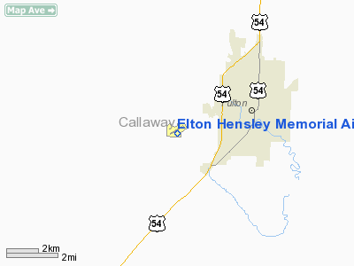
Elton Hensley Memorial Airport |
Location & QuickFacts
| FAA Information Effective: | 2008-09-25 |
| Airport Identifier: | FTT |
| Airport Status: | Operational |
| Longitude/Latitude: | 092-00-09.3281W/38-50-17.1797N
-92.002591/38.838105 (Estimated) |
| Elevation: | 886 ft / 270.05 m (Surveyed) |
| Land: | 370 acres |
| From nearest city: | 3 nautical miles SW of Fulton, MO |
| Location: | Callaway County, MO |
| Magnetic Variation: | 03E (1985) |
Owner & Manager
| Ownership: | Publicly owned |
| Owner: | City Of Fulton |
| Address: | 18 E. 4th St, Box 130
Fulton, MO 65251 |
| Phone number: | 573-642-6826 |
| Manager: | Travis St. John |
| Address: | 4420 County Rd 304
Fulton, MO 65251 |
| Phone number: | 573-642-6222 |
Airport Operations and Facilities
| Airport Use: | Open to public |
| Wind indicator: | Yes |
| Segmented Circle: | Yes |
| Control Tower: | No |
| Lighting Schedule: | DUSK-DAWN |
| Beacon Color: | Clear-Green (lighted land airport) |
| Landing fee charge: | No |
| Sectional chart: | Kansas City |
| Region: | ACE - Central |
| Boundary ARTCC: | ZKC - Kansas City |
| Tie-in FSS: | COU - Columbia |
| FSS on Airport: | No |
| FSS Toll Free: | 1-800-WX-BRIEF |
| NOTAMs Facility: | COU (NOTAM-d service avaliable) |
| Federal Agreements: | NGY |
Airport Communications
| CTAF: | 122.700 |
| Unicom: | 122.700 |
Airport Services
| Fuel available: | 100LL |
| Airframe Repair: | MAJOR |
| Power Plant Repair: | MAJOR |
Runway Information
Runway 05/23
| Dimension: | 3205 x 47 ft / 976.9 x 14.3 m
WIDTH VARIANCE 47-50 FT. |
| Surface: | ASPH, Fair Condition |
| Weight Limit: | Single wheel: 30000 lbs.
RY 18/36 LIMITED BY ARPT OPR TO 12,5000 LBS SWG. FOR ACFT EXCEEDING 12,500 LBS SWG, CONTACT AMGR ON 573-642-6222. |
| Edge Lights: | Medium |
| |
Runway 05 |
Runway 23 |
| Longitude: | 092-00-29.6720W | 091-59-55.6780W |
| Latitude: | 38-50-15.5770N | 38-50-32.7680N |
| Elevation: | 879.00 ft | 881.00 ft |
| Alignment: | 57 | 127 |
| Traffic Pattern: | Left | Left |
| Markings: | Non-precision instrument, Poor Condition
RWY 05 MARKINGS FADED. | Non-precision instrument, Poor Condition
RWY 23 MARKINGS FADED. |
| Crossing Height: | 19.00 ft | 19.00 ft |
| VASI: | 2-box SAVASI on left side | 2-box SAVASI on left side |
| Visual Glide Angle: | 3.85° | 3.85° |
| Runway End Identifier: | Yes
REIL OTS INDEFLY. | Yes
REIL OTS INDEFLY. |
| Obstruction: | 32 ft tree, 727.0 ft from runway, 295 ft right of centerline, 16:1 slope to clear | 15 ft road, 280.0 ft from runway, 250 ft right of centerline, 5:1 slope to clear |
|
Runway 12/30
| Dimension: | 2487 x 100 ft / 758.0 x 30.5 m
WIDTH VARIANCE 47-50 FT. |
| Surface: | TURF, Fair Condition |
| |
Runway 12 |
Runway 30 |
| Longitude: | 092-00-32.5500W | 092-00-06.2500W |
| Latitude: | 38-50-29.7200N | 38-50-16.6800N |
| Elevation: | 880.00 ft | 868.00 ft |
| Traffic Pattern: | Left | Left |
| Obstruction: | 32 ft tree, 212.0 ft from runway, 165 ft left of centerline, 6:1 slope to clear | 50 ft pline, 2065.0 ft from runway, 280 ft right of centerline, 41:1 slope to clear |
|
Runway 18/36
| Dimension: | 4000 x 75 ft / 1219.2 x 22.9 m
WIDTH VARIANCE 47-50 FT. |
| Surface: | CONC, Good Condition |
| Weight Limit: | Single wheel: 12500 lbs.
RY 18/36 LIMITED BY ARPT OPR TO 12,5000 LBS SWG. FOR ACFT EXCEEDING 12,500 LBS SWG, CONTACT AMGR ON 573-642-6222. |
| Edge Lights: | Medium |
| |
Runway 18 |
Runway 36 |
| Longitude: | 091-59-59.5351W | 092-00-01.2332W |
| Latitude: | 38-50-27.5916N | 38-49-48.0754N |
| Elevation: | 877.00 ft | 877.00 ft |
| Alignment: | 127 | 1 |
| Traffic Pattern: | Left | Left |
| Markings: | Non-precision instrument, Good Condition | Non-precision instrument, Good Condition |
| Crossing Height: | 42.00 ft | 39.00 ft |
| VASI: | 4-light PAPI on left side | 4-light PAPI on left side |
| Visual Glide Angle: | 3.00° | 3.00° |
| Runway End Identifier: | Yes | Yes |
| Obstruction: | 16 ft road, 915.0 ft from runway, 44:1 slope to clear | 36 ft trees, 1185.0 ft from runway, 279 ft right of centerline, 27:1 slope to clear |
|
Radio Navigation Aids
| ID |
Type |
Name |
Ch |
Freq |
Var |
Dist |
| FTT | NDB | Guthrie | | 317.00 | 03E | 0.3 nm |
| ONH | NDB | Noah | | 515.00 | 03E | 16.6 nm |
| JE | NDB | Algoa | | 397.00 | 03E | 17.7 nm |
| VER | NDB | Viertel | | 347.00 | 02E | 32.6 nm |
| COU | VOR/DME | Columbia | 039X | 110.20 | 03E | 10.2 nm |
| VIH | VOR/DME | Vichy | 124X | 117.70 | 06E | 43.4 nm |
| HLV | VORTAC | Hallsville | 089X | 114.20 | 06E | 17.6 nm |
| FTZ | VORTAC | Foristell | 045X | 110.80 | 05E | 49.1 nm |
| JEF | VOT | Jefferson City | | 112.00 | | 16.5 nm |
Remarks
- ULTRALIGHT ACTIVITY ON & INVOF ARPT.
- INSUF RWY SAFETY AREA LENGTH BYND RWY 05 END; LARGE DROP OFF.
Images and information placed above are from
http://www.airport-data.com/airport/FTT/
We thank them for the data!
| General Info
|
| Country |
United States
|
| State |
MISSOURI
|
| FAA ID |
FTT
|
| Latitude |
38-50-23.549N
|
| Longitude |
092-00-15.158W
|
| Elevation |
886 feet
|
| Near City |
FULTON
|
We don't guarantee the information is fresh and accurate. The data may
be wrong or outdated.
For more up-to-date information please refer to other sources.
|
|


