 |
|
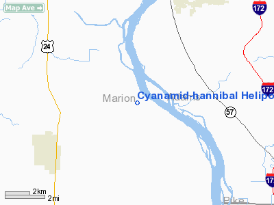
Cyanamid-hannibal Heliport |
Location & QuickFacts
| FAA Information Effective: | 2008-09-25 |
| Airport Identifier: | 34MO |
| Airport Status: | Operational |
| Longitude/Latitude: | 091-26-24.5460W/39-49-57.1640N
-91.440152/39.832546 (Estimated) |
| Elevation: | 468 ft / 142.65 m (Estimated) |
| Land: | 0 acres |
| From nearest city: | 9 nautical miles NW of Hannibal, MO |
| Location: | Marion County, MO |
| Magnetic Variation: | 03E (1985) |
Owner & Manager
| Ownership: | Privately owned |
| Owner: | American Cyanamid Co |
| Address: | P.o. Box 817
Hannibal, MO 63401 |
| Phone number: | 314-769-2011 |
| Manager: | D.e. Warren |
| Address: | P.o. Box 817
Hannibal, MO 63401 |
| Phone number: | 314-769-2011 |
Airport Operations and Facilities
| Airport Use: | Private |
| Wind indicator: | Yes |
| Segmented Circle: | Yes |
| Control Tower: | No |
| Lighting Schedule: | PHONE REQ
FOR FLOOD LGTS ON HELIPAD CALL 314-769-2011. |
| Landing fee charge: | No |
| Sectional chart: | Kansas City |
| Region: | ACE - Central |
| Boundary ARTCC: | ZKC - Kansas City |
| Tie-in FSS: | STL - Saint Louis |
| FSS on Airport: | No |
| FSS Toll Free: | 1-800-WX-BRIEF |
Runway Information
Helipad H1
| Dimension: | 20 x 20 ft / 6.1 x 6.1 m |
| Surface: | CONC,
20 X 20' CONC PAD WITHIN 100 X 100' TURF AREA. |
| |
Runway H1 |
Runway |
| Traffic Pattern: | Left | Left |
|
Radio Navigation Aids
| ID |
Type |
Name |
Ch |
Freq |
Var |
Dist |
| HAE | NDB | Hannibal | | 411.00 | 03E | 6.3 nm |
| UI | NDB | Quincy | | 293.00 | 02E | 9.2 nm |
| PPQ | NDB | Pittsfield | | 344.00 | 02E | 32.5 nm |
| EOK | NDB | Keokuk | | 366.00 | 02E | 38.0 nm |
| MCM | VOR/DME | Macon | 076X | 112.90 | 06E | 49.3 nm |
| UIN | VORTAC | Quincy | 083X | 113.60 | 05E | 7.5 nm |
Remarks
- PROVIDED THE APCH/DEPARTURE PATHS TO THE LANDING AREA ARE MAINTAINED FOR A 2:1 SLOPE AND THAT THE GLIDE SLOPE BE MAINTAINED FOR A MINIMUM 8:1 SLOPE.
Images and information placed above are from
http://www.airport-data.com/airport/34MO/
We thank them for the data!
| General Info
|
| Country |
United States
|
| State |
MISSOURI
|
| FAA ID |
34MO
|
| Latitude |
39-49-57.164N
|
| Longitude |
091-26-24.546W
|
| Elevation |
468 feet
|
| Near City |
HANNIBAL
|
We don't guarantee the information is fresh and accurate. The data may
be wrong or outdated.
For more up-to-date information please refer to other sources.
|
|


