 |
|
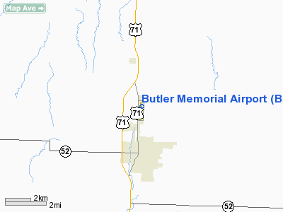
Location & QuickFacts
| FAA Information Effective: | 2008-09-25 |
| Airport Identifier: | BUM |
| Airport Status: | Operational |
| Longitude/Latitude: | 094-20-24.4570W/38-17-23.1730N
-94.340127/38.289770 (Estimated) |
| Elevation: | 892 ft / 271.88 m (Surveyed) |
| Land: | 190 acres |
| From nearest city: | 2 nautical miles N of Butler, MO |
| Location: | Bates County, MO |
| Magnetic Variation: | 04E (1995) |
Owner & Manager
| Ownership: | Publicly owned |
| Owner: | City Of Butler, Mo |
| Address: | 101 N. Lyon-box 420
Butler, MO 64730 |
| Phone number: | 660-679-4182 |
| Manager: | Chris Hall |
| Address: | 1413 N. Orange
Butler, MO 64730 |
| Phone number: | 816-529-5867 |
Airport Operations and Facilities
| Airport Use: | Open to public |
| Wind indicator: | Yes |
| Segmented Circle: | No |
| Control Tower: | No |
| Lighting Schedule: | DUSK-DAWN
PAPI 18/36 OPERATES 24 HRS. |
| Beacon Color: | Clear-Green (lighted land airport) |
| Landing fee charge: | No |
| Sectional chart: | Kansas City |
| Region: | ACE - Central |
| Boundary ARTCC: | ZKC - Kansas City |
| Tie-in FSS: | COU - Columbia |
| FSS on Airport: | No |
| FSS Toll Free: | 1-800-WX-BRIEF |
| NOTAMs Facility: | COU (NOTAM-d service avaliable) |
| Federal Agreements: | NGY |
Airport Communications
Airport Services
| Fuel available: | 100LL |
| Airframe Repair: | MINOR |
| Power Plant Repair: | MINOR |
| Bottled Oxygen: | NONE |
| Bulk Oxygen: | NONE |
Runway Information
Runway 18/36
| Dimension: | 4000 x 75 ft / 1219.2 x 22.9 m |
| Surface: | ASPH, Poor Condition
LARGE OPEN LONGITUDINAL & TRANSVERSE CRACKS ON RY. |
| Surface Treatment: | Rubberized Friction Seal Coat |
| Weight Limit: | Single wheel: 12000 lbs. |
| Edge Lights: | Medium |
| |
Runway 18 |
Runway 36 |
| Longitude: | 094-20-23.6240W | 094-20-25.2910W |
| Latitude: | 38-17-42.9300N | 38-17-03.4160N |
| Elevation: | 870.00 ft | 892.00 ft |
| Alignment: | 127 | 2 |
| Traffic Pattern: | Left | Left |
| Markings: | Non-precision instrument, Poor Condition
DESIGNATION FADED. | Non-precision instrument, Poor Condition
DESIGNATION FADED. |
| Crossing Height: | 37.00 ft | 36.00 ft |
| VASI: | 2-light PAPI on left side | 2-light PAPI on left side |
| Visual Glide Angle: | 3.00° | 3.00° |
| Obstruction: | , 50:1 slope to clear | 28 ft trees, 916.0 ft from runway, 250 ft right of centerline, 25:1 slope to clear |
|
Radio Navigation Aids
| ID |
Type |
Name |
Ch |
Freq |
Var |
Dist |
| EAD | NDB | Nevada | | 209.00 | 06E | 26.0 nm |
| GLY | NDB | Golden Valley | | 388.00 | 04E | 31.2 nm |
| FSK | NDB | Fort Scott | | 379.00 | 05E | 35.8 nm |
| LXT | NDB | Lesumit | | 263.00 | 04E | 40.4 nm |
| HCK | NDB | Hawks | | 296.00 | 04E | 41.5 nm |
| LLU | NDB | Spring River | | 356.00 | 05E | 48.3 nm |
| GKB | NDB | Norge | | 517.00 | 05E | 48.7 nm |
| GQ | NDB | Norge | | 517.00 | 05E | 48.7 nm |
| SZL | TACAN | Whiteman | 035X | | 04E | 45.8 nm |
| OJC | VOR/DME | Johnson County | 077X | 113.00 | 06E | 38.0 nm |
| BUM | VORTAC | Butler | 106X | 115.90 | 07E | 7.1 nm |
| ANX | VORTAC | Napoleon | 087X | 114.00 | 07E | 49.4 nm |
Remarks
- ULTRALIGHTS ON & INVOF ARPT.
- TWO TWRS +195 FT & +411 FT; APRXLY 7000 FT & 14000 FT S OF RY 36 THLD.
Images and information placed above are from
http://www.airport-data.com/airport/BUM/
We thank them for the data!
| General Info
|
| Country |
United States
|
| State |
MISSOURI
|
| FAA ID |
BUM
|
| Latitude |
38-17-23.173N
|
| Longitude |
094-20-24.457W
|
| Elevation |
892 feet
|
| Near City |
BUTLER
|
We don't guarantee the information is fresh and accurate. The data may
be wrong or outdated.
For more up-to-date information please refer to other sources.
|
|


