 |
|
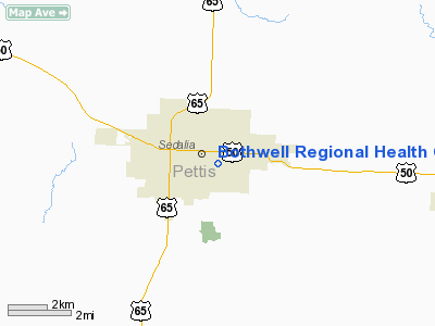
Bothwell Regional Health Center Heliport |
Location & QuickFacts
| FAA Information Effective: | 2008-09-25 |
| Airport Identifier: | 86MO |
| Airport Status: | Operational |
| Longitude/Latitude: | 093-13-20.7390W/38-41-55.0590N
-93.222427/38.698628 (Estimated) |
| Elevation: | 898 ft / 273.71 m (Estimated) |
| Land: | 0 acres |
| From nearest city: | 0 nautical miles N of Sedalia, MO |
| Location: | Pettis County, MO |
| Magnetic Variation: | 04E (1985) |
Owner & Manager
| Ownership: | Publicly owned |
| Owner: | Bothwell Regional Health Ctr |
| Address: | P O Box 1706
Sedalia, MO 65302 |
| Phone number: | 816-826-8833 |
| Manager: | James Rank, Admin. |
| Address: | P O Box 1706
Sedalia, MO 65302 |
| Phone number: | 816-826-8833 |
Airport Operations and Facilities
| Airport Use: | Private
MEDICAL. |
| Wind indicator: | No |
| Segmented Circle: | Yes |
| Control Tower: | No |
| Landing fee charge: | No |
| Sectional chart: | Kansas City |
| Region: | ACE - Central |
| Boundary ARTCC: | ZKC - Kansas City |
| Tie-in FSS: | COU - Columbia |
| FSS on Airport: | No |
| FSS Toll Free: | 1-800-WX-BRIEF |
Runway Information
Helipad H1
| Dimension: | 100 x 100 ft / 30.5 x 30.5 m |
| Surface: | CONC, |
| |
Runway H1 |
Runway |
| Traffic Pattern: | Left | Left |
|
Radio Navigation Aids
| ID |
Type |
Name |
Ch |
Freq |
Var |
Dist |
| DMO | NDB | Sedalia | | 281.00 | 03E | 2.2 nm |
| HCK | NDB | Hawks | | 296.00 | 04E | 17.0 nm |
| PUR | NDB | Marshall | | 371.00 | 03E | 20.7 nm |
| VER | NDB | Viertel | | 347.00 | 02E | 29.4 nm |
| GLY | NDB | Golden Valley | | 388.00 | 04E | 29.8 nm |
| ONH | NDB | Noah | | 515.00 | 03E | 46.0 nm |
| AIZ | NDB | Kaiser | | 377.00 | 05E | 48.0 nm |
| SZL | TACAN | Whiteman | 035X | | 04E | 15.5 nm |
| COU | VOR/DME | Columbia | 039X | 110.20 | 03E | 47.5 nm |
| SHY | VOR/DME | Sunshine | 021X | 108.40 | 05E | 49.2 nm |
| ANX | VORTAC | Napoleon | 087X | 114.00 | 07E | 48.6 nm |
Remarks
- BECAUSE SAFE APCH & DEP PATHS HAVE NOT BEEN MAINTAINED.
Images and information placed above are from
http://www.airport-data.com/airport/86MO/
We thank them for the data!
| General Info
|
| Country |
United States
|
| State |
MISSOURI
|
| FAA ID |
86MO
|
| Latitude |
38-41-55.059N
|
| Longitude |
093-13-20.739W
|
| Elevation |
898 feet
|
| Near City |
SEDALIA
|
We don't guarantee the information is fresh and accurate. The data may
be wrong or outdated.
For more up-to-date information please refer to other sources.
|
|


