 |
|
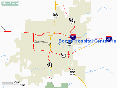
Boone Hospital Center Heliport |
Location & QuickFacts
| FAA Information Effective: | 2008-09-25 |
| Airport Identifier: | 91MO |
| Airport Status: | Operational |
| Longitude/Latitude: | 092-18-57.6600W/38-57-00.1390N
-92.316017/38.950039 (Estimated) |
| Elevation: | 780 ft / 237.74 m (Estimated) |
| Land: | 0 acres |
| From nearest city: | 0 nautical miles N of Columbia, MO |
| Location: | Boone County, MO |
| Magnetic Variation: | 03E (1985) |
Owner & Manager
| Ownership: | Publicly owned |
| Owner: | Boone Hospital Center |
| Address: | 1600 E. Broadway
Columbia, MO 65201 |
| Phone number: | 314-875-4545 |
| Manager: | Joe Howard |
| Address: | 1600 E. Broadway
Columbia, MO 65201 |
| Phone number: | 314-875-3410 |
Airport Operations and Facilities
| Airport Use: | Private
MEDICAL. |
| Wind indicator: | Yes |
| Segmented Circle: | Yes |
| Control Tower: | No |
| Lighting Schedule: | PHONE REQ
FOR ROTG BCN CALL 314-875-3410. |
| Beacon Color: | Clear (unlighted land airport) |
| Landing fee charge: | No |
| Sectional chart: | Kansas City |
| Region: | ACE - Central |
| Boundary ARTCC: | ZKC - Kansas City |
| Tie-in FSS: | COU - Columbia |
| FSS on Airport: | No |
| FSS Toll Free: | 1-800-WX-BRIEF |
Runway Information
Helipad H1
| Dimension: | 30 x 30 ft / 9.1 x 9.1 m |
| Surface: | CONC, Good Condition
ROOFTOP |
| |
Runway H1 |
Runway |
| Traffic Pattern: | Left | Left |
|
Radio Navigation Aids
| ID |
Type |
Name |
Ch |
Freq |
Var |
Dist |
| FTT | NDB | Guthrie | | 317.00 | 03E | 15.9 nm |
| VER | NDB | Viertel | | 347.00 | 02E | 17.2 nm |
| ONH | NDB | Noah | | 515.00 | 03E | 19.1 nm |
| JE | NDB | Algoa | | 397.00 | 03E | 26.7 nm |
| PUR | NDB | Marshall | | 371.00 | 03E | 41.5 nm |
| DMO | NDB | Sedalia | | 281.00 | 03E | 42.9 nm |
| COU | VOR/DME | Columbia | 039X | 110.20 | 03E | 9.5 nm |
| MCM | VOR/DME | Macon | 076X | 112.90 | 06E | 43.0 nm |
| HLV | VORTAC | Hallsville | 089X | 114.20 | 06E | 13.2 nm |
| JEF | VOT | Jefferson City | | 112.00 | | 23.1 nm |
Remarks
- CONDL: PROVIDED APPROACH/DEPARTURE PATHS ARE MAINTAINED FOR A MIN 8:1 GLIDE SLOPE AND THE TRANSITIONAL SURFACE BE MAINTAINED FOR A MIN 2:1 SLOPE.
Images and information placed above are from
http://www.airport-data.com/airport/91MO/
We thank them for the data!
| General Info
|
| Country |
United States
|
| State |
MISSOURI
|
| FAA ID |
91MO
|
| Latitude |
38-57-00.139N
|
| Longitude |
092-18-57.660W
|
| Elevation |
780 feet
|
| Near City |
COLUMBIA
|
We don't guarantee the information is fresh and accurate. The data may
be wrong or outdated.
For more up-to-date information please refer to other sources.
|
|


