 |
|
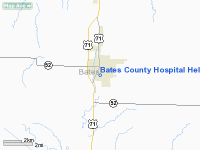
Bates County Hospital Heliport |
Location & QuickFacts
| FAA Information Effective: | 2008-09-25 |
| Airport Identifier: | 81MO |
| Airport Status: | Operational |
| Longitude/Latitude: | 094-20-32.0000W/38-14-54.0000N
-94.342222/38.248333 (Estimated) |
| Elevation: | 820 ft / 249.94 m (Estimated) |
| Land: | 7 acres |
| From nearest city: | 0 nautical miles S of Butler, MO |
| Location: | Bates County, MO |
| Magnetic Variation: | 05E (1985) |
Owner & Manager
| Ownership: | Publicly owned |
| Owner: | Bates County Hospital |
| Address: | 615 W Nursery
Butler, MO 64730 |
| Phone number: | 816-679-4135 |
| Manager: | Jim Baldwin |
| Address: | 615 W Nursery
Butler, MO 64730 |
| Phone number: | 816-679-4135 |
Airport Operations and Facilities
| Airport Use: | Private
MEDICAL. |
| Wind indicator: | Yes |
| Segmented Circle: | No |
| Control Tower: | No |
| Landing fee charge: | No |
| Sectional chart: | Kansas City |
| Region: | ACE - Central |
| Boundary ARTCC: | ZKC - Kansas City |
| Tie-in FSS: | COU - Columbia |
| FSS on Airport: | No |
| FSS Toll Free: | 1-800-WX-BRIEF |
Runway Information
Helipad H1
| Dimension: | 60 x 60 ft / 18.3 x 18.3 m |
| Surface: | GRASS, |
| |
Runway H1 |
Runway |
| Traffic Pattern: | Left | Left |
|
Radio Navigation Aids
| ID |
Type |
Name |
Ch |
Freq |
Var |
Dist |
| EAD | NDB | Nevada | | 209.00 | 06E | 23.5 nm |
| GLY | NDB | Golden Valley | | 388.00 | 04E | 31.7 nm |
| FSK | NDB | Fort Scott | | 379.00 | 05E | 33.7 nm |
| LXT | NDB | Lesumit | | 263.00 | 04E | 42.8 nm |
| HCK | NDB | Hawks | | 296.00 | 04E | 42.9 nm |
| LLU | NDB | Spring River | | 356.00 | 05E | 45.8 nm |
| SZL | TACAN | Whiteman | 035X | | 04E | 47.4 nm |
| OJC | VOR/DME | Johnson County | 077X | 113.00 | 06E | 40.1 nm |
| BUM | VORTAC | Butler | 106X | 115.90 | 07E | 7.0 nm |
Remarks
- PRVDD CLR APCH/DEP PATHS FOR A MIN 8:1 GS; A CLEAR TRANSITIONAL SFC FOR A MIN 2:1 SLOPE; & ALL OBSTNS ARE MKD & LGTD IN ACCORD WITH AIRSPACE LTR(04/01/93) PRIOR TO ACTIVATIN OF HELIPAD.
Images and information placed above are from
http://www.airport-data.com/airport/81MO/
We thank them for the data!
| General Info
|
| Country |
United States
|
| State |
MISSOURI
|
| FAA ID |
81MO
|
| Latitude |
38-14-54.000N
|
| Longitude |
094-20-32.000W
|
| Elevation |
820 feet
|
| Near City |
BUTLER
|
We don't guarantee the information is fresh and accurate. The data may
be wrong or outdated.
For more up-to-date information please refer to other sources.
|
|


