 |
|
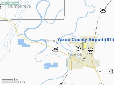
Location & QuickFacts
| FAA Information Effective: | 2008-09-25 |
| Airport Identifier: | 87I |
| Airport Status: | Operational |
| Longitude/Latitude: | 090-27-49.1310W/32-52-59.5740N
-90.463647/32.883215 (Estimated) |
| Elevation: | 104 ft / 31.70 m (Surveyed) |
| Land: | 300 acres |
| From nearest city: | 4 nautical miles NW of Yazoo City, MS |
| Location: | Yazoo County, MS |
| Magnetic Variation: | 02E (1990) |
Owner & Manager
| Ownership: | Publicly owned |
| Owner: | County Of Yazoo |
| Address: | P.o.box 172
Yazoo City, MS 39194 |
| Phone number: | 662-746-1273 |
| Manager: | William D. Bradley |
| Address: | P.o. Box 110
Yazoo City, MS 39194 |
| Phone number: | 662-571-2802 |
Airport Operations and Facilities
| Airport Use: | Open to public |
| Wind indicator: | Yes |
| Segmented Circle: | Yes |
| Control Tower: | No |
| Lighting Schedule: | DUSK-DAWN
MIRL RY 17/35 PRESET LOW INTST; FOR HIGHER INTST ACTVT - CTAF. ACTIVATE PAPI RYS 17 & 35 - CTAF. |
| Beacon Color: | Clear-Green (lighted land airport) |
| Sectional chart: | Memphis |
| Region: | ASO - Southern |
| Boundary ARTCC: | ZME - Memphis |
| Tie-in FSS: | GWO - Greenwood |
| FSS Toll Free: | 1-800-WX-BRIEF |
| NOTAMs Facility: | GWO (NOTAM-d service avaliable) |
| Federal Agreements: | NGY |
Airport Communications
| CTAF: | 122.800 |
| Unicom: | 122.800 |
Airport Services
| Fuel available: | 100LL |
| Airframe Repair: | MAJOR |
| Power Plant Repair: | MAJOR |
Runway Information
Runway 17/35
| Dimension: | 5000 x 100 ft / 1524.0 x 30.5 m |
| Surface: | ASPH, Good Condition |
| Weight Limit: | Single wheel: 30000 lbs.
Dual tandem wheel: 64000 lbs. |
| Edge Lights: | Medium |
| |
Runway 17 |
Runway 35 |
| Longitude: | 090-27-52.0260W | 090-27-46.2380W |
| Latitude: | 32-53-24.1880N | 32-52-34.9600N |
| Elevation: | 104.00 ft | 104.00 ft |
| Alignment: | 127 | 127 |
| Traffic Pattern: | Left | Left |
| Markings: | Non-precision instrument, Good Condition | Non-precision instrument, Good Condition |
| Crossing Height: | 35.00 ft | 35.00 ft |
| VASI: | 2-light PAPI on left side | 2-light PAPI on left side |
| Visual Glide Angle: | 3.00° | 3.00° |
| Obstruction: | , 50:1 slope to clear | 49 ft trees, 1464.0 ft from runway, 25:1 slope to clear |
|
Radio Navigation Aids
| ID |
Type |
Name |
Ch |
Freq |
Var |
Dist |
| JH | NDB | Brenz | | 260.00 | 02E | 30.1 nm |
| RYB | NDB | Raymond | | 375.00 | 03E | 35.1 nm |
| BLE | NDB | Lake Providence | | 278.00 | 03E | 36.8 nm |
| IDL | NDB | Indianola | | 284.00 | 03E | 37.4 nm |
| MTQ | NDB | Metcalf | | 359.00 | 03E | 41.7 nm |
| VKS | NDB | Vicksburg | | 382.00 | 03E | 45.6 nm |
| TV | NDB | Savry | | 344.00 | 02E | 47.8 nm |
| OSX | NDB | Kosciusko | | 269.00 | 00W | 48.2 nm |
| GLH | VOR/DME | Greenville | 039X | 110.20 | 04E | 46.5 nm |
| JAN | VORTAC | Jackson | 073X | 112.60 | 05E | 27.1 nm |
| SQS | VORTAC | Sidon | 094X | 114.70 | 03E | 36.1 nm |
| JAN | VOT | Jackson | | 111.00 | | 39.9 nm |
Images and information placed above are from
http://www.airport-data.com/airport/87I/
We thank them for the data!
| General Info
|
| Country |
United States
|
| State |
MISSISSIPPI
|
| FAA ID |
87I
|
| Latitude |
32-52-59.574N
|
| Longitude |
090-27-49.131W
|
| Elevation |
104 feet
|
| Near City |
YAZOO CITY
|
We don't guarantee the information is fresh and accurate. The data may
be wrong or outdated.
For more up-to-date information please refer to other sources.
|
|


