 |
|
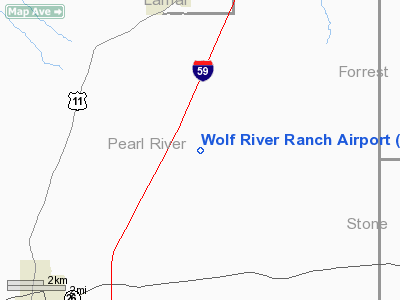
Location & QuickFacts
| FAA Information Effective: | 2008-09-25 |
| Airport Identifier: | MS53 |
| Airport Status: | Operational |
| Longitude/Latitude: | 089-26-40.2260W/30-54-52.6650N
-89.444507/30.914629 (Estimated) |
| Elevation: | 365 ft / 111.25 m (Surveyed) |
| Land: | 0 acres |
| From nearest city: | 6 nautical miles NE of Poplarville, MS |
| Location: | Pearl River County, MS |
| Magnetic Variation: | 02E (1985) |
Owner & Manager
| Ownership: | Privately owned |
| Owner: | Poplarville Development Corp |
| Address: | P O Box 391
Poplarville, MS 39470 |
| Manager: | James M George |
| Address: | Rt 3 Wolf River Ranch
Lumberton, MS 39455 |
| Phone number: | 601-796-4432 |
Airport Operations and Facilities
| Airport Use: | Private |
| Wind indicator: | No |
| Segmented Circle: | No |
| Control Tower: | No |
| Landing fee charge: | No |
| Sectional chart: | New Orleans |
| Region: | ASO - Southern |
| Boundary ARTCC: | ZHU - Houston |
| Tie-in FSS: | GWO - Greenwood |
| FSS on Airport: | No |
| FSS Toll Free: | 1-800-WX-BRIEF |
Runway Information
Runway 16/34
| Dimension: | 3000 x 100 ft / 914.4 x 30.5 m |
| Surface: | TURF, |
| |
Runway 16 |
Runway 34 |
| Traffic Pattern: | Left | Left |
| Obstruction: | | 50 ft trees, 120.0 ft from runway |
|
Radio Navigation Aids
| ID |
Type |
Name |
Ch |
Freq |
Var |
Dist |
| BX | NDB | Carma | | 353.00 | 02E | 21.6 nm |
| MJD | NDB | Picayune | | 276.00 | 01E | 27.4 nm |
| HS | NDB | Hanco | | 221.00 | 01E | 27.9 nm |
| AYI | NDB | Hanco | | 221.00 | 03E | 27.9 nm |
| FOH | NDB | Foxworth | | 331.00 | 05E | 29.9 nm |
| FNA | NDB | Florenville | | 371.00 | 03E | 35.7 nm |
| DEF | NDB | Slidell | | 256.00 | 03E | 42.3 nm |
| THJ | NDB | Tallahala | | 346.00 | 00E | 48.3 nm |
| BIX | TACAN | Keesler | 055X | | 01E | 40.5 nm |
| PCU | VOR/DME | Picayune | 059X | 112.20 | 05E | 25.9 nm |
| GPT | VOR/DME | Gulfport | 27X | 109.00 | 02E | 36.1 nm |
| LBY | VORTAC | Eaton | 043X | 110.60 | 05E | 30.8 nm |
| MCB | VORTAC | Mc Comb | 114X | 116.70 | 03E | 48.0 nm |
Remarks
Images and information placed above are from
http://www.airport-data.com/airport/MS53/
We thank them for the data!
| General Info
|
| Country |
United States
|
| State |
MISSISSIPPI
|
| FAA ID |
MS53
|
| Latitude |
30-54-52.665N
|
| Longitude |
089-26-40.226W
|
| Elevation |
365 feet
|
| Near City |
POPLARVILLE
|
We don't guarantee the information is fresh and accurate. The data may
be wrong or outdated.
For more up-to-date information please refer to other sources.
|
|


