 |
|
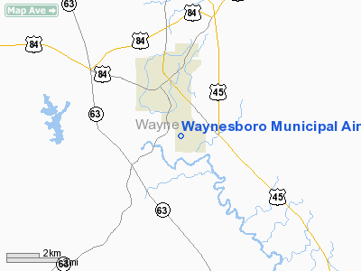
Waynesboro Municipal Airport |
Location & QuickFacts
| FAA Information Effective: | 2008-09-25 |
| Airport Identifier: | 2R0 |
| Airport Status: | Operational |
| Longitude/Latitude: | 088-38-05.1240W/31-38-45.5810N
-88.634757/31.645995 (Estimated) |
| Elevation: | 164 ft / 49.99 m (Surveyed) |
| Land: | 61 acres |
| From nearest city: | 2 nautical miles S of Waynesboro, MS |
| Location: | Wayne County, MS |
| Magnetic Variation: | 02E (1985) |
Owner & Manager
| Ownership: | Publicly owned |
| Owner: | City Of Waynesboro
MARTY STADALIS - CHAIRMAN ARPT BOARD. |
| Address: | 714 Wayne St.
Waynesboro, MS 39367 |
| Phone number: | 601-735-4874 |
| Manager: | Janice Wolff |
| Address: | P.o. Box 872
Waynesboro, MS 39367 |
| Phone number: | 601-735-9682 |
Airport Operations and Facilities
| Airport Use: | Open to public |
| Wind indicator: | Yes |
| Segmented Circle: | Yes |
| Control Tower: | No |
| Lighting Schedule: | DUSK-DAWN
ACTIVATE MIRL RY 02/20 & PAPI RY 02/20 - CTAF. |
| Beacon Color: | Clear-Green (lighted land airport) |
| Landing fee charge: | No |
| Sectional chart: | New Orleans |
| Region: | ASO - Southern |
| Boundary ARTCC: | ZME - Memphis |
| Tie-in FSS: | GWO - Greenwood |
| FSS on Airport: | No |
| FSS Toll Free: | 1-800-WX-BRIEF |
| NOTAMs Facility: | GWO (NOTAM-d service avaliable) |
| Federal Agreements: | NGY |
Airport Communications
| CTAF: | 122.800 |
| Unicom: | 122.800 |
Airport Services
| Fuel available: | 100LL |
| Bottled Oxygen: | NONE |
| Bulk Oxygen: | NONE |
Runway Information
Runway 02/20
| Dimension: | 5000 x 75 ft / 1524.0 x 22.9 m |
| Surface: | ASPH, Good Condition |
| Weight Limit: | Single wheel: 15000 lbs. |
| Edge Lights: | Medium |
| |
Runway 02 |
Runway 20 |
| Traffic Pattern: | Left | Left |
| Markings: | Basic, Good Condition | Basic, Good Condition |
| Displaced threshold: | 0.00 ft | 665.00 ft |
| VASI: | 2-light PAPI on left side | 2-light PAPI on left side |
| Obstruction: | 56 ft trees, 1700.0 ft from runway, 26:1 slope to clear | 23 ft rr, 600.0 ft from runway, 17:1 slope to clear
RY 20 APCH RATIO 50+:1 TO DSPLCD THLD. |
|
Radio Navigation Aids
| ID |
Type |
Name |
Ch |
Freq |
Var |
Dist |
| THJ | NDB | Tallahala | | 346.00 | 00E | 28.5 nm |
| ME | NDB | Savoy | | 356.00 | 01E | 36.8 nm |
| BCZ | NDB | Choctaw | | 228.00 | 01E | 38.5 nm |
| GCV | VORTAC | Greene County | 104X | 115.70 | 05E | 33.8 nm |
| LBY | VORTAC | Eaton | 043X | 110.60 | 05E | 38.5 nm |
| EWA | VORTAC | Kewanee | 085X | 113.80 | 04E | 44.2 nm |
| MEI | VORTAC | Meridian | 117X | 117.00 | 05E | 44.9 nm |
Images and information placed above are from
http://www.airport-data.com/airport/2R0/
We thank them for the data!
| General Info
|
| Country |
United States
|
| State |
MISSISSIPPI
|
| FAA ID |
2R0
|
| Latitude |
31-38-45.581N
|
| Longitude |
088-38-05.124W
|
| Elevation |
164 feet
|
| Near City |
WAYNESBORO
|
We don't guarantee the information is fresh and accurate. The data may
be wrong or outdated.
For more up-to-date information please refer to other sources.
|
|


