 |
|
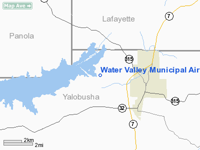
Water Valley Municipal Airport |
Location & QuickFacts
| FAA Information Effective: | 2008-09-25 |
| Airport Identifier: | 33M |
| Airport Status: | Operational |
| Longitude/Latitude: | 089-41-10.3100W/34-10-00.3950N
-89.686197/34.166776 (Estimated) |
| Elevation: | 270 ft / 82.30 m (Estimated) |
| Land: | 78 acres |
| From nearest city: | 3 nautical miles NW of Water Valley, MS |
| Location: | Yalobusha County, MS |
| Magnetic Variation: | 02E (1985) |
Owner & Manager
| Ownership: | Publicly owned |
| Owner: | City Of Water Valley |
| Address: | City Hall, Box 888
Water Valley, MS 38965 |
| Phone number: | 662-473-1533 |
| Manager: | Michael Scroggins |
| Address: | City Hall Box 888
Water Valley, MS 38965 |
| Phone number: | 662-473-4229
AFT HRS CALL 662-473-7676. |
Airport Operations and Facilities
| Airport Use: | Open to public |
| Wind indicator: | Yes |
| Segmented Circle: | No |
| Control Tower: | No |
| Lighting Schedule: | DUSK-DAWN |
| Beacon Color: | Clear-Green (lighted land airport) |
| Landing fee charge: | No |
| Sectional chart: | Memphis |
| Region: | ASO - Southern |
| Boundary ARTCC: | ZME - Memphis |
| Tie-in FSS: | GWO - Greenwood |
| FSS on Airport: | No |
| FSS Toll Free: | 1-800-WX-BRIEF |
| NOTAMs Facility: | GWO (NOTAM-d service avaliable) |
| Federal Agreements: | NY1 |
Airport Communications
Airport Services
| Airframe Repair: | NONE |
| Power Plant Repair: | NONE |
| Bottled Oxygen: | NONE |
| Bulk Oxygen: | NONE |
Runway Information
Runway 15/33
| Dimension: | 3000 x 50 ft / 914.4 x 15.2 m |
| Surface: | ASPH, Fair Condition |
| Weight Limit: | Single wheel: 20000 lbs. |
| Edge Lights: | Low |
| |
Runway 15 |
Runway 33 |
| Traffic Pattern: | Left | Left |
| Markings: | Basic, Fair Condition | Basic, Fair Condition |
| Obstruction: | 29 ft trees, 1200.0 ft from runway, 250 ft left of centerline, 34:1 slope to clear | 40 ft trees, 1730.0 ft from runway, 100 ft right of centerline, 38:1 slope to clear |
|
Radio Navigation Aids
| ID |
Type |
Name |
Ch |
Freq |
Var |
Dist |
| SBQ | NDB | Scobey | | 245.00 | 01E | 19.0 nm |
| CKM | NDB | Clarksdale | | 341.00 | 02E | 41.9 nm |
| OLV | NDB | Olive Branch | | 275.00 | 01E | 49.1 nm |
| OTB | VOR/DME | Tupelo | 035X | 109.80 | 04E | 44.3 nm |
| HLI | VORTAC | Holly Springs | 071X | 112.40 | 03E | 37.5 nm |
Remarks
- LARGE FLOCKS OF DUCKS OVER LAKE.
Images and information placed above are from
http://www.airport-data.com/airport/33M/
We thank them for the data!
| General Info
|
| Country |
United States
|
| State |
MISSISSIPPI
|
| FAA ID |
33M
|
| Latitude |
34-10-00.395N
|
| Longitude |
089-41-10.310W
|
| Elevation |
270 feet
|
| Near City |
WATER VALLEY
|
We don't guarantee the information is fresh and accurate. The data may
be wrong or outdated.
For more up-to-date information please refer to other sources.
|
|


