 |
|
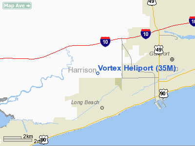
Location & QuickFacts
| FAA Information Effective: | 2008-09-25 |
| Airport Identifier: | 35M |
| Airport Status: | Operational |
| Longitude/Latitude: | 089-09-55.0000W/30-23-19.0000N
-89.165278/30.388611 (Estimated) |
| Elevation: | 24 ft / 7.32 m (Estimated) |
| Land: | 19 acres |
| From nearest city: | 4 nautical miles N of Long Beach, MS |
| Location: | Harrison County, MS |
| Magnetic Variation: | 01E (1995) |
Owner & Manager
| Ownership: | Privately owned |
| Owner: | Vortex Helicopters Inc |
| Address: | 7120 Jones Truck Line Road
Long Beach, MS 39560 |
| Phone number: | 228-864-7357 |
| Manager: | Joe Sheeran |
| Address: | 7120 Jones Truck Line Road
Long Beach, MS 39560 |
| Phone number: | 228-864-7357 |
Airport Operations and Facilities
| Airport Use: | Open to public |
| Wind indicator: | Yes |
| Segmented Circle: | No |
| Control Tower: | No |
| Lighting Schedule: | DUSK-DAWN |
| Beacon Color: | Clear-Green-Yellow (heliport) |
| Sectional chart: | New Orleans |
| Region: | ASO - Southern |
| Boundary ARTCC: | ZHU - Houston |
| Tie-in FSS: | GWO - Greenwood |
| FSS Toll Free: | 1-800-WX-BRIEF |
| NOTAMs Facility: | GWO (NOTAM-d service avaliable) |
Airport Communications
Airport Services
Runway Information
Helipad H1
| Dimension: | 75 x 75 ft / 22.9 x 22.9 m |
| Surface: | TURF, |
| |
Runway H1 |
Runway |
| Traffic Pattern: | Left | Left |
|
Radio Navigation Aids
| ID |
Type |
Name |
Ch |
Freq |
Var |
Dist |
| HS | NDB | Hanco | | 221.00 | 01E | 15.5 nm |
| AYI | NDB | Hanco | | 221.00 | 03E | 15.5 nm |
| MJD | NDB | Picayune | | 276.00 | 01E | 26.1 nm |
| FNA | NDB | Florenville | | 371.00 | 03E | 34.0 nm |
| DEF | NDB | Slidell | | 256.00 | 03E | 35.1 nm |
| BX | NDB | Carma | | 353.00 | 02E | 46.7 nm |
| MO | NDB | Wisle | | 248.00 | 02E | 49.9 nm |
| BIX | TACAN | Keesler | 055X | | 01E | 12.3 nm |
| GPT | VOR/DME | Gulfport | 27X | 109.00 | 02E | 4.8 nm |
| PCU | VOR/DME | Picayune | 059X | 112.20 | 05E | 31.1 nm |
| SJI | VORTAC | Semmes | 100X | 115.30 | 05E | 46.4 nm |
| NEW | VOT | New Orleans Lakefront | | 111.00 | | 49.4 nm |
Remarks
- HIGH VOLUME STUDENT TRAINING ON & INVOF HELIPORT.
- 30 FT POWER LINE WEST, 45 FT TREES & 30 FT POWER LINE SOUTH OF HELIPAD.
- MAINTAIN TFC PATS EAST OF HELIPAD.
- PRVDD AREA IS MKD & WIND INDICATOR IS MAINTAINED.
Images and information placed above are from
http://www.airport-data.com/airport/35M/
We thank them for the data!
| General Info
|
| Country |
United States
|
| State |
MISSISSIPPI
|
| FAA ID |
35M
|
| Latitude |
30-23-19.000N
|
| Longitude |
089-09-55.000W
|
| Elevation |
24 feet
|
| Near City |
LONG BEACH
|
We don't guarantee the information is fresh and accurate. The data may
be wrong or outdated.
For more up-to-date information please refer to other sources.
|
|


