 |
|
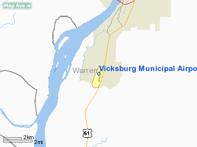
Vicksburg Municipal Airport |
Location & QuickFacts
| FAA Information Effective: | 2008-09-25 |
| Airport Identifier: | VKS |
| Airport Status: | Operational |
| Longitude/Latitude: | 090-55-42.3790W/32-14-21.5390N
-90.928439/32.239316 (Estimated) |
| Elevation: | 106 ft / 32.31 m (Estimated) |
| Land: | 316 acres |
| From nearest city: | 7 nautical miles SW of Vicksburg, MS |
| Location: | Warren County, MS |
| Magnetic Variation: | 03E (1985) |
Owner & Manager
| Ownership: | Publicly owned |
| Owner: | City Of Vicksburg |
| Address: | Po Box 150
Vicksburg, MS 39180 |
| Phone number: | 601-634-4525 |
| Manager: | Frank May
FBO VICKSBURG AIRPORT MANAGEMENT SERVICES. |
| Address: | 5855 Highway 61 South
Vicksburg, MS 39180 |
| Phone number: | 601-636-4925 |
Airport Operations and Facilities
| Airport Use: | Open to public |
| Wind indicator: | Yes |
| Segmented Circle: | Yes |
| Control Tower: | No |
| Lighting Schedule: | DUSK-DAWN
ACTVT MIRL RY 01/19 - CTAF. |
| Beacon Color: | Clear-Green (lighted land airport) |
| Landing fee charge: | No |
| Sectional chart: | Memphis |
| Region: | ASO - Southern |
| Boundary ARTCC: | ZME - Memphis |
| Tie-in FSS: | GWO - Greenwood |
| FSS on Airport: | No |
| FSS Toll Free: | 1-800-WX-BRIEF |
| NOTAMs Facility: | GWO (NOTAM-d service avaliable) |
| Federal Agreements: | N1 |
Airport Communications
| CTAF: | 122.800 |
| Unicom: | 122.800 |
Airport Services
| Fuel available: | 100LLA |
| Airframe Repair: | MAJOR |
| Power Plant Repair: | MAJOR |
| Bottled Oxygen: | NONE |
| Bulk Oxygen: | NONE |
Runway Information
Runway 01/19
| Dimension: | 5000 x 100 ft / 1524.0 x 30.5 m |
| Surface: | ASPH, Good Condition |
| Weight Limit: | Single wheel: 30000 lbs.
Dual wheel: 50000 lbs.
Dual tandem wheel: 90000 lbs.
LMTD TO S-30 GWT. |
| Edge Lights: | Medium |
| |
Runway 01 |
Runway 19 |
| Longitude: | 090-55-45.3450W | 090-55-37.7350W |
| Latitude: | 32-13-56.4190N | 32-14-45.4710N |
| Elevation: | 96.00 ft | 105.00 ft |
| Alignment: | 8 | 127 |
| Traffic Pattern: | Left | Left |
| Markings: | Non-precision instrument, Good Condition | Non-precision instrument, Good Condition |
| Displaced threshold: | 300.00 ft | 480.00 ft |
| Runway End Identifier: | No | No |
| Obstruction: | 73 ft trees, 1700.0 ft from runway, 300 ft left of centerline, 20:1 slope to clear
RWY 01 APCH RATIO 27:1 TO DSPLCD THLD. | 37 ft tree, 540.0 ft from runway, 240 ft left of centerline, 9:1 slope to clear
RWY 19 APCH RATIO 27:1 TO DSPLCD THLD. |
|
Radio Navigation Aids
| ID |
Type |
Name |
Ch |
Freq |
Var |
Dist |
| VKS | NDB | Vicksburg | | 382.00 | 03E | 0.4 nm |
| TV | NDB | Savry | | 344.00 | 02E | 5.0 nm |
| RYB | NDB | Raymond | | 375.00 | 03E | 26.5 nm |
| JH | NDB | Brenz | | 260.00 | 02E | 35.5 nm |
| HAH | NDB | Natchez-adams County | | 388.00 | 03E | 37.9 nm |
| BLE | NDB | Lake Providence | | 278.00 | 03E | 37.9 nm |
| MRK | NDB | Molly Ridge | | 338.00 | 02E | 44.0 nm |
| BVV | NDB | Brookhaven | | 407.00 | 03E | 46.2 nm |
| HEZ | VOR/DME | Natchez | 037X | 110.00 | 03E | 41.9 nm |
| JAN | VORTAC | Jackson | 073X | 112.60 | 05E | 41.9 nm |
| JAN | VOT | Jackson | | 111.00 | | 44.1 nm |
Remarks
- NORTH PARALLEL TWY PERMANENTLY CLOSED.
- EXISTED PRIOR TO 1959.
Images and information placed above are from
http://www.airport-data.com/airport/VKS/
We thank them for the data!
| General Info
|
| Country |
United States
|
| State |
MISSISSIPPI
|
| FAA ID |
VKS
|
| Latitude |
32-14-21.539N
|
| Longitude |
090-55-42.379W
|
| Elevation |
106 feet
|
| Near City |
VICKSBURG
|
We don't guarantee the information is fresh and accurate. The data may
be wrong or outdated.
For more up-to-date information please refer to other sources.
|
|


