 |
|
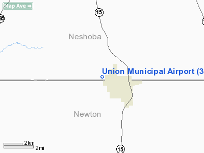
Location & QuickFacts
| FAA Information Effective: | 2008-09-25 |
| Airport Identifier: | 3MS9 |
| Airport Status: | Operational |
| Longitude/Latitude: | 089-08-10.2130W/32-34-50.4970N
-89.136170/32.580694 (Estimated) |
| Elevation: | 512 ft / 156.06 m (Surveyed) |
| Land: | 127 acres |
| From nearest city: | 2 nautical miles NW of Union, MS |
| Location: | Neshoba County, MS |
| Magnetic Variation: | 02E (1985) |
Owner & Manager
| Ownership: | Privately owned |
| Owner: | Town Of Union |
| Address: | 404 Bank Street
Union, MS 39365 |
| Phone number: | 601-774-9422 |
| Manager: | Max Sessums, Mayor |
| Address: | 404 Bank Street
Union, MS 39365 |
| Phone number: | 601-774-9422 |
Airport Operations and Facilities
| Airport Use: | Private |
| Wind indicator: | No |
| Segmented Circle: | No |
| Control Tower: | No |
| Landing fee charge: | No |
| Sectional chart: | Memphis |
| Region: | ASO - Southern |
| Boundary ARTCC: | ZME - Memphis |
| Tie-in FSS: | GWO - Greenwood |
| FSS on Airport: | No |
| FSS Toll Free: | 1-800-WX-BRIEF |
| Federal Agreements: | 1 |
Airport Services
| Airframe Repair: | NONE |
| Power Plant Repair: | NONE |
| Bottled Oxygen: | NONE |
| Bulk Oxygen: | NONE |
Runway Information
Runway 10/28
| Dimension: | 2550 x 200 ft / 777.2 x 61.0 m |
| Surface: | TURF, Poor Condition
RUTS MIDWAY OF TURF STRIP. |
| |
Runway 10 |
Runway 28 |
| Traffic Pattern: | Left | Left |
| Obstruction: | 18 ft trees, 200.0 ft from runway, 120 ft right of centerline, 11:1 slope to clear | 39 ft trees, 378.0 ft from runway, 150 ft left of centerline, 9:1 slope to clear |
|
Radio Navigation Aids
| ID |
Type |
Name |
Ch |
Freq |
Var |
Dist |
| MPE | NDB | Philadelphia | | 219.00 | 01E | 13.1 nm |
| ME | NDB | Savoy | | 356.00 | 01E | 27.3 nm |
| LMS | NDB | Louisville | | 212.00 | 00E | 34.1 nm |
| OSX | NDB | Kosciusko | | 269.00 | 00W | 36.8 nm |
| NJW | TACAN | Joe Williams | 61Y | | 01E | 19.9 nm |
| NMM | TACAN | Meridian | 056X | | 01E | 29.9 nm |
| MEI | VORTAC | Meridian | 117X | 117.00 | 05E | 20.8 nm |
| EWA | VORTAC | Kewanee | 085X | 113.80 | 04E | 36.7 nm |
| JAN | VOT | Jackson | | 111.00 | | 49.9 nm |
Remarks
- RWY 10-28 700' FM WEST END TO 1150' WET AND BOGGY DURG WET WEATHER.
- PRIOR TO FAA ACT.
Images and information placed above are from
http://www.airport-data.com/airport/3MS9/
We thank them for the data!
| General Info
|
| Country |
United States
|
| State |
MISSISSIPPI
|
| FAA ID |
3MS9
|
| Latitude |
32-34-50.497N
|
| Longitude |
089-08-10.213W
|
| Elevation |
512 feet
|
| Near City |
UNION
|
We don't guarantee the information is fresh and accurate. The data may
be wrong or outdated.
For more up-to-date information please refer to other sources.
|
|


