 |
|
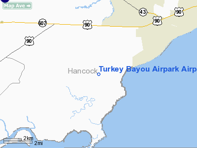
Turkey Bayou Airpark Airport |
Location & QuickFacts
| FAA Information Effective: | 2008-09-25 |
| Airport Identifier: | 5MS2 |
| Airport Status: | Operational |
| Longitude/Latitude: | 089-27-03.6000W/30-15-02.9000N
-89.451000/30.250806 (Estimated) |
| Elevation: | 9 ft / 2.74 m (Estimated) |
| Land: | 6 acres |
| From nearest city: | 2 nautical miles SW of Lakeshore, MS |
| Location: | Hancock County, MS |
| Magnetic Variation: | 01E () |
Owner & Manager
| Ownership: | Privately owned |
| Owner: | Turkey Bayou Pilots Assn |
| Address: | 2606 Kelly Ave
Gulfport, MS 39501 |
| Phone number: | 228-868-7694 |
| Manager: | Capt John Madden |
| Address: | 2606 Kelly Ave
Gulfport, MS 39501 |
| Phone number: | 228-868-7694 |
Airport Operations and Facilities
| Airport Use: | Private |
| Wind indicator: | Yes |
| Segmented Circle: | No |
| Control Tower: | No |
| Sectional chart: | New Orleans |
| Region: | ASO - Southern |
| Boundary ARTCC: | ZHU - Houston |
| Tie-in FSS: | GWO - Greenwood |
| FSS Toll Free: | 1-800-WX-BRIEF |
Runway Information
Runway 09/27
| Dimension: | 2000 x 20 ft / 609.6 x 6.1 m |
| Surface: | CONC-TURF,
FIRST 1300 FT RY 09 IS CONC, REMAINDER TURF. |
| |
Runway 09 |
Runway 27 |
| Traffic Pattern: | Left | Left |
|
Radio Navigation Aids
| ID |
Type |
Name |
Ch |
Freq |
Var |
Dist |
| AYI | NDB | Hanco | | 221.00 | 03E | 12.0 nm |
| HS | NDB | Hanco | | 221.00 | 01E | 12.0 nm |
| MJD | NDB | Picayune | | 276.00 | 01E | 18.0 nm |
| DEF | NDB | Slidell | | 256.00 | 03E | 20.1 nm |
| FNA | NDB | Florenville | | 371.00 | 03E | 21.6 nm |
| BX | NDB | Carma | | 353.00 | 02E | 43.5 nm |
| BIX | TACAN | Keesler | 055X | | 01E | 28.6 nm |
| GPT | VOR/DME | Gulfport | 27X | 109.00 | 02E | 21.6 nm |
| PCU | VOR/DME | Picayune | 059X | 112.20 | 05E | 23.6 nm |
| HRV | VORTAC | Harvey | 088X | 114.10 | 02E | 37.5 nm |
| NEW | VOT | New Orleans Lakefront | | 111.00 | | 32.5 nm |
Remarks
- DIRT ROAD, POWER LINES & SUPPORTING POLES, PINE TREES BOTH SIDES OF RY 09/27 AND ROAD IN APCH TO RY 09.
- DIRT ROAD, POWER LINES, POWER LINE POLES & PINE TREES OBSTRUCT.
Images and information placed above are from
turkey_bayou_airpark_mississippi
We thank them for the data!
| General Info
|
| Country |
United States
|
| State |
MISSISSIPPI
|
| FAA ID |
5MS2
|
| Latitude |
30-15-02.900N
|
| Longitude |
089-27-03.600W
|
| Elevation |
9 feet
|
| Near City |
LAKESHORE
|
We don't guarantee the information is fresh and accurate. The data may
be wrong or outdated.
For more up-to-date information please refer to other sources.
|
|


