 |
|
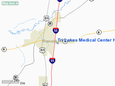
Tri Lakes Medical Center Heliport |
Location & QuickFacts
| FAA Information Effective: | 2008-09-25 |
| Airport Identifier: | MS31 |
| Airport Status: | Operational |
| Longitude/Latitude: | 089-54-48.0000W/34-18-25.0000N
-89.913333/34.306944 (Estimated) |
| Elevation: | 337 ft / 102.72 m (Estimated) |
| Land: | 0 acres |
| From nearest city: | 2 nautical miles N of Batesville, MS |
| Location: | Panola County, MS |
| Magnetic Variation: | 01E (2000) |
Owner & Manager
| Ownership: | Privately owned |
| Owner: | Tri Lakes Medical Center |
| Address: | 496 Forest Drive
Batesville, MS 38606 |
| Phone number: | 662-563-5611 |
| Address: |
|
Airport Operations and Facilities
| Airport Use: | Private |
| Wind indicator: | Yes |
| Segmented Circle: | No |
| Control Tower: | No |
| Lighting Schedule: | PHONE REQ
FOR PERIMETER & FLOOD LGTS CALL 662-563-5611. |
| Sectional chart: | Memphis |
| Region: | ASO - Southern |
| Boundary ARTCC: | ZME - Memphis |
| Tie-in FSS: | GWO - Greenwood |
| FSS Toll Free: | 1-800-WX-BRIEF |
Runway Information
Helipad H1
| Dimension: | 50 x 50 ft / 15.2 x 15.2 m |
| Surface: | CONC, |
| |
Runway H1 |
Runway |
| Traffic Pattern: | Left | Left |
|
Radio Navigation Aids
| ID |
Type |
Name |
Ch |
Freq |
Var |
Dist |
| SBQ | NDB | Scobey | | 245.00 | 01E | 25.1 nm |
| CKM | NDB | Clarksdale | | 341.00 | 02E | 29.9 nm |
| OLV | NDB | Olive Branch | | 275.00 | 01E | 40.9 nm |
| HEE | NDB | Thompson-robbins | | 251.00 | 01E | 41.0 nm |
| ME | NDB | Elvis | | 287.00 | 01E | 46.0 nm |
| UJM | VOR/DME | Marvell | 033X | 109.60 | 01E | 41.0 nm |
| HLI | VORTAC | Holly Springs | 071X | 112.40 | 03E | 34.7 nm |
| MEM | VORTAC | Memphis | 122X | 117.50 | 01E | 42.7 nm |
| MEM | VOT | Memphis Metropolitn | | 111.00 | | 44.8 nm |
Remarks
- 453 FT TOWER 600 FT NORTHEAST, 20 FT LGTD POLE 70 FT WEST, 25 FT LGTD POLE 98 FT SOUTH OF HELIPAD.
- PRVDD VFR OPNS, PVT USE, AREA IS MKD, WIND INDICATOR IS MAINTAINED.
Images and information placed above are from
http://www.airport-data.com/airport/MS31/
We thank them for the data!
| General Info
|
| Country |
United States
|
| State |
MISSISSIPPI
|
| FAA ID |
MS31
|
| Latitude |
34-18-25.000N
|
| Longitude |
089-54-48.000W
|
| Elevation |
337 feet
|
| Near City |
BATESVILLE
|
We don't guarantee the information is fresh and accurate. The data may
be wrong or outdated.
For more up-to-date information please refer to other sources.
|
|


