 |
|
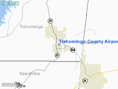
Tishomingo County Airport |
Location & QuickFacts
| FAA Information Effective: | 2008-09-25 |
| Airport Identifier: | 01M |
| Airport Status: | Operational |
| Longitude/Latitude: | 088-12-04.0000W/34-29-30.0000N
-88.201111/34.491667 (Estimated) |
| Elevation: | 578 ft / 176.17 m (Estimated) |
| Land: | 49 acres |
| From nearest city: | 2 nautical miles S of Belmont, MS |
| Location: | Tishomingo County, MS |
| Magnetic Variation: | 01E (1985) |
Owner & Manager
| Ownership: | Publicly owned |
| Owner: | Tishomingo County
MR LEON COOK, CHAIRMAN BOARD OF SUPERVISORS. |
| Address: | Po Box 1008
Iuka, MS 38852 |
| Phone number: | 662-423-7032 |
| Manager: | Board Of Supervisors |
| Address: | Po Box 1008
Iuka, MS 38852 |
| Phone number: | 662-423-7032 |
Airport Operations and Facilities
| Airport Use: | Open to public |
| Wind indicator: | Yes
LGTS OTS INDEFLY. |
| Segmented Circle: | Yes |
| Control Tower: | No |
| Lighting Schedule: | DUSK-DAWN
ACTVT MIRL RY 17/35 - CTAF. |
| Beacon Color: | Clear-Green (lighted land airport)
ROTATING BCN OPER INTERMITTENTLY. |
| Landing fee charge: | No |
| Sectional chart: | Memphis |
| Region: | ASO - Southern |
| Boundary ARTCC: | ZME - Memphis |
| Tie-in FSS: | GWO - Greenwood |
| FSS on Airport: | No |
| FSS Toll Free: | 1-800-WX-BRIEF |
| NOTAMs Facility: | GWO (NOTAM-d service avaliable) |
| Federal Agreements: | NY1 |
Airport Communications
| CTAF: | 122.800 |
| Unicom: | 122.800 |
Airport Services
| Fuel available: | 100LLA |
| Airframe Repair: | MAJOR |
| Power Plant Repair: | MAJOR |
| Bottled Oxygen: | NONE |
| Bulk Oxygen: | NONE |
Runway Information
Runway 17/35
| Dimension: | 4000 x 60 ft / 1219.2 x 18.3 m |
| Surface: | ASPH, Good Condition |
| Weight Limit: | Single wheel: 20000 lbs. |
| Edge Lights: | Medium |
| |
Runway 17 |
Runway 35 |
| Traffic Pattern: | Left | Left |
| Markings: | Basic, Good Condition | Basic, Good Condition |
| Displaced threshold: | 500.00 ft
DSPLCD THLD NOT LIGHTED. | 977.00 ft |
| Obstruction: | 56 ft trees, 200.0 ft from runway, 125 ft right of centerline
RWY 17 APCH RATIO 12:1 FROM DSPLCD THLD +56' TREES 125'R @ 700' FROM DSPLCD THLD.
8 FT FENCE 150 FT FM RY END. | 70 ft trees, 900.0 ft from runway, 150 ft left of centerline, 10:1 slope to clear
RWY 35 APCH RATIO 26 :1 FROM DSPLCD THLD +70' TREES 150'L @ 1877' FROM DSPLCD THLD.
+70' TREES 174' FROM END OF RUNWAY AND 150' LEFT. |
|
Radio Navigation Aids
| ID |
Type |
Name |
Ch |
Freq |
Var |
Dist |
| HHY | NDB | Pinhook | | 346.00 | 01W | 45.8 nm |
| SZY | NDB | Sibley | | 386.00 | 01E | 47.4 nm |
| OTB | VOR/DME | Tupelo | 035X | 109.80 | 04E | 33.7 nm |
| HAB | VORTAC | Hamilton | 041X | 110.40 | 02E | 20.1 nm |
| MSL | VORTAC | Muscle Shoals | 112X | 116.50 | 01E | 37.4 nm |
Images and information placed above are from
http://www.airport-data.com/airport/01M/
We thank them for the data!
| General Info
|
| Country |
United States
|
| State |
MISSISSIPPI
|
| FAA ID |
01M
|
| Latitude |
34-29-30.000N
|
| Longitude |
088-12-04.000W
|
| Elevation |
578 feet
|
| Near City |
BELMONT
|
We don't guarantee the information is fresh and accurate. The data may
be wrong or outdated.
For more up-to-date information please refer to other sources.
|
|


