 |
|
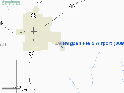
Location & QuickFacts
| FAA Information Effective: | 2008-09-25 |
| Airport Identifier: | 00M |
| Airport Status: | Operational |
| Longitude/Latitude: | 089-14-04.2170W/31-57-13.5540N
-89.234505/31.953765 (Estimated) |
| Elevation: | 351 ft / 106.98 m (Estimated) |
| Land: | 39 acres |
| From nearest city: | 3 nautical miles SE of Bay Springs, MS |
| Location: | Jasper County, MS |
| Magnetic Variation: | 02E (1985) |
Owner & Manager
| Ownership: | Publicly owned |
| Owner: | City Of Bay Springs |
| Address: | Po Box 307
Bay Springs, MS 39422 |
| Phone number: | 601-764-4112 |
| Manager: | Kendrick Blakeney |
| Address: | Po Box 307
Bay Springs, MS 39422 |
| Phone number: | 601-764-8482
MGR MAY BE REACHED AFTER HRS AT (601) 764-2572. |
Airport Operations and Facilities
| Airport Use: | Open to public |
| Wind indicator: | Yes |
| Segmented Circle: | Yes |
| Control Tower: | No |
| Lighting Schedule: | DUSK-DAWN |
| Beacon Color: | Clear-Green (lighted land airport) |
| Landing fee charge: | No |
| Sectional chart: | New Orleans |
| Region: | ASO - Southern |
| Boundary ARTCC: | ZME - Memphis |
| Tie-in FSS: | GWO - Greenwood |
| FSS on Airport: | No |
| FSS Toll Free: | 1-800-WX-BRIEF |
| NOTAMs Facility: | GWO (NOTAM-d service avaliable) |
| Federal Agreements: | NY1 |
Airport Communications
Airport Services
| Bottled Oxygen: | NONE |
| Bulk Oxygen: | NONE |
Runway Information
Runway 16/34
| Dimension: | 3000 x 50 ft / 914.4 x 15.2 m |
| Surface: | ASPH, Fair Condition |
| Weight Limit: | Single wheel: 8000 lbs. |
| Edge Lights: | Medium |
| |
Runway 16 |
Runway 34 |
| Longitude: | 089-14-13.0000W | 089-14-01.0000W |
| Latitude: | 31-57-27.0000N | 31-56-59.5000N |
| Elevation: | 330.00 ft | 358.00 ft |
| Traffic Pattern: | Left | Left |
| Markings: | Basic, Fair Condition
RY 16/34 MARKINGS BADLY FADED. | Basic, Good Condition |
| Obstruction: | 66 ft trees, 1535.0 ft from runway, 20:1 slope to clear | 109 ft trees, 2075.0 ft from runway, 100 ft left of centerline, 17:1 slope to clear |
|
Radio Navigation Aids
| ID |
Type |
Name |
Ch |
Freq |
Var |
Dist |
| THJ | NDB | Tallahala | | 346.00 | 00E | 16.2 nm |
| ME | NDB | Savoy | | 356.00 | 01E | 29.4 nm |
| FOH | NDB | Foxworth | | 331.00 | 05E | 49.6 nm |
| LBY | VORTAC | Eaton | 043X | 110.60 | 05E | 32.6 nm |
| MEI | VORTAC | Meridian | 117X | 117.00 | 05E | 33.6 nm |
| EWA | VORTAC | Kewanee | 085X | 113.80 | 04E | 46.6 nm |
| JAN | VOT | Jackson | | 111.00 | | 47.4 nm |
Remarks
- PUBLIC PHONE AT ARPT 601-764-2558.
- TREES ON EAST AND WEST SIDES OF RY VIOLATE TRANSITIONAL SFC.
Images and information placed above are from
http://www.airport-data.com/airport/00M/
We thank them for the data!
| General Info
|
| Country |
United States
|
| State |
MISSISSIPPI
|
| FAA ID |
00M
|
| Latitude |
31-57-13.553N
|
| Longitude |
089-14-04.217W
|
| Elevation |
351 feet
|
| Near City |
BAY SPRINGS
|
We don't guarantee the information is fresh and accurate. The data may
be wrong or outdated.
For more up-to-date information please refer to other sources.
|
|


